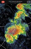
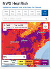
Didn't make 90 today imby sad this is an achievement
-
Hello, please take a minute to check out our awesome content, contributed by the wonderful members of our community. We hope you'll add your own thoughts and opinions by making a free account!
You are using an out of date browser. It may not display this or other websites correctly.
You should upgrade or use an alternative browser.
You should upgrade or use an alternative browser.
Pattern July Fry and Dry
- Thread starter SD
- Start date
It seems to me that with this much northwest flow we have had and are getting later, that the ring of fire would have set up somewhere, but it just is not happening. Those MCS' are nowhere to be found so far and no real signs of them showing up.
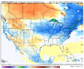
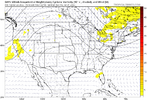
If we can get here it'll be the start of the mcs party as we establish a nice thera E gradient and start zipping energy down the trough
Last edited:
You’re welcome, jrips.
We’ll get an early test of the two models today. (Note that I just corrected errors in my earlier post where I said the highs were for KATL when they’re really for KPDK (NE ATL station/Chamblee for those who don’t know)).
For today at KPDK/Chamblee, the 0Z GFS has a high of 100 vs only 93 for the 0Z/6Z Euro, a whopping 7 F cooler on day 1! FFC is going in between with mid 90s, which I bet will do well.
At 11AM it was 88 in Chamblee. The 0Z GFS had 90 for then vs the 0Z/6Z Euro’s 86. So, it’s currently halfway between.
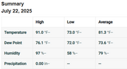
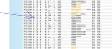
Verification of today’s high at KPDK (NE Atlanta/Chamblee):
Today’s 0Z GFS had 100; 0Z Euro had 93
Actual was 95, meaning actual was in between but 0Z Euro closer:
..THE DEKALB PEACHTREE AIRPORT CLIMATE SUMMARY FOR JULY 22 2025
VALID TODAY AS OF 0400 PM LOCAL TIME.
CLIMATE NORMAL PERIOD: 1991 TO 2020
CLIMATE RECORD PERIOD: 9999 TO 9999
WEATHER ITEM OBSERVED TIME RECORD YEAR NORMAL DEPARTURE LAST
VALUE (LST) VALUE VALUE FROM YEAR
NORMAL
...............................................................
TEMPERATURE (F)
TODAY
MAXIMUM 95 2:39 PM
@jrips27
iGRXY
Member
Made it to 88.
JHS
Member
Verification of today’s high at KPDK (NE Atlanta/Chamblee):
Today’s 0Z GFS had 100; 0Z Euro had 93
Actual was 95, meaning actual was in between but 0Z Euro closer:
..THE DEKALB PEACHTREE AIRPORT CLIMATE SUMMARY FOR JULY 22 2025
VALID TODAY AS OF 0400 PM LOCAL TIME.
CLIMATE NORMAL PERIOD: 1991 TO 2020
CLIMATE RECORD PERIOD: 9999 TO 9999
WEATHER ITEM OBSERVED TIME RECORD YEAR NORMAL DEPARTURE LAST
VALUE (LST) VALUE VALUE FROM YEAR
NORMAL
...............................................................
TEMPERATURE (F)
TODAY
MAXIMUM 95 2:39 PM
@jrips27
Seems a little suspect to me, but it is what it is.
KPDK
BrickTamland
Member
Down in North Myrtle this week. Had some storms and a lot of rain today. Looks like next week is going to be even hotter back home than it has been recently.
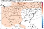
I'd like to see that ridge center back over the 4 corners area...just a tad west.If we can get here it'll be the strat of the mcs party as we establish a nice thera E gradient and start zipping energy down the troughView attachment 173607
Either way, going to be hot for as far as the eye can see. Need those NW flow events. Some of those could be quite strong, given the heat and moisture that's likely to be in place.
GeorgiaGirl
Member
It continues to be fascinating to me how all the pop-up storms seemingly swing and miss involving my house. But I can say that if the clouds block out the sun and there's a bit of a breeze, it can actually be tolerable in the evening.
Edit: Noticed a thunderstorm statement on my MSN page about 30 minutes ago, initially thought that had no chance of missing, but yep, it most likely will. Just incredible stuff.
Edit: Noticed a thunderstorm statement on my MSN page about 30 minutes ago, initially thought that had no chance of missing, but yep, it most likely will. Just incredible stuff.
Last edited:
JHS
Member
The 18z Euro is not backing down and has 100+ from Sat to the end of its run. The 100+ temps could very well be going to happen.
wonderful
Euro had one day of extreme 850s most days were 21-23c which recently has translated to 95-97 minus at the rdu airport. Op euro has also had the tendency to over heat 2mT over the last few years only to walk it back in the last 72 hours
Yeah, I don't buy the 100s+ way out. But even so, it's going to be hot and humid, with many temps in the mid-upper 90s and heat indexes probably near or over 100 for a good long time. Just unrelenting. Hoping for another backdoor front near the first of the new month.Euro had one day of extreme 850s most days were 21-23c which recently has translated to 95-97 minus at the rdu airport. Op euro has also had the tendency to over heat 2mT over the last few years only to walk it back in the last 72 hours
Iceagewhereartthou
Member
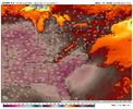
Isn't "apparent temp" basically HI? If so these might be legitimate. If not, I don't think this will happen for actual temps.
GSP 90 degree day streak now 32 for third all time and just one day behind 2nd place from 1999. If we don't break it tomorrow or Thursday we will be into the 40s before the next possible shot. Forecast for each of the next 2 days is 89 but I don't think we have any realistic shot of staying below 90. Will take sustained heavy cloud cover or storms and that's not been happening. What a rediculous pattern this is and it's only July 22nd.
BTW, CAE has not been below 75 since the 13th and has not been below 70 since June 8th. Interestingly, as hot as its been, they've only reached 100 once, which is below average for them.
Last edited:
Isn't "apparent temp" basically HI? If so these might be legitimate. If not, I don't think this will happen for actual temps.
Yes, “apparent temp” is either the same as or is similar to the H.I.
JHS
Member
They keep getting in on pop up storms even if 99% of the state does not see them. There have been 5-6 times only 1-2 storm show up in SC but were around CAE.Isn't "apparent temp" basically HI? If so these might be legitimate. If not, I don't think this will happen for actual temps.
GSP 90 degree day streak now 32 for third all time and just one day behind 2nd place from 1999. If we don't break it tomorrow or Thursday we will be into the 40s before the next possible shot. Forecast for each of the next 2 days is 89 but I don't think we have any realistic shot of staying below 90. Will take sustained heavy cloud cover or storms and that's not been happening. What a rediculous pattern this is and it's only July 22nd.
BTW, CAE has not been below 75 since the 13th and has not been below 70 since June 8th. Interestingly, as hot as its been, they've only reached 100 once, which is below average for them.
65
The RDU Inferno Gauge has 69 on it. So their streak is over.
Good news for those of us in the summer can't end fast enough crowd. We've lost our 8 weeks of twilight as we roll into work. 1st sign I use to gauge Summer is on the slow downhill slope. HS/College football practice kicks into high gear in one week. Then it's Cane season. Hang in there, Labor day is only about 38ish days away.
Good news for those of us in the summer can't end fast enough crowd. We've lost our 8 weeks of twilight as we roll into work. 1st sign I use to gauge Summer is on the slow downhill slope. HS/College football practice kicks into high gear in one week. Then it's Cane season. Hang in there, Labor day is only about 38ish days away.
Shaggy
Member
Wilmington has dipped to 71 but is back up a degree right now. We will continue our 70+ streak but it feels like fall outside with a temp of 71 and dp of 69.........that's my guage of how horrible this summer has been. When your DP is around 70 and that feels comfortable then it's been hot for too long.The RDU Inferno Gauge has 69 on it. So their streak is over.
Good news for those of us in the summer can't end fast enough crowd. We've lost our 8 weeks of twilight as we roll into work. 1st sign I use to gauge Summer is on the slow downhill slope. HS/College football practice kicks into high gear in one week. Then it's Cane season. Hang in there, Labor day is only about 38ish days away.
Multiple days with the eps mean at 100 now, yikes
The GFS continues showing inferno like temperatures starting this Sunday and continuing for six consecutive days at above 100 degrees. While this is probably turning up the heat a bit too much, there is no question that next week is going to be miserable for most of us.
It was 68 at my residence around 7:00 AM this morning and I had to go outside to do a little unexpected yard work before I went to the office.
A large branch broke off of the pecan tree in my front yard and I had to cut that up and move it to the side yard until I can haul it off. The pecan tree in my yard keeps the squirrels busy when pecans are available.
A large branch broke off of the pecan tree in my front yard and I had to cut that up and move it to the side yard until I can haul it off. The pecan tree in my yard keeps the squirrels busy when pecans are available.
Iceagewhereartthou
Member
Well this morning's GFS, GEFS, ECMWF, EPS all have the same basic idea; one of the hottest weeks in years for many from this Sat through the end of the month, then a very noticeable change for the first week of August to 80s/60s for many. That will feel like a nice relief for us if it verifies but what an awful finish to the month!
81/63 may as well be November
That's about normal in the Raleigh area these days for the October. You aren't far off.81/63 may as well be November
tennessee storm
Member
Must have taken reading in front of the ac lol69/69 this morning. Feels great.
tennessee storm
Member
This title may neee be changed … July fry and dry and die…. Starting get some heat related deaths unfortunately
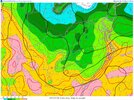
Tempests run lowIdk where yall getting all these 60s, another AM at 72 here in the upstate. Bahama in Durham county got to 64. Here’s your sorta wedge at 12z:
View attachment 173613
JHS
Member
The 12z GFS ends this heat with a bang next Thursday. That day may have to be watched for a derecho as the model shows a major MCS developing over the mountains and moving east right at peak heating.Well this morning's GFS, GEFS, ECMWF, EPS all have the same basic idea; one of the hottest weeks in years for many from this Sat through the end of the month, then a very noticeable change for the first week of August to 80s/60s for many. That will feel like a nice relief for us if it verifies but what an awful finish to the month!
Can’t wait to use that this winter

