Cook
-
Hello, please take a minute to check out our awesome content, contributed by the wonderful members of our community. We hope you'll add your own thoughts and opinions by making a free account!
You are using an out of date browser. It may not display this or other websites correctly.
You should upgrade or use an alternative browser.
You should upgrade or use an alternative browser.
Pattern July Fry and Dry
- Thread starter SD
- Start date
NoSnowATL
Member
Wen rain?
Brent
Member
The month we lose 35 minutes of daylight!
snowc
Member
snowc
Member
Oh yeah, I LOOVE july..
Me thinking about wen rain
And the start of Fall
and FOOTBALL!
snowc
Member
Also, It's been a year since I've rejoined SouthernWX. 
using the right threadLooks like another run at upper 90s to low 100s right after the 4th. That one is going to be the classic western heat release though so it's likely have a big EML and disturbed NW flow.
The first week of July looks like typical weather for most of us with highs in the low to mid nineties and isolated thunderstorms for those lucky enough to see one. Wednesday looks to be the best chance to see precipitation as a weak cold front moves in and stalls out over eastern North Carolina. The RDU discussion did mentioned that dewpoints would be lower as dryer air moves in at the end of the week making it feel more tolerable outside but decreasing the chances for rain.
Last edited:
snowc
Member
Not even noon yet and storms are forming! 


snowc
Member
Welp, the HRRR was right.,. No storms at 3pm!
JHS
Member
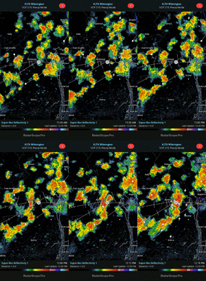
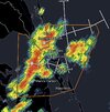
We got hit about 3 hours ago from another line of storms that formed just to our west and moved over us.Ever since I moved away, seems like yall get a Storm almost everyday during the summer!! Hope this can hold together for ShetleysView attachment 173304
lexxnchloe
Member
The more the better.The month we lose 35 minutes of daylight!
The amount of texts I got from people about this is insane lol
BrickTamland
Member
Looks like all the storms are going to my north tonight.
snowc
Member
Last edited:
Already got plenty of convection in central NC this morning
Those lower dew points later this week are going to feel good compared to the low and mid seventies we've seen that past two weeks. It's sad to say but I'm looking forward to the low temperatures in the upper sixties and highs near 90 this weekend.
snowc
Member
FLOOD ADVISORY FOR HARNETT
WGUS82 KRAH 021534
FLSRAH
Flood Advisory
National Weather Service Raleigh NC
1134 AM EDT Wed Jul 2 2025
NCC037-085-105-125-021845-
/O.NEW.KRAH.FA.Y.0088.250702T1534Z-250702T1845Z/
/00000.N.ER.000000T0000Z.000000T0000Z.000000T0000Z.OO/
Chatham NC-Harnett NC-Lee NC-Moore NC-
1134 AM EDT Wed Jul 2 2025
...FLOOD ADVISORY IN EFFECT UNTIL 245 PM EDT THIS AFTERNOON...
* WHAT...Flooding caused by excessive rainfall is expected.
* WHERE...A portion of central North Carolina, including the
following counties, Chatham, Harnett, Lee and Moore.
* WHEN...Until 245 PM EDT.
* IMPACTS...Minor flooding in low-lying and poor drainage areas.
Ponding of water in urban or other areas is occurring or is
imminent.
* ADDITIONAL DETAILS...
- At 1133 AM EDT, Doppler radar indicated heavy rain due to
thunderstorms. Minor flooding is ongoing or expected to begin
shortly in the advisory area.
- Some locations that will experience flooding include...
Sanford, Southern Pines, Lillington, Carthage, Pinehurst,
Aberdeen, Angier, Goldston, Whispering Pines, Pinebluff,
Broadway, Foxfire, Taylortown, Vass, Cameron and Lemon
Springs.
- http://www.weather.gov/safety/flood
PRECAUTIONARY/PREPAREDNESS ACTIONS...
Turn around, don't drown when encountering flooded roads. Most flood
deaths occur in vehicles.
&&
LAT...LON 3559 7940 3564 7912 3552 7869 3534 7854
3525 7861 3527 7879 3517 7912 3521 7925
3505 7946 3510 7956 3525 7970 3551 7977
3552 7956
$$
10
Shaggy
Member
Shaggy
Member
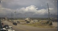
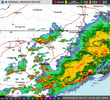
OH... So... close.. View attachment 173321
Shaggy
Member
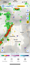
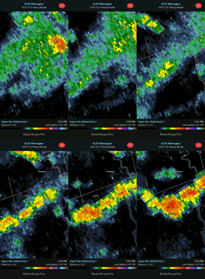
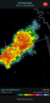
Been painfully left out so far today but the next line looks goodI'm receiving a very nice Downpour ATM..
Unless the follow up line on radar gives Wake County some rain, it looks like for the most part it will dodge the majority of the precipitation from the passage of the frontal trough. After today, things look high and dry for at least the next seven days unless we get a pop up isolated thunderstorm or shower later in the period. I was hoping for something more significant from this event.
Going to be some unsettled weather for southeast beach-goers this weekend, I'm afraid.
Shaggy
Member
snowc
Member
@Downeastnc,, Should be getting Decent Showers..
Flash flood/
Flood Advisory is in effect..
Flood Advisory is in effect..
snowc
Member
Our goose is ------- cooked
WUUS52 KRAH 022143
SVRRAH
NCC085-101-183-022230-
/O.NEW.KRAH.SV.W.0188.250702T2143Z-250702T2230Z/
BULLETIN - IMMEDIATE BROADCAST REQUESTED
Severe Thunderstorm Warning
National Weather Service Raleigh NC
543 PM EDT Wed Jul 2 2025
The National Weather Service in Raleigh has issued a
* Severe Thunderstorm Warning for...
Northeastern Harnett County in central North Carolina...
Southwestern Wake County in central North Carolina...
Southwestern Johnston County in central North Carolina...
* Until 630 PM EDT.
* At 543 PM EDT, a severe thunderstorm was located near Cary, moving
south at 30 mph.
HAZARD...60 mph wind gusts.
SOURCE...Radar indicated.
IMPACT...Expect damage to roofs, siding, and trees.
* Locations impacted include...
Raleigh, Cary, Garner, Fuquay-Varina, Angier, Benson, Apex, Holly
Springs, Morrisville, and Coats.
PRECAUTIONARY/PREPAREDNESS ACTIONS...
For your protection move to an interior room on the lowest floor of a
building.
&&
LAT...LON 3552 7840 3535 7856 3548 7895 3556 7894
3558 7892 3559 7894 3580 7891 3582 7864
TIME...MOT...LOC 2143Z 339DEG 24KT 3572 7875
HAIL THREAT...RADAR INDICATED
MAX HAIL SIZE...<.75 IN
WIND THREAT...RADAR INDICATED
MAX WIND GUST...60 MPH
$$
10
snowc
Member
How about changing the thread title to July Fry and Dye?! /s
@snowc c, you hype up too much..
this is Typical Summer time Weather..
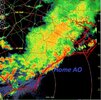
Among the downpours & lighting here.. I had the quite pleasant Dog walk w/My hound.. A few minutes ago, She "wallered" in every puddle/Mud Hole, She could find.. Which is the whole Ditch line in My AO.. about a 100 yards.. cool ASF,, rain & Lighting..
MUD PUDDLES, & a hound Dog, cooped up for a week, (She was just Spayed),, what COULD BE BETTER THAN THAT? (BESIDES 6" OF snow? ), ya did that too last winter..
We were
Singin in the rain...
Power barely holding on

