• Hello, please take a minute to check out our awesome content, contributed by the wonderful members of our community. We hope you'll add your own thoughts and opinions by making a free account!

Pattern July Fry and Dry

This is the weirdest summer ever here... The GFS has no heat ridge through July 23rd 🤣 🤣 🤣 still haven't been above 95

It's been a long time since we had one of these summers
Who cares about actual temp. All that matters is what it feels like. And I see a Real Feel of 105 for you on Thursday.
 
Big Daddy PWs this week. Going to see some loaded downbursts and torrential downpours. I'd guess Flood Watches go up in a day or two.
 
God ------- ------ Mother NATURE!
------- goose is NOW ------- cooked
WUUS52 KRAH 082114
SVRRAH
NCC051-085-082200-
/O.NEW.KRAH.SV.W.0191.250708T2114Z-250708T2200Z/

BULLETIN - IMMEDIATE BROADCAST REQUESTED
Severe Thunderstorm Warning
National Weather Service Raleigh NC
514 PM EDT Tue Jul 8 2025

The National Weather Service in Raleigh has issued a

* Severe Thunderstorm Warning for...
Central Harnett County in central North Carolina...
Northeastern Cumberland County in central North Carolina...

* Until 600 PM EDT.

* At 514 PM EDT, a severe thunderstorm was located 8 miles southwest
of Lillington, moving east at 10 mph.

HAZARD...60 mph wind gusts and quarter size hail.

SOURCE...Radar indicated.

IMPACT...Hail damage to vehicles is expected. Expect wind damage
to roofs, siding, and trees.

* Locations impacted include...
Lillington, Dunn, Godwin, Erwin, Coats, Wade, Falcon, Linden,
Anderson Creek, and Timberlake.

PRECAUTIONARY/PREPAREDNESS ACTIONS...

For your protection move to an interior room on the lowest floor of a
building.

&&

LAT...LON 3518 7896 3544 7894 3544 7861 3543 7861
3540 7859 3526 7860 3525 7862 3520 7863
3520 7864 3517 7863 3517 7864 3516 7863
3515 7864
TIME...MOT...LOC 2114Z 267DEG 9KT 3528 7889

HAIL THREAT...RADAR INDICATED
MAX HAIL SIZE...1.00 IN
WIND THREAT...RADAR INDICATED
MAX WIND GUST...60 MPH

$$

LH
 
GOOSE IS NOW ------- COOKED NOW. GOODBYE POWER FOR AT LEAST 34 HOURS!
Please stop with the constant, way over the top drama. One post every 3 hours is enough to get the point across. 3 posts every minute aren't needed.
 
heads up @ragtop50
WUUS52 KRAH 082257
SVRRAH
NCC051-085-101-163-191-195-082345-
/O.NEW.KRAH.SV.W.0195.250708T2257Z-250708T2345Z/

BULLETIN - IMMEDIATE BROADCAST REQUESTED
Severe Thunderstorm Warning
National Weather Service Raleigh NC
657 PM EDT Tue Jul 8 2025

The National Weather Service in Raleigh has issued a

* Severe Thunderstorm Warning for...
Central Wayne County in central North Carolina...
Northern Sampson County in central North Carolina...
Southeastern Harnett County in central North Carolina...
Northeastern Cumberland County in central North Carolina...
Southwestern Wilson County in central North Carolina...
Johnston County in central North Carolina...

* Until 745 PM EDT.

* At 657 PM EDT, severe thunderstorms were located along a line
extending from near Smithfield to 11 miles northwest of Clinton,
moving northeast at 25 mph.

HAZARD...60 mph wind gusts and quarter size hail.

SOURCE...Radar indicated.

IMPACT...Hail damage to vehicles is expected. Expect wind damage
to roofs, siding, and trees.

* Locations impacted include...
Goldsboro, Smithfield, Dunn, Mount Olive, Benson, Godwin, Micro,
Selma, Erwin, and Coats.

PRECAUTIONARY/PREPAREDNESS ACTIONS...

For your protection move to an interior room on the lowest floor of a
building.

&&

LAT...LON 3548 7872 3572 7802 3519 7801 3519 7804
3518 7807 3518 7809 3519 7816 3518 7817
3514 7816 3506 7866
TIME...MOT...LOC 2257Z 242DEG 21KT 3552 7844 3515 7841

HAIL THREAT...RADAR INDICATED
MAX HAIL SIZE...1.00 IN
WIND THREAT...RADAR INDICATED
MAX WIND GUST...60 MPH

$$

LH
 
hate when meteorologists use the real feel temperature.

Yeah and it's still way better than what we saw a couple summers ago. I remember the 130 heat index 😜

NWS barely has us over 100 heat index btw

I mean personally I'm not convinced yet August won't be endless awful heat but just to get this far is interesting and again it just seems like we can't shake the unsettled pattern
 
Not that this matters locally, as a former crew member, having our plane push back with this … makes for a long sit on the tarmac : DFW-> CLT
5778c5f74a986e400af7e9308461bf66.jpg


Sent from my iPhone using Tapatalk
 
Stop. If you spent 2 more seconds reading what cloud seeding is and how it works, you’d know that had zero impact on the flooding in Texas or anywhere in the world.

Let me help. This is from an actual meteorologist.
 
Stop. If you spent 2 more seconds reading what cloud seeding is and how it works, you’d know that had zero impact on the flooding in Texas or anywhere in the world.

Let me help. This is from an actual meteorologist.


I understand why some conspiracy theories exist and some raise some interesting thoughts. I cannot understand why something so logical as this flood needs a conspiracy theory though. Events like this has happened before and will continue as long as people flock to flash flood prone areas.

 
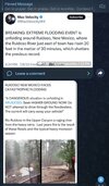
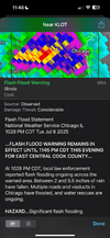
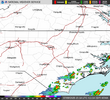
Radar estimating almost 6 inches of rain had fallen on the West Side of Chicago tonight. Multiple water rescues ongoing


IMG_5444.png
 
Stop. If you spent 2 more seconds reading what cloud seeding is and how it works, you’d know that had zero impact on the flooding in Texas or anywhere in the world.

Let me help. This is from an actual meteorologist.


Thank you. I'm blocking people left and right on Facebook who won't stop talking about a conspiracy

Why don't you tell the parents of missing and dead kids that it was weather modification. It's so stupid
 
Radar estimating almost 6 inches of rain had fallen on the West Side of Chicago tonight. Multiple water rescues ongoing


View attachment 173412

KNCERWIN28 reported 4 inches per hour last night. Now we have beaten the fastest time to rain within the first 10 days of July. Last year we were only at 2 inches for the month around this time, now at almost 6 inches!
 
Stop. If you spent 2 more seconds reading what cloud seeding is and how it works, you’d know that had zero impact on the flooding in Texas or anywhere in the world.

Let me help. This is from an actual meteorologist.

whoa! I was just posting wx banter. Cloud seeding had 0 to do with Texas Flood. I've heard the target in post, interviewed. Sowed 2 clouds a county away like day before. clouds dissolved and where long gone. I know how it works etc, thank you!
 
Not even noon and cells are popping up. Just a friendly reminder there are 30 days are until the Panthers play the Browns, and 57 days till regular season NFL. 75 days till Fall as well.
1752075811858.png
 
Last edited:
As of 300 AM Wednesday...

* Scattered flash-flooding is expected this afternoon through late
this evening, especially in urban areas of the Piedmont (including
the Triad) as well as the hydrological sensitive areas of the
eastern Piedmont from Chantal rainfall.

* Flood Watch in effect for a majority of the central NC Piedmont
and western Sandhills from 2 PM today until 2 AM tonight.

Convectively amplified shortwaves are expected to ripple through the
base of the broad mid/upper level trough currently stretching from
the Great Lakes through the Ohio Valley and into the ArkLaTex
region. This will result in weak but gradual H5 heights falls to
leak into the Mid-Atlantic this afternoon through the overnight
period. Anomalous deep layer moisture will gradually increase to
around 2" areawide (exceeding the 90th percentile) and prime the
area for efficient heavy rainfall showers/storms during the
afternoon. Showers and storms are expected to develop along the
eastern slopes of the mountains and over western NC and gradually
shift eastward into central NC through mid-afternoon.

The likely greatest concern through tonight will be for scattered
instances of flash-flooding this afternoon through late this
evening. Anomalous deep-layer moisture, weak steering winds, a deep
warm-cloud layer >10,000 ft, and moderate to strong instability are
all very favorable ingredients for flash-flooding. Additionally, the
eastern Piedmont is still hydrological sensitive due to rainfall
from Chantal (soil moisture still 50-70% and FFG of around 2.5" in 6
hours). 00z HREF and the 18z REFS continue to indicate 40 to +60%
probabilities for >3" in 24 hours, but investigating the LPMM
fields, these areas of locally enhanced rainfall will likely be
scattered in nature in concentrated areas. The limited coverage of
these amounts in available guidance precludes higher probabilities
for flash-flooding at this time. Observational trends will be
assessed through this afternoon whether a moderate risk for excessive
rainfall (Level 3 out of 4) will be needed. Finally, even with
continued weak synoptic support for showers/storms to continue
overnight, available guidance still shows a noticeable weakening
trend to convective intensity from 03-06z. As such, will opt to not
extend the Flood Watch through the overnight hours at this time.
 
Had a rain shower and a couple of rumbles of thunder yesterday evening. Nothing big. Have to see if we get more storms tonight. Hopefully the forecast will bust and the rain will stay away from the areas that flooded last Sunday.
 
Back
Top