-
Hello, please take a minute to check out our awesome content, contributed by the wonderful members of our community. We hope you'll add your own thoughts and opinions by making a free account!
You are using an out of date browser. It may not display this or other websites correctly.
You should upgrade or use an alternative browser.
You should upgrade or use an alternative browser.
Pattern Januworry
- Thread starter SD
- Start date
Yeah I had a stiff southerly breeze all day but with clouds only made it to 42. One of the few times I recall windchills in the 30s with a south wind lol46/15 more wind than I thought today
Z
Zander98al
Guest
NCSNOW
Member
- Joined
- Dec 2, 2016
- Messages
- 9,579
- Reaction score
- 19,089
GSO is at -2.3 for the month. Amazing after first 3 days really. We went above seasonal climo on the snowfall. One of the best January's in a while no doubt.
Think we get 2 more shots at a winter storm between now and Feb 20. Not sure how Feb 20-3/15 will take shape to close out. Feb/March is usually when we get the big dog if theirs one to be had. Honestly was just hoping to avoid a shut out back during the Holidays. Just shows you never know long range. Every time you think you have a good pulse, idea, Mother nature throws a new pitch we never seen before.
Think we get 2 more shots at a winter storm between now and Feb 20. Not sure how Feb 20-3/15 will take shape to close out. Feb/March is usually when we get the big dog if theirs one to be had. Honestly was just hoping to avoid a shut out back during the Holidays. Just shows you never know long range. Every time you think you have a good pulse, idea, Mother nature throws a new pitch we never seen before.
If you took the first two big departure days at the beginning of the month and just had them as average days, our average temp this month would be 37.93 at RDU.
Z
Zander98al
Guest
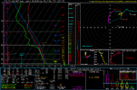
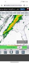
We Have to be careful or we may need a warm sector thread for the Feb 2-4 system. ? Pre frontal convection is in question along with just how much instability is present. But a stout QCLS looks to be in store
Good post. Yes, it's been cold for the Triad. I thought we would start to snap out of the is pattern by now but the staying power is unreal. Are we looking at a very warm March...maybe? There will probably be a few more systems to watch and potentially a big dog to really shake up the pattern.GSO is at -2.3 for the month. Amazing after first 3 days really. We went above seasonal climo on the snowfall. One of the best January's in a while no doubt.
Think we get 2 more shots at a winter storm between now and Feb 20. Not sure how Feb 20-3/15 will take shape to close out. Feb/March is usually when we get the big dog if theirs one to be had. Honestly was just hoping to avoid a shut out back during the Holidays. Just shows you never know long range. Every time you think you have a good pulse, idea, Mother nature throws a new pitch we never seen before.
21 this morning. Take away first day or two of this month and she's been cold
GSO is at -2.3 for the month. Amazing after first 3 days really. We went above seasonal climo on the snowfall. One of the best January's in a while no doubt.
Think we get 2 more shots at a winter storm between now and Feb 20. Not sure how Feb 20-3/15 will take shape to close out. Feb/March is usually when we get the big dog if theirs one to be had. Honestly was just hoping to avoid a shut out back during the Holidays. Just shows you never know long range. Every time you think you have a good pulse, idea, Mother nature throws a new pitch we never seen before.
For the period January 15-30, 2022 vs normal in addition to three wintry events in portions of the SE:
GSO and RDU -7
Huntsville, GSP and Hogtown -6
CLT, BNA, CAE and SAV -5
BHM, CHA and ATL -4
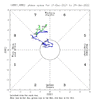
The MJO has been almost entirely inside the left half of the circle since January 15th:
January at ATL based on 40 years (ignore the 1978):
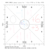
So, January 15-30 was a textbook cold period vs averages for the MJO in that location, which is pretty much the coldest location for the MJO during January in the SE US averaged out.
Last edited:
Z
Zander98al
Guest
Z
Zander98al
Guest
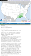
Hey mods, I may make a thread by tommorow for severe weather if things hold or a spc outline is shown.
33.7 looks like I'll finish the month around 39.0
We will see where we are in the morningHey mods, I may make a thread by tommorow for severe weather if things hold or a spc outline is shown.
Z
Zander98al
Guest
Z
Zander98al
Guest
Z
Zander98al
Guest
Huh?
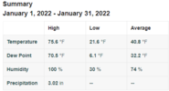
KATL managed to finish .3F below average, remarkable considering the beginning of the month. There was a trace of snow on five different calender days.
KATL

KPDK (NNE side of town)

Cartersville (NW metro) @EmersonGA

Blairsville (1883') @DixieBlizzard

Home
Average High: 50.9F
Average Low: 31.9F
Total Snow: 2.1"
KATL

KPDK (NNE side of town)

Cartersville (NW metro) @EmersonGA

Blairsville (1883') @DixieBlizzard

Home
Average High: 50.9F
Average Low: 31.9F
Total Snow: 2.1"

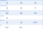
Min. 12.2
Max. 77.9
Avg. 37.2
Precip 5.21
snow 3.7
zr/ip trace
Max. 77.9
Avg. 37.2
Precip 5.21
snow 3.7
zr/ip trace

