znel52
Member
Januworry stats.

Sent from my Pixel 6 Pro using Tapatalk

Sent from my Pixel 6 Pro using Tapatalk


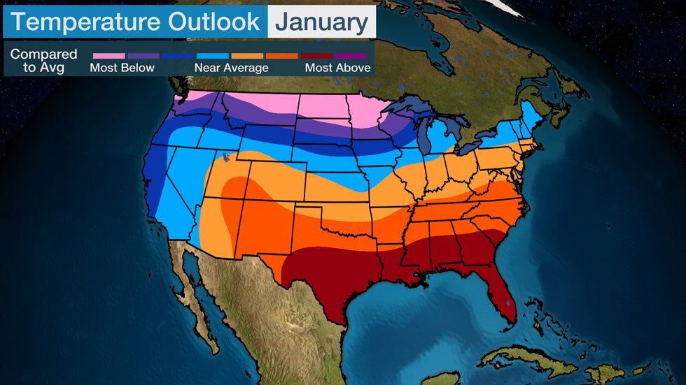
Where's the TWC January forecast to compare this map to? ???Not a bad January at allView attachment 112200
Where's the TWC January forecast to compare this map to? ???
GSO is at -2.3 for the month. Amazing after first 3 days really. We went above seasonal climo on the snowfall. One of the best January's in a while no doubt.
Think we get 2 more shots at a winter storm between now and Feb 20. Not sure how Feb 20-3/15 will take shape to close out. Feb/March is usually when we get the big dog if theirs one to be had. Honestly was just hoping to avoid a shut out back during the Holidays. Just shows you never know long range. Every time you think you have a good pulse, idea, Mother nature throws a new pitch we never seen before.
