• Hello, please take a minute to check out our awesome content, contributed by the wonderful members of our community. We hope you'll add your own thoughts and opinions by making a free account!

Pattern January Joke

Hey @griteater, seems like there’s mixed views on what MJO phase 1 and 2 brings in February, particularly given the state of ENSO. Any thoughts on that?
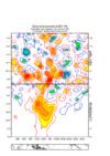
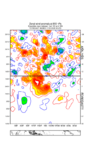
Yeah, you see varying opinions on the MJO pattern influence, but looking at these Paul Roundy MJO plots (link below), phases 1 and 2 are fine in late winter / better than they are in early winter (December).

Paul Roundy MJO


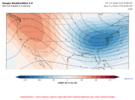
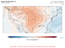
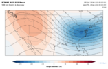
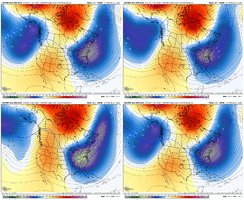
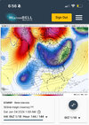
The PAC Jet is going to extend soon and likely gives us the nice looking +PNA pattern late Jan. Going into early Feb, we may lose our cold TPV in eastern Canada for a bit, and the modeling wants to go a bit zonal flow across the conus with the fully extended Pac Jet and big gulf of Alaska low. But that may be brief. You can already see the Euro AI Ens trending a bit weaker towards the end of its run with the Pac Jet extension. So with the Pac Jet backing off a bit, and combining that with Webb’s eastward moving West Pac warm pool & MJO in favorable 8-1-2, the Euro Wk progression of maintaining or going back into -EPO / +PNA makes sense in early to mid Feb. And I don’t see hostility with Asia / EAMT. Those are some thoughts. We’ll see how it goes. Always tough to project
 
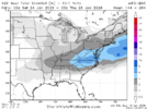
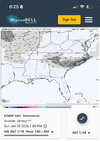
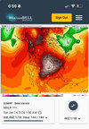
0z euro ai ensemble is loaded, this is only out to hour 180. Thinking we may be cooking earlier in the period.
1362ae19d9bfe083c7362be36f26fbc0.jpg


Sent from my iPhone using Tapatalk
 
Yeah, you see varying opinions on the MJO pattern influence, but looking at these Paul Roundy MJO plots (link below), phases 1 and 2 are fine in late winter / better than they are in early winter (December).

Paul Roundy MJO


The PAC Jet is going to extend soon and likely gives us the nice looking +PNA pattern late Jan. Going into early Feb, we may lose our cold TPV in eastern Canada for a bit, and the modeling wants to go a bit zonal flow across the conus with the fully extended Pac Jet and big gulf of Alaska low. But that may be brief. You can already see the Euro AI Ens trending a bit weaker towards the end of its run with the Pac Jet extension. So with the Pac Jet backing off a bit, and combining that with Webb’s eastward moving West Pac warm pool & MJO in favorable 8-1-2, the Euro Wk progression of maintaining or going back into -EPO / +PNA makes sense in early to mid Feb. And I don’t see hostility with Asia / EAMT. Those are some thoughts. We’ll see how it goes. Always tough to project
Thank you! This sounds awesome
 
915e5c8e4f896cb1023de3fe961695cb.jpg

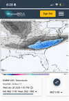
874624068a2b3676e549f4f21c3bc864.jpg

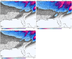
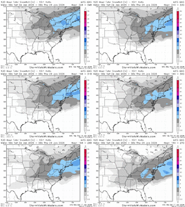
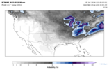
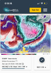
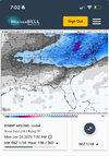
This is only through 186 hours. The EURO AI is honking! This is for Saturday-Monday timeframe so only 6-8 days out. Not sure I ever remember a model doing this so far out. December 2018 comes to mind.


Sent from my iPhone using Tapatalk
I’m gonna wake up the whole neighborhood
 
So, no superstrong WWB after all? What happened? Are the models that bad?


Here’s an alternate viewpoint on this.

Mike’s hovmoller forecasts are from the GFS. The charts are actual zonal winds and not zonal wind anomalies. And the charts are from 5 deg N latitude to 5 deg S latitude. All of that is fine, but as a contrast…

Here is the Euro Wk forecast from Jan 6 (same date as Mike’s first forecast chart date). This chart is zonal winds anomalies and for 15N to 15S.

IMG_4610.png


Then here is the same chart from today’s Euro Wk. You can see here that the WWB signal still looks robust and has increased in strength as we’ve gotten closer

IMG_4614.png
 
I see that the euro ai ensemble map is one of the only ones being posted right now in the extended. I wanted to know if these ensemble maps have the same weight as for example the euro ensemble showing 6 inch+ means that far out. I remember seeing that the ai snow maps that far out shouldn't be trusted. Thanks!
 

Yeah this last week in January is just showing some amazing signals for cold/winter weather. EPS/AIF ens have been really consistent with those two ideas…I mean if we don’t see something happen in the 1/24-1/29 timeframe…extreme shame will set in.


Sent from my iPhone using Tapatalk
 
All winter long, it seems like troughs in the east have retrograded southwestward in the medium range. I'm not used to that. Typically, deep troughs in the eastern US usually wind up further north than models forecast in the medium to long range. Fascinating.
 
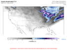
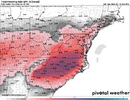
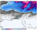
I don't always like this off pivotal, but I do think the ice storm signal is strong for CAD areas.
View attachment 184898

The modeling seems to be pointing toward either a strong messy CAD winter storm or a southern miller A idea. I agree with you that’s a classic CAD look there. Main thing is we have plenty of cold air up north available for use.


Sent from my iPhone using Tapatalk
 
236b77be8844bfe2a70f61e2fb404909.jpg

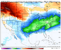
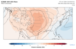
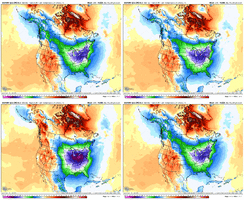
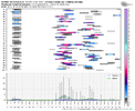
00z EPS showing some impressive cold 10-12 degrees below normal as well as below normal temps for all the SE. I think I counted in MBY at least 60 hours or so of below freezing temps from the evening of 1/27 through late morning of 1/30! I would imagine the CPC/WPC will be issuing some hazardous cold outlooks down the road if this trend continues.


Sent from my iPhone using Tapatalk
 
The January Thaw signature across the lower 48 states is crumbling. The formation and position of a James Bay vortex almost always implies bitterly cold air from the Rocky Mountains to the Gulf and Atlantic coastlines. A southern branch storm track deriving energy and moisture from the Madden-Julian Oscillation moves through northern Mexico into the warm Gulf waters, creating opportunities for cold advection and frozen precipitation. And the vast snow cover stretching from Eurasia across the North Pole into North America will help chill the atmosphere while enabling additional snow and ice development. This sounds like a near-perfect scenario for an active second half of January until the first week of March.

While things can go wrong in the forecast set-ups (we are still feeling the results of that data cut-back from lost rawinsondes....). Most of the numerical models have dumped earlier projections for widespread warmth in the lower 48 states this winter. The analog system has performed remarkably well, even projecting the extremely cold negative 500MB height anomaly passing through Akimiski Island coming up around January 28. Temperatures are already turning colder, while the +PNA ridge, albeit in somewhat muted form, has been dominant in the West. The general idea that model guidance has shown repeatedly is a warm West vs. cold Central/East alignment.

Aside from the minor "starved" shortwaves tracking around the big gyre around James Bay, all that seems to matter is for the large storm and moisture fetch off of western Canada to eject a disturbance along the frontal structure below the Rio Grande Valley and on into the neck of Florida. I urge caution while following the forecast, simply because tight snow/ice/rain division may emerge in areas that do not often see any frozen precipitation. And because some bitterly cold air will increase heating demand like crazy between now and February 15. This will not be an easy forecast period, trust me.


Prepared by Meteorologist LARRY COSGROVE on
Sunday, January 18, 2026 at 3:10 P.M. CT
 
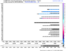
I went back and looked: This makes 9 consecutive runs of the euro AI with a major/widespread winter storm for the southeast in the same timeframe. Going back further it’s been there 11 of the last 12 runs.

This is getting all the way back to 300hr+ forecasts. We are now inside of 240hrs for start time of this threat.

Absolutely crazy how consistent it’s been with this threat.

Yes rock solid so far, thanks for keeping us updated…I certainly hope a lot of folks on this board get rewarded by the end of the month.


Sent from my iPhone using Tapatalk
 
Back
Top