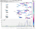
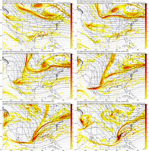
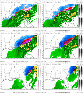
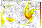
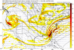
Uhhhh, do i see Central Florida snow on a few of those? LolAlright. Let’s have some fun. Get out your magnifying glasses. Feast your eyes on the AIFS Ensemble members. Loaded!
View attachment 184376View attachment 184377
-
Hello, please take a minute to check out our awesome content, contributed by the wonderful members of our community. We hope you'll add your own thoughts and opinions by making a free account!
You are using an out of date browser. It may not display this or other websites correctly.
You should upgrade or use an alternative browser.
You should upgrade or use an alternative browser.
Pattern January Joke
- Thread starter SD
- Start date
broken025
Member
50 is my favoriteAlright. Let’s have some fun. Get out your magnifying glasses. Feast your eyes on the AIFS Ensemble members. Loaded!
View attachment 184376View attachment 184377
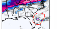
Welcome to the forum! My maternal grandfather was born in Richmond County a long time ago. Here's to ending that snowless streak soon.The ensembles look amazing for Jan 25th-29th timeframe. They also looked awesome three days ago. But maybe this will have Big Dog potential. The Southern Piedmont is going on quite the snowless streak.
Only the GFS ensemble looked good 3 days agoThe ensembles look amazing for Jan 25th-29th timeframe. They also looked awesome three days ago. But maybe this will have Big Dog potential. The Southern Piedmont is going on quite the snowless streak.
packfan98
Moderator
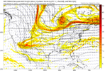
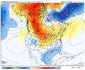
Incredibly intriguing pattern on the Euro AI Ensemble mean that we’ve been scouting in here for a while now
1. Retrograding Scandi to Greenland blocking ridge
2. NW Atlantic / 50-50 Low anomaly forming - with surface high behind it / west of it
3. Pacific Jet extending in MJO Phase 7-8 - you can see that with the sizeable low moving east into the Gulf of Alaska and then subsequently sending waviness through the west coast ridge where the waves are forced to dig southeast in the confluent pattern over the Northeast forced by the retrograding block and 50-50 low anomaly, eventually deepening the east coast trough
Thoughts / Questions:
1. Can we get the models to hold this big picture look? The sizeable MJO pass helps on the Pac side. The retrograding block part may be more difficult to get right. Always tough up there. But a long time out to hold the look
2. It’s possible this look only lasts for a week or so…if so, gotta cash in when ripe. Pattern could be fruitful for us…or north of us in Mid Atlantic / NE
3. Which goes back to WxGSO’s point that simple timing of matching a wave up with cold high pressure to the north becomes paramount. Bad timing - no go
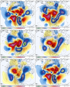
Mean surface pattern - how good is that?
1. Retrograding Scandi to Greenland blocking ridge
2. NW Atlantic / 50-50 Low anomaly forming - with surface high behind it / west of it
3. Pacific Jet extending in MJO Phase 7-8 - you can see that with the sizeable low moving east into the Gulf of Alaska and then subsequently sending waviness through the west coast ridge where the waves are forced to dig southeast in the confluent pattern over the Northeast forced by the retrograding block and 50-50 low anomaly, eventually deepening the east coast trough
Thoughts / Questions:
1. Can we get the models to hold this big picture look? The sizeable MJO pass helps on the Pac side. The retrograding block part may be more difficult to get right. Always tough up there. But a long time out to hold the look
2. It’s possible this look only lasts for a week or so…if so, gotta cash in when ripe. Pattern could be fruitful for us…or north of us in Mid Atlantic / NE
3. Which goes back to WxGSO’s point that simple timing of matching a wave up with cold high pressure to the north becomes paramount. Bad timing - no go

Mean surface pattern - how good is that?

wow
Member
March 2, 2001At this range and with this look when was the last time we saw such a consistent pic across the major globals. One that didn't work out.
T
The last time I can remember us even having this strong a signal across all ensembles at this range was February 2014.At this range and with this look when was the last time we saw such a consistent pic across the major globals. One that didn't work out.
LukeBarrette
im north of 90% of people on here so yeah
Meteorology Student
Member
2024 Supporter
2017-2023 Supporter
Euro Ens being the best look of the bunch >
At this range and with this look when was the last time we saw such a consistent pic across the major globals. One that didn't work out.
I don't get a hit for march 2001 on any NC snow mapsMarch 2, 2001
wow
Member
Yeah it didn't work out. Models were all showing a banger of a storm 7+ days out.
The one that did? March 93.
The one that did? March 93.
At this range and with this look when was the last time we saw such a consistent pic across the major globals. One that didn't work out.
I don't get a hit for march 2001 on any NC snow mapuo
Stormlover
Member
That’s within 240 for the western folks?
SnowNiner
Member
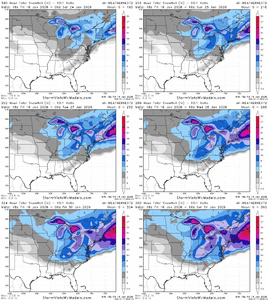
Here was the final mean. That elusive 6 inch mean was creeping closer.
View attachment 184378
Am I the only one blown away by this? I’ve been a weenie and tracking a long time now. I’ve never seen such a high mean that far out. Close to a 5 inch mean for mby? Crazy. And the Euro AI for that matter.
Surely it can’t be serious.
That’s amazing too. Amazing what can be modeled when you have cold entering the conus from a good pacific AND a true -NAO.
Can this just happen once please?
It high up there man. Been a while no doubtAm I the only one blown away by this? I’ve been a weenie and tracking a long time now. I’ve never seen such a high mean that far out. Close to a 5 inch mean for mby? Crazy. And the Euro AI for that matter.
Surely it can’t be serious.
That’s amazing too. Amazing what can be modeled when you have cold entering the conus from a good pacific AND a true -NAO.
Can this just happen once please?
I mean obviously this could all fall apart, but synoptically it makes sense. If the NAO blocking comes together as modeled, we appear to finally have some semblance of a southern jet leading into this period while also having favorable MJO pass in prime climo. Will really be a kick in the pants if a decent winter storm doesn’t materialize. Quite different than northern stream dominance we’ve seen thus far.
Sent from my iPhone using Tapatalk
Sent from my iPhone using Tapatalk
SnowNiner
Member
Here was the final mean. That elusive 6 inch mean was creeping closer.
View attachment 184378
I can’t unsee this now. If this evaporates like the GEFS did for Sunday, I don’t think I’ll be able to take it. Like grit says it probably comes down to whether or not the 50/50 really sets up for a true block and confluence.
LukeBarrette
im north of 90% of people on here so yeah
Meteorology Student
Member
2024 Supporter
2017-2023 Supporter
Too much dumping in the Pac NW this 00z gfs run. Not going to work for us. Doesn’t align with the Euro Ens so it’s all good
LukeBarrette
im north of 90% of people on here so yeah
Meteorology Student
Member
2024 Supporter
2017-2023 Supporter
Flow is jammed for a prolonged period. This is where you sneak one through and end the drought
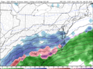
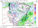
Yeah GFS with Mid Atlantic hit for first system in this window post 1/25, then cooks with the 2nd systemView attachment 184475
Late in the run so it doesn’t matter but this is certainly a look
LukeBarrette
im north of 90% of people on here so yeah
Meteorology Student
Member
2024 Supporter
2017-2023 Supporter
Feb 1899 redux!! Panama
LukeBarrette
im north of 90% of people on here so yeah
Meteorology Student
Member
2024 Supporter
2017-2023 Supporter
bncho
Member
There is a real chance that by the end of the month, the Great Lakes could be approaching record ice cover. And, extensive snow cover will be in place over the Midwest and upper plains. With the right pattern, this not only increases the chances of snow in the South but also heightens the risk of an extreme Arctic outbreak before the end of the month or into early February.
That looks awfully familiar. Well, I wish. Or have I been staring at these 500MB panels with little pesky Saturday night special too much?
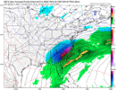
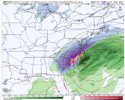
They say ‘93 SOC was showing up 8-10 days out!They all have the same storm. They say the big ones can be seen from way downtown View attachment 184490View attachment 184491View attachment 184492
I’d give up my snow for the rest of the winter for that storm to happen that way! CLT to RAH everybody get 10”+
I see snow all the time now, but I know it hits different down there!
 ️
️
I see snow all the time now, but I know it hits different down there!
There’s only 13 days worth of NW trending to go.

