I'm not clever enough, plus I'm old so.....vanilla title i was expecting more from the men behind the curtain
-
Hello, please take a minute to check out our awesome content, contributed by the wonderful members of our community. We hope you'll add your own thoughts and opinions by making a free account!
You are using an out of date browser. It may not display this or other websites correctly.
You should upgrade or use an alternative browser.
You should upgrade or use an alternative browser.
Pattern January Joke
- Thread starter SD
- Start date
last 5 runs of the Euro in the Pacific centered on Friday morning. slow and steady trend and doesn't look it's done yet either.

ChattaVOL
Member
last 5 runs of the Euro in the Pacific centered on Friday morning. slow and steady trend and doesn't look it's done yet either.
View attachment 183364
Odds for us in Chattanooga?
Sent from my iPhone using Tapatalk
rburrel2
Member
My two cents, but there’s hardly any difference at 5h between the euro and gfs, especially as the event begins.
The gfs just simply has a better/more aggressive qpf response than the euro.
If we get that exact 5h evolution I’d bet my life savings the euro is too dry right now on the northern edge.
The gfs just simply has a better/more aggressive qpf response than the euro.
If we get that exact 5h evolution I’d bet my life savings the euro is too dry right now on the northern edge.
Close up...95 corridor jackpot

My two cents, but there’s hardly any difference at 5h between the euro and gfs, especially as the event begins.
The gfs just simply has a better/more aggressive qpf response than the euro.
If we get that exact 5h evolution I’d bet my life savings the euro is too dry right now on the northern edge.
Just like Webber stated this morning on the globals horrible at handling this.
This may come down to the short range models anywayMy two cents, but there’s hardly any difference at 5h between the euro and gfs, especially as the event begins.
The gfs just simply has a better/more aggressive qpf response than the euro.
If we get that exact 5h evolution I’d bet my life savings the euro is too dry right now on the northern edge.
Stormsfury
Member
Right now, I think the answers lie somewhere between the 12z GFS/Euro in regard to current depictions. BUT where that REX Block sets out out west and we may likely not have a good handle on that until Friday, also once when the s/w in question gets over Alaska and Canada.
NBAcentel
Member
Btw the CMC ens, which it’s OP has been lackluster for 
bncho
Member
Euro definitely trends the shortwave west early, but there’s no space for it to turn neutral/negative because of that northern stream kicker in the upper Midwest
LukeBarrette
im north of 90% of people on here so yeah
Meteorology Student
Member
2024 Supporter
2017-2023 Supporter
We have a new thread for the event! Don't forget that before you post in here
Weekend (potential) storm discourse should shift to the dedicated thread:
Leave this one for what comes after
Jan. 17-18, 2026 SE Winter Weather Threat
First possible board wide threat in forever or nah? In other words, do we RAGE or do we ditch Mitch? Let'er rip and reel it in!
southernwx.com
Leave this one for what comes after
Yowza! Euro popping out some bangers for cold.

SnowNiner
Member
With the blocky -AO the Euro is showing the next 2 weeks, this is the time frame for the western piedmont IMO. -NAO, and PNA together should really help us get some amp on a vort, and keep it south (and CAD blast us).
Light Rain, has reached the Coast..
CURRENTLY->51º
Rain
Today's high 57º(Early this Morning)
Today's low 46º (Just after 1AM or so)..
humidity 73%
dew point 42.8º
rainfall, (SO FAR)-> 0.03 inch
pressure 29.99 inch
Wind(s) outta the West @ 3MPH..
CURRENTLY->51º
Rain
Today's high 57º(Early this Morning)
Today's low 46º (Just after 1AM or so)..
humidity 73%
dew point 42.8º
rainfall, (SO FAR)-> 0.03 inch
pressure 29.99 inch
Wind(s) outta the West @ 3MPH..
SegTindo
Member
Almost a double member increase on the 12z gefs vs 06z gefs for bhm. Enesmbles haven’t been very impressive at all so far and this is a huge jump. EPS also hasn’t looked great, so I hope to see it double up at 12z. I will post them when available.
BHM and MGM below for Alabama folks.
View attachment 183360View attachment 183361View attachment 183362View attachment 183363
Could you do South AL? Like Dothan Mobile?
Sent from my iPhone using Tapatalk

Regardless if there's rain or snow or nothing, it's looking very cold for the extended period. Just like we had Thanksgiving day until a day or two before Christmas. That was not fun working outside every day.
Showmeyourtds
Member
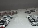
Got some mixed precip here in Holly Springs GA. Pingers & maybe a scattered flake or 2.
It ended by the time I could post this.
PWS (lanked below) is reporting a 5 degree drop in the last 15 minutes
It ended by the time I could post this.
PWS (lanked below) is reporting a 5 degree drop in the last 15 minutes
I just pulled in from a long drive from DC. It was calm 30 minutes ago, but that brief shower brought some significant gusts and a quick drop in temps. I’m not at all shocked you saw some sleet pellets. I would anticipate a flake or two into the early morning hours as temps approach the mid 30s.Got some mixed precip here in Holly Springs GA. Pingers & maybe a scattered flake or 2.
It ended by the time I could post this.
PWS (lanked below) is reporting a 5 degree drop in the last 15 minutes
- Joined
- Nov 29, 2021
- Messages
- 42
- Reaction score
- 144
Interesting SREF plume charts for Birmingham, AL and even more interesting for Lake Charles, LA for Saturday into Sunday’s system: 1/18/2026. 

LukeBarrette
im north of 90% of people on here so yeah
Meteorology Student
Member
2024 Supporter
2017-2023 Supporter
Nasty rainy wind here right now. Temp will drop quick behind this
This is for you @Mitch West
Attachments
- Joined
- Nov 29, 2021
- Messages
- 42
- Reaction score
- 144
Banner elk

SnowNiner
Member
Uh oh, what's this nonsense at the end of the EPS? Don't lose my -AO/-EPO/+PNA combo....

Seems like the story:
Pretty darn cold next 6ish days aside from SAT
Swing back mild late next week/weekend then perhaps come back BN after that?
Pretty darn cold next 6ish days aside from SAT
Swing back mild late next week/weekend then perhaps come back BN after that?
GEFS still looks good. I guess.Uh oh, what's this nonsense at the end of the EPS? Don't lose my -AO/-EPO/+PNA combo....
View attachment 183674

- Joined
- Jan 23, 2021
- Messages
- 4,604
- Reaction score
- 15,203
- Location
- Lebanon Township, Durham County NC

Winter will have another chance before the month is up imo
Brent
Member
An hour ago hereWinter will have another chance before the month is up imo

Is that a meme?An hour ago here
View attachment 183725
Well what’s next?
What's the coldest we're projected to be in the next couple weeks. I was reading earlier about the bottom really dropping out at the EOM.
Brent
Member
Well what’s next?
There's a next?
*Goes to find the hurricane list*

broken025
Member
Looks good. Should have additional opportunities to fail in the future.
- Joined
- Jan 23, 2021
- Messages
- 4,604
- Reaction score
- 15,203
- Location
- Lebanon Township, Durham County NC
I sincerely believe we're not done.
Fab Feb! You know the drill, I'm 1 degree away from coming back in here and starting all over again with ya lol.Well what’s next?
What did yall do with my man Fro? Do we need t0 call Mecklenburg county and do a welfare check?
Here's the problem.

Yeah...it needs to be massaged some more...why I thought maybe once we get into Feb.