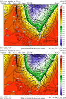
looks to have a similar footprint as the op so far.
View attachment 183323
Love seeing all of that back to the west and in Louisiana and southern Mississippi.
looks to have a similar footprint as the op so far.
View attachment 183323
Yeah was going to say model noise as well. Not quite as sharp at the base / touch more positive tilt. Not as much sfc reflection off the coast. UKMet is kind of a wild child too. It can be jumpy rather than slowly trending in one directioni really don't mind this evolution at all, small step back from 00z but feels like noise, not a warning shot

Don't think we're done trending west. The upstream pattern over the Pacific keeps ticking back.
View attachment 183319
View attachment 183324
This is good at this range, needed to reign in NW trend anyway. I think GFS just about as far west as it could go, maybe a little more but not much. Models will hone in on a final track soon enough. As long as Euro isn't a complete whiff, we good lol
At this lead time, the Ensembles are going to mirror the op somewhat. Biggest difference is a general flatter and out to sea look than the op. That means that the op is on the western side of the guidance. It does have some support from some of the members though. Steady as she goes!Consensus is there for a more juiced up event on the GEFS. Also a slight NW trend
View attachment 183336
I vote yes
Need a 2nd opinion from the 12z good Dr still...We will start a thread soon enough, no offense but no need to clutter this thread asking. Thanks.
A thread will most likely go up after the Euro and I highly doubt this turns into an apps cutter.As far as a thread, it is still a bit early for that. There is the chance that we might be talking about a App cutter when all is said and done. I think that 72 hours before would be good for a thread if things are still looking like they do now.
I think there needs to be a distinction between nw trend and apps cutter. The first doesn’t mean the second.A thread will most likely go up after the Euro and I highly doubt this turns into an apps cutter.
But the UK shows no precip over our area. I am close to your area.
GA Mets not saying anything about snow except the far most no truth counties tonight and it's not supposed to matter much. Even Glenn Butns is not saying anything.yeah well, when you are him, with a reputation, you have to think that what he says can affect all the local business and government functions. it can cost people a lot of money if things shut down and nothing happens, so why add to the chaos, let the nws deal with it
Chris Zelman at WALB in Albany, GA has already made a social media post about potential 1-3 inch totals across South Georgia. However, the Macon area market seems to be playing it conservatively as of now.GA Mets not saying anything about snow except the far most no truth counties tonight and it's not supposed to matter much. Even Glenn Butns is not saying anything.
the faster/less digging progression on Sunday is what gets me the most about it right nowActually I think the Euro AI is a perfect example of how this could all go wrong.
I’m kind of worried a bit about how the Atlantic ridge is also pumping with each run, I know it’s a thread the needle situation but I hope this trend slows a biti won't worry too much about the thermos on the EC-AI yet. gotta like the H5 trend
View attachment 183339
Both AI’s are a red flag right now for sure. Both don’t have enough separation between the lead wave that generates the precip up thru E TN on Saturday and the trailing wave diving down for our coastalActually I think the Euro AI is a perfect example of how this could all go wrong.
@BurgerTimeboard is gonna popping after this euro run View attachment 183340
If the reg Euro lines up with the GFS here in a second. It will be a great battle / case study to see who raises the white flag 1st. Physics models v/s AI modelsBoth AI’s are a red flag right now for sure. Both don’t have enough separation between the lead wave that generates the precip up thru E TN on Saturday and the trailing wave diving down for our coastal
totally agree. i want to get a grasp on what they are good at and what they are bad atIf the reg Euro lines up with the GFS here in a second. It will be a great battle / case study to see who raises the white flag 1st. Physics models v/s AI models
No…this will continue to trend north and west…it is the absolute perfect setup for snow in central/north AL, through northern GA, eastern TN, and western Carolinas.So does this mean that us North Alabama folks is out of the game?
