Unfortunately, one of those features that are difficult for models to figure out, but a little detail that will make all the difference here. This may be one of those storms where we are down to 24 hours and will have no idea what will happen, LOL18z euro probably isn’t gonna cut it. We need that embedded piece of northern stream to dig further southwest and try to drop it more towards the base of the H5 trof. As long as that feature stays north, it’s a cold frontal passage with a bloomer off the coast. If that digs more, it generates precipitation while cold air advection is occuring through upper level processes, and it would be a colder setup VS just relying on the digging pacific oriented energy. Dream scenario here is digging it further southwest and cutting it off, similar to the 12z GFS. View attachment 182080
-
Hello, please take a minute to check out our awesome content, contributed by the wonderful members of our community. We hope you'll add your own thoughts and opinions by making a free account!
You are using an out of date browser. It may not display this or other websites correctly.
You should upgrade or use an alternative browser.
You should upgrade or use an alternative browser.
Pattern January Joke
- Thread starter SD
- Start date
Please explain?It's going to take something truly special to get upstate SC into a major snowstorm. I see Atlanta, Columbia, and even Charleston getting hit big before we do.
Then probably won't get anything, can't wait to see his clown mapDT is honking the horn!!
Sent from my iPhone using Tapata
Hey man - yeah EPS & Eur Wk look pretty poor after next week. GFS & CMC Suites not as bad with some cold to our north. MJO / Trop forcing look good, not a red flag. Biggest concern I see is what looks to be a decent -EAMT event in about a week which would want to retract the jet in the following week, and a lot of times the models don’t catch on with that until we get closer in…but that would lower our chances at seeing the western ridging we need for cold. Ever evolving, we’ll see how it goesView attachment 182063View attachment 182062
Definitely seems like we will have some sort of warm up after the two threats. However I wonder if the mean trough trends itself more to the east as we get closer in time. That has been the trend this winter so far. Would love your thoughts @Webberweather53 or @griteater for the 25th of Jan thru the 5th of Feb.
I mean this has already happened. You can include Tallahassee Florida in that as well.It's going to take something truly special to get upstate SC into a major snowstorm. I see Atlanta, Columbia, and even Charleston getting hit big before we do.
NBAcentel
Member
Bingo. The thing that caused our November flizzard was a small piece of northern stream vorticity, that thing was not resolved on modeling more clearly until 48-60 hours out. Gonna be lots of bouncing around with that peice of energy, for the better and for the worseUnfortunately, one of those features that are difficult for models to figure out, but a little detail that will make all the difference here. This may be one of those storms where we are down to 24 hours and will have no idea what will happen, LOL
Webberweather53
Meteorologist
View attachment 182063View attachment 182062
Definitely seems like we will have some sort of warm up after the two threats. However I wonder if the mean trough trends itself more to the east as we get closer in time. That has been the trend this winter so far. Would love your thoughts @Webberweather53 or @griteater for the 25th of Jan thru the 5th of Feb.
Things seem to be generally going along as I thought they would the last week or so.
Get a big cold push with some winter storm threats around MLK Day, then we back off at the end of Jan into the beginning of Feb with the SE ridge flexing. I suspect we may try to go back our current pattern by mid February ish, tho the mean wavelengths will be getting shorter, which might be a concern for SE ridging
We will probably see us get a good cold push initially as this EPO block sets up, then the SE ridge flexes late month as everything retrogrades.
My hunch is we will load up yet again early to mid February as the MJO orbits into the Western Hemisphere and is convectively coupled to the developing El Niño event in the Pacific.
If you want snow in the south, you need to strike around MLK Day or so before the pattern retrogrades to a point where the SE ridge flexes.
JHS
Member
Something like March 2009 or March 1993. Both were once in a lifetime systems.Please explain?
0z ICON @ 144, little late on turn, but it phases in the northern energy wholesale over the middle and lower MS River Valley.

NBAcentel
Member
That’s a nice move on the icon. Close man 
trackersacker
Member
For what I would say was a W move in the ICON upper air pattern, the surface/snowfall sure wasn’t very impressive
W move???For what I would say was a W move in the ICON upper air pattern, the surface/snowfall sure wasn’t very impressive
trackersacker
Member
A win. It was a better phase, but cold air availability is roughW move???
trackersacker
Member
Feel like if this look was to verify for next weekend, we’ve got a strong southern shortwave with a TPV that’s liable to drop south in a way that wouldn’t let this cut too much and keep it further south no?
WolfpackHomer91
Member
Almost got to break out the bowling shoes there ... for that bowling ballThat’s a nice move on the icon. Close man View attachment 182102

accu35
Member
Better NS diving south?
NBAcentel
Member

Hold onnn

She gonna try with the first system and help with second system.Better NS diving south?
accu35
Member
this could help with our second system
Big fan of how this NS wave is diving and hanging back so far
Man I wish that was over southwest LAShe gonna try with the first system.
HailCore
Member

accu35
Member
Trending west?Man I wish that was over southwest LA
Someone is getting crushed this run I think


Lots of bouncing around, so hard to detect a real trend yet.Trending west?
LukeBarrette
im north of 90% of people on here so yeah
Meteorology Student
Member
2024 Supporter
2017-2023 Supporter
The DC weenies are going to lose their sh….
DC getting crushed

accu35
Member
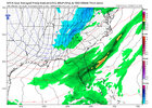
That low off the east coast is definitely further west seems like
A little north with occlusion ivo Richmond / VA Capes, certainly a look we can work with 5 + days out.

trackersacker
Member
My jaw is on the floor
So are us NYC weenies...The DC weenies are going to lose their sh….
Players still on the board and we haven't lost big potential on the OPs yet. Ain't gonna complain about that.
Surface low formed a lot further north than 500 mb looked like it shouId, but holy moly will definitely take this look.A little north with occlusion ivo Richmond / VA Capes, certainly a look we can work with 5 + days out.
View attachment 182118