GeorgiaGirl
Member
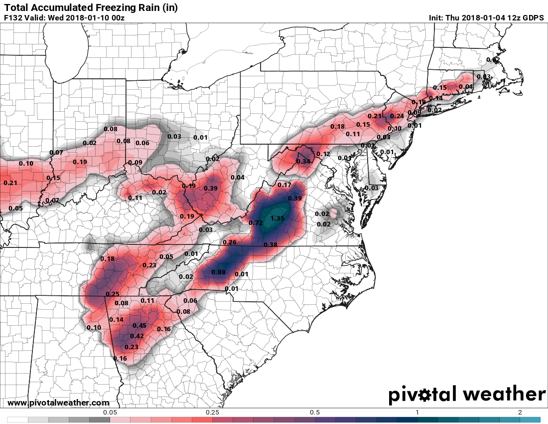
CMC goes from 27° to 40° in a matter of hours. Sorry that’s not happening
yeeeaaahhhh I wouldn't be so sure about that, in typical CAD situations, yeah but the high pressure is quickly exiting stage right in this case.
CMC goes from 27° to 40° in a matter of hours. Sorry that’s not happening
I don’t buy that for a single secondCold retreats in a hurry on the cmc
FFC and Mellish seemed concerned even with yesterdays runs, everyone seemingly knows thru experience how underwhelming models handle CAD events and we've seem them come in stronger before with weaker H and less in place cold air then what we've hadMellish worried models underestimating wedge
Well, the storm track yesterday was usually the kind that gives us a good storm here, but it took forever to overcome the dry air. Seems like the cold we had so long actually hampered things.Of course we get perfect storm tracks when the cold retreats
Always love your input...lolAs mentioned all depends on what that HP does if indeed it continues to shift off the East Coast at the onset yes ZR very possible in the CAD areas from xtreme E AL and points to the North and East and if there is some blocking upstream to hold the HP in place well we know major ice storm could take place
... Carry on
Sent from my iPhone using Tapatalk
I wouldn't expect much there as it's on the other side of the mountains. The whole deal with CAD involves topography and how the cold air is sheared off and by upper level winds due to the mountains in addition to low level cold being fed in. Maybe some for an hour or two but without support from the high pressure and cold being pushed in on the lower levels, you won't get much accretion for very long and it will melt fast as temps rise.Models even put southeast TN in play for some freezing rain, sleet and snow. Yep watching it. We know how CAD goes.
And it warms up too muchCMC totals pretty rough uptick from 00z run not as bad as yesterdays 12z though

No if anything it’s under doing it. It warms to 40 while raining in great cad areas. That doesn’t happenIs it me or do I think the CMC may be overdoing it a little?
Is it me or do I think the CMC may be overdoing it a little?


That accounts for ice right? I think it does, but I'm just wondering.All in for e10

Sent from my SM-J320VPP using Tapatalk
For whoever said wouldnt expect much there have been plenty of times SE TN has dealt with CAD ice freezing rain events. That is ominous. Power outages.CMC totals pretty rough uptick from 00z run not as bad as yesterdays 12z though

Yes as far as i know it doesEuro running anybody able to see those models


Slower, but colder. That's the thing about this. Still looks equally if not nastier.Crazy low dew points for cad regions


Sent from my SM-J320VPP using Tapatalk

That's weird. I don't think it just wetbulbs out and temps start rising.Euro says move along brief period of zr possible View attachment 2609
Sent from my SM-J320VPP using Tapatalk
That rain well be very welcome as dry as it has beenEuro says move along brief period of zr possible View attachment 2609
Sent from my SM-J320VPP using Tapatalk
