I wish Tony was up this way. We are having a pretty heavy sleet event at our house at the moment.
-
Hello, please take a minute to check out our awesome content, contributed by the wonderful members of our community. We hope you'll add your own thoughts and opinions by making a free account!
You are using an out of date browser. It may not display this or other websites correctly.
You should upgrade or use an alternative browser.
You should upgrade or use an alternative browser.
Wintry January 8-9, 2018 Ice threat
- Thread starter ForsythSnow
- Start date
radar just picked up a heavy snow sounding in Gadsden AL
If I didn't know what the models had been puking out the past few days and I was only going off of radar, I would think my area was about to have a big snow and ice storm
You know just looking at the short range models and times from 07z/08z runs for RAP/HRRR the front looks to me to be about 2 hours or so in front of what was modeled. Western counties should be seeing some precip within the next hour and thats about 2-3 hours ahead of what models had?
DadOfJax
Member
...and it's incorrect. Nothing but moderate rain and temps between 33 and 34.radar just picked up a heavy snow sounding in Gadsden AL
Batman
Member
Alabama WX - James Spann reporting road closures in Blount, Marshall, Etowah (Gadsden), and Cherokee counties. Not snow, but freezing rain. Very slick. Some roads have become impassable.
ChattaVOL
Member
Roads around Chattanooga are getting iffy.
BPATL
Member
Really kind of much ado about nothing, IMO..Next
Meh, the people in the 35-40 car pile up on I 75 N of ATL , probably disagree with this statementReally kind of much ado about nothing, IMO..Next
ForsythSnow
Moderator
Yeah, there are some issues being caused, and it's too early to call anything off. Have to wait until the environment is too warm, then call it off.Meh, the people in the 35-40 car pile up on I 75 N of ATL , probably disagree with this statement
Taylor C
Member
Non event for me. Too warm at 34 degrees. Other places in the county are as warm as 36 degrees.
We live on a cul-de-sac and it was very slick earlier. I walked out a few minutes ago to check it out. Looked like it was just plain old rain and wet. I decided to walk down for a close up look. . I don't recommend walking on what appears to be a "wet road". My damn feet went up in the air and I'm guessing I looked like a cartoon character that slips on a banana peel. My ass is now recovering from meeting the asphalt with a bang!
Currently 31* with drizzle at our house.
Currently 31* with drizzle at our house.
Last edited:
There’s an area of precipation that should hit south metro very soon. It looks frozen.
My back deck is totally covered in a glaze of ice. I assume that means my driveway and the road are not just wet like it looks. I’m near Dalton, Ga.
Sent from my iPhone using Tapatalk
Throw a trash can lid down the drive...if it glides with ease you’ll know. Lmao.
Sent from my iPhone using Tapatalk
Taylor C
Member
Non event for me. Too warm at 34 degrees. Other places in the county are as warm as 36 degrees.
Upon further investigation, and very interestingly three weather stations in southern Randolph county near Roanoke are reporting temperatures of 32-31 degrees. They are getting a good amount of precipitation to go with it.
Throw a trash can lid down the drive...if it glides with ease you’ll know. Lmao.
Sent from my iPhone using Tapatalk
Not a bad idea! Lol
Sent from my iPhone using Tapatalk
Wulfer
Member
I saw many Chattanooga Tn. police and State Trooper cars and SUVs all up and down 75 and 1-53 highways at 9am this morning. Traffic was clearly listening to warning as no car was moving above 50 mph.
That wedge moved out in a hurry
Winter Weather Advisory extended to 1pm in North GA.
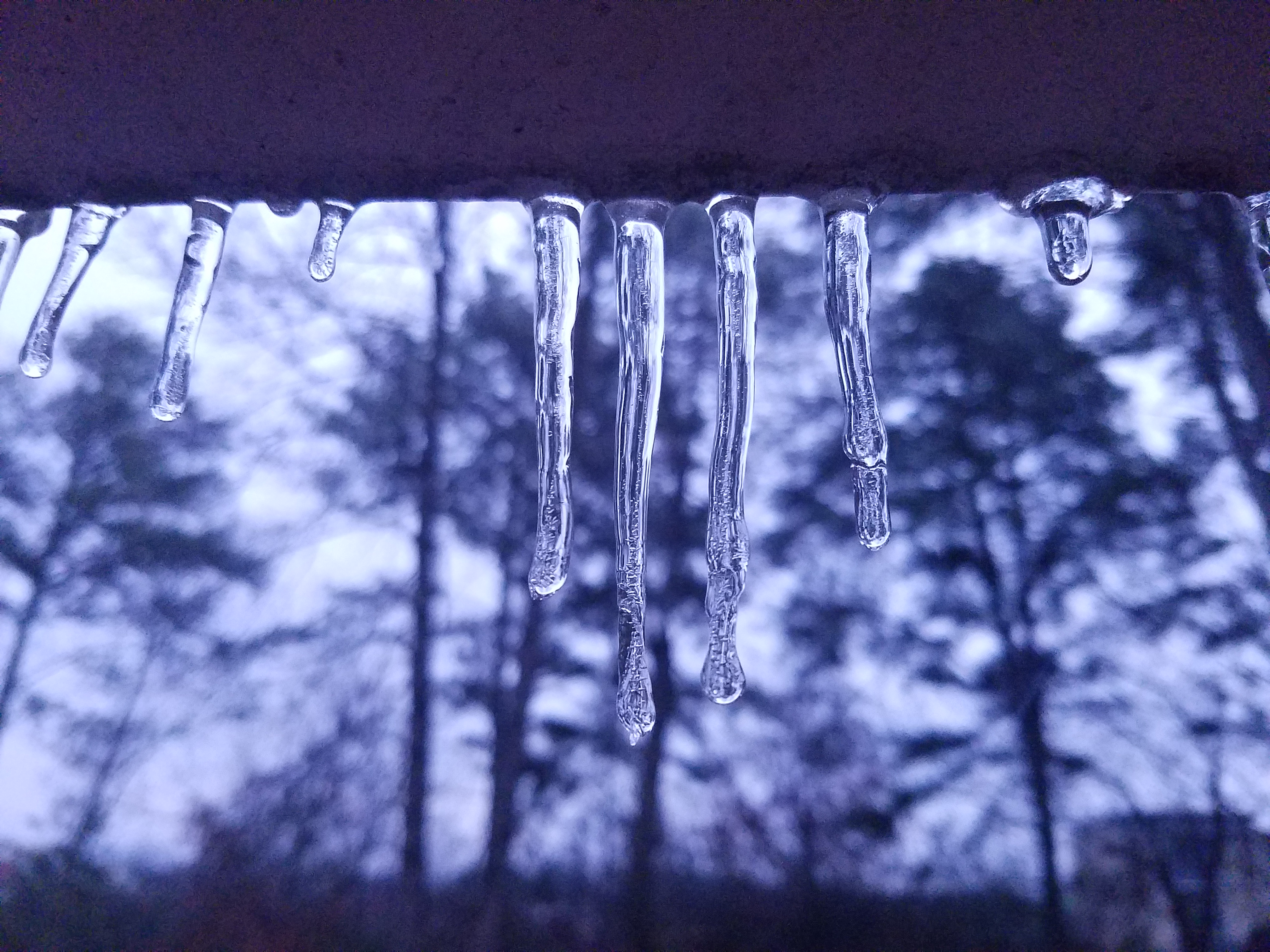
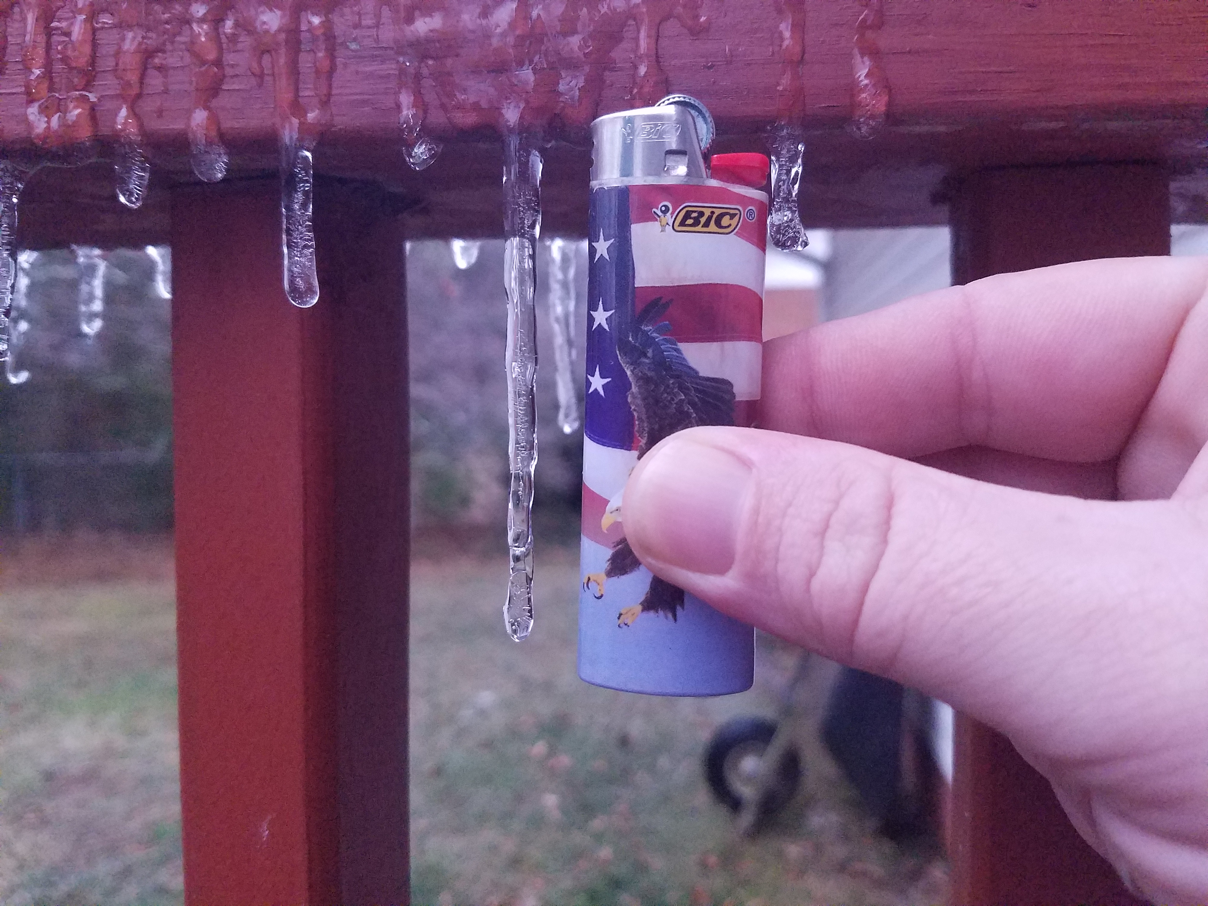
KCHA has officially reported 0.19" of ZR as of 17z, quite a bit more than expected. Have icicles here up to 3" long. Currently 32/28.
Btw looks like the NAM and the RGEM pretty well nailed it for this area.
Btw looks like the NAM and the RGEM pretty well nailed it for this area.
ForsythSnow
Moderator
Looks like there was an exception. Seems to be very localized.KCHA has officially reported 0.19" of ZR as of 17z, quite a bit more than expected. Have icicles here up to 3" long. Currently 32/28.
Btw looks like the NAM and the RGEM pretty well nailed it for this area.
Taylor C
Member
That wedge moved out in a hurry
Yeah, in the 40s here now.
NAM, RGEM nailed this ice event. We had hundreds of wrecks early this morning all across southeast TN and north GA. Lots of ice all over the place. Real good job short range models. & Still reports of icy roads across certain areas still near freezing. For those who downplayed the event. The multiple people who wrecked their cars disagree. Ice event 1/8/2017 -A
This could of been much worse if it moved in overnight. So glad we are not dealing with the icy roads and power outages. ForsythSnow's ice shield was in full effect here!
ForsythSnow
Moderator
Yep. I successfully killed the ice threat LOL. Good thing it was too dry, or things would be bad by now.This could of been much worse if it moved in overnight. So glad we are not dealing with the icy roads and power outages. ForsythSnow's ice shield was in full effect here!
GeorgiaGirl
Member
There was a 35 car pile up on I-75 this morning that shut down the interstate at my exit for awhile. I guess the roads were pretty nasty after all.
Sent from my iPhone using Tapatalk
This was what I was warning about all along, even if it wasn't that much precip, where anything fell at all with it still below freezing there was going to be problems on the road. And it happened.
dsaur
Member
Had a few minutes of rain after the temps got up to 35. Dodged another bullet! But I'd like some rain, and I didn't get any of that either...yet...just a sprinkle for a few minutes. Too far south...unless I'm too far north, lol. Oh, well, the pendulum will swing, and I'll be in the sweet spot some day...then the north will be too far north, and the south will be too far south, lol. Right now I'm just glad to miss the zr.
^ Regarding the 0Z Euro, the lack of ZR in most of N GA is not for the lack of qpf as it still is as high as 0.50" parts of ATL metro. It is only because the Euro has temperatures warming above 32 for the bulk of the precip. Is that correct? I don't know. It does have a bit of a warm bias at 2m.
Regardless of amounts, all it takes is a thin glaze and roads could become treacherous.
Kudos to the Euro having 2 meter temperatures being above 32 for the bulk of the event and therefore very little ZR most of N GA.
Blue_Ridge_Escarpment
Member
Getting icy on roads here now. Of course icing occurs after advisory expires
Nomanslandva
Member
HRRR had temps pretty good too. Pretty interesting event in that we started at 17 F and a DP of 0 but there was no wedge at all. By the time moisture got here we were mid 30s and did not wet bulb hardly at all. Cold air just bolted out. It is 32 now and a little icy but nowhere near as bad as it could have been considering how cold the ground is .