-
Hello, please take a minute to check out our awesome content, contributed by the wonderful members of our community. We hope you'll add your own thoughts and opinions by making a free account!
You are using an out of date browser. It may not display this or other websites correctly.
You should upgrade or use an alternative browser.
You should upgrade or use an alternative browser.
Wintry January 23rd-27th 2026
- Thread starter SD
- Start date
ForsythSnow
Moderator
Between this and the FV3 I have a bit more confidence that if colder verifies we will get a raging sleetstorm the first half. That should save a ton of power problems at leastYou should like this @MSnowAtl this would give much of the area sleet. That’s how cold it is!
Man, the icon continues to advertise an all-time historical storm for NE GA/Upstate/Central and eastern NC.
I'm not buying the super dry modeling on the southern fringe.
The euro says we have that gulf convection(and thus more precip further south in our area) and at this lead time, it's hard to beat the euro on precip forecasting. and it has support from the rgem/icon/gfs/fv3.
Probably a dumb question...you think the mesos/euro are limiting precip to the carolinas due to gulf convection? I have heard that before just didn't know how prevalent it was in events.
RTRwx
Member
Man, I have no idea what to expect in southeast TN, Northeast AL and North GA. Modeled dew points in the single digits tomorrow morning make me question the models that take the region above freezing Sunday morning. Now the ICON and a few Meso models are trending colder each run.. A couple of degrees can be difference in a quarter inch of ice and a catastrophe.
Any opinions for this region?
Any opinions for this region?
Brent
Member
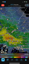
Snow report on mPING just northeast of Little Rock, AR....
No precip here yet... Closer to sunset
I think that front thump of the storm will bring us more snow than forecasted in Raleigh right now. Maybe 1-3” and then sleet. Ice will still be just as concerning
LukeBarrette
im north of 90% of people on here so yeah
Meteorology Student
Member
2024 Supporter
2017-2023 Supporter
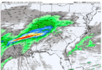
NAM 12km always pushes bands of precipitation further north than modeled. Several instances of this before. Here is an example from last winter where I talked about this.3k Nam looks more reasonable View attachment 187961
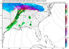
NAM vs what actually happened for 1/5/2025
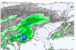
That's almost a night and day difference between the ICON and the Euro/NAM with QPF totals. That tells me that the models still haven't honed in on a solution with this storm and almost anything is still on the table except for snow for most of us.This would be all-frozen for the major NC metros. It's on the wetter side of guidance for sure.
View attachment 187985
rburrel2
Member
No I think that gulf convection is helping to boost our qpf in this case. Because it's limiting moisture transport to the north across the midwest, and serving as a focal point for precip racing out ahead farther south and east. Just go look at the drier models radar loops and compare to the "wetter" model radar loops and you'll see what I mean.Probably a dumb question...you think the mesos/euro are limiting precip to the carolinas due to gulf convection? I have heard that before just didn't know how prevalent it was in events.
LovingGulfLows
Member
- Joined
- Jan 5, 2017
- Messages
- 1,499
- Reaction score
- 4,100
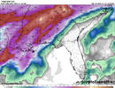
I don't have access to ice accumulations. (too cheap) but this tells the tale well. The Icon keeps the Atlanta NE burbs subfreezing into the 'squall' line.
View attachment 187994
Really Really hope the Icon is wrong here.
Me tooReally Really hope the Icon is wrong here.
rburrel2
Member
Icon flips winds at the sfc to the N then NW in response to the coastal. That's interesting
I believe the ICON is to the other extreme on qpf. Between the models, the RDU area is averaging between .75" on the low end and roughly 1.5" on the high end. I really like around 1" qpf total for this area. Again, this is my opinion.
This is weird because usually in the spring time, convection along the gulf robs our energy source... usually what saves ATL doing spring severe weather season. Interesting concept.Nam 3km... 0 gulf convection. Euro.... copious gulf convection.
The convection the NAM has over central MS/Arkansas is too far north to get us.... that's the problem with it.
The Euro convection does get us in on precip though.
View attachment 187995View attachment 187999
I have no idea how well it handles CAD situations, but having grown up in New Orleans and following last year's Gulf Coast blizzard closely, I do know the ICON was handled that storm nearly perfectly. It's not to be ignored.Really Really hope the Icon is wrong here.
Stormsfury
Member
Depending on the orientation, it’s seemingly ruined or at least cut back on some of our past winter storms, too. But the convection can also enhance totals in certain situations, as we see in some of the modeling.This is weird because usually in the spring time, convection along the gulf robs our energy source... usually what saves ATL doing spring severe weather season. Interesting concept.
That's what happened in January of 2005. We expected a lot worse but the sleet saved the day early.Between this and the FV3 I have a bit more confidence that if colder verifies we will get a raging sleetstorm the first half. That should save a ton of power problems at least
I don't have access to ice accumulations. (too cheap) but this tells the tale well. The Icon keeps the Atlanta NE burbs subfreezing into the 'squall' line.
View attachment 187994
rainfall rates around a 1in an hour.
RTRwx
Member
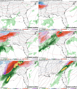
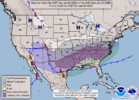
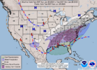
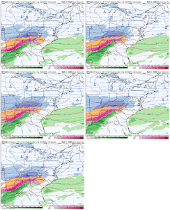
Lol, well that's different. Assuming an earlier transfer to the east coast?WPC created these maps around 345am Friday morning. They're keeping the lows and fronts further south.
View attachment 188001
View attachment 188002
rburrel2
Member
Right. This system is so far North and West compared to our normal systems that gulf-robbing convection may actually "help" us in this storm.This is weird because usually in the spring time, convection along the gulf robs our energy source... usually what saves ATL doing spring severe weather season. Interesting concept.
That's my opinion anyways.
Makeitsnow
Member
And i think it will be right. I don't buy the surface warming models are showing in the core of the wedge over ne ga. A wedge of this magnitude is going to be extremely tough to scour or warm. But we will soon find out.ICON sticking to its Gatling Guns. Almost all of this has occurred in sub-freezing air in the Ga. CAD region with much of it occurring with temps in the mid to upper twenties north and east of Atlanta, with 32 or below back into Atlanta.
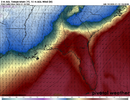
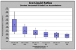
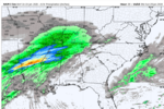
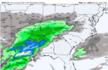
View attachment 187989View attachment 187990
Those ratios vary greatly depending on temps. I wonder what surface temperature is being used?
Orientation of the Gulf Convection also matters a lot: if it is oriented SW to NE, it will enhance moisture transport inland; if it is oriented E to W, it significantly reduces transport. So, for those that want more precip you want convection in the gulf BUT you do not want it to orient E to WNo I think that gulf convection is helping to boost our qpf in this case. Because it's limiting moisture transport to the north across the midwest, and serving as a focal point for precip racing out ahead farther south and east. Just go look at the drier models radar loops and compare to the "wetter" model radar loops and you'll see what I mean.
BHS1975
Member
That will actually thin out the CAD dome making it more vulnerable to mixing out with the warm nose.Icon flips winds at the sfc to the N then NW in response to the coastal. That's interesting
Psalm 148:8
Member
- Joined
- Dec 25, 2016
- Messages
- 344
- Reaction score
- 789
Ok.. totally lost here.. west central Ga near LaGrange/east Alabama.. no watches,,advisories.. this map clearly has us in frozen precip as well as the HRRR with the stout climatologically based wedge around 28 degrees.. what am I to think?? Thunderstorm line? Frozen precip from wedge.. m at a loss!! Help please..WPC created these maps around 345am Friday morning. They're keeping the lows and fronts further south.
View attachment 188001
View attachment 188002
Which makes the icon being the coldest curious. It might be right but it just seems odd as a wholeThat will actually thin out the CAD dome making it more vulnerable to mixing out with the warm nose.
Wonder if FFC will maybe go Ice Storm Warning for Fulton County (Atlanta). Think it’s issued when there’s a greater than 80% chance .25” or more. Most recent graphic I saw had Atlanta at 73%.
North Fulton likely has higher odds. Anyone know when the last ice storm warning was for Atlanta?
North Fulton likely has higher odds. Anyone know when the last ice storm warning was for Atlanta?
Maybe Feb 2014.Wonder if FFC will maybe go Ice Storm Warning for Fulton County (Atlanta). Think it’s issued when there’s a greater than 80% chance .25” or more. Most recent graphic I saw had Atlanta at 73%.
North Fulton likely has higher odds. Anyone know when the last ice storm warning was for Atlanta?
Would indicate the Icon is trying to develop the coastal low somewhere off the SC coast, where other models are much further north, I think.Icon flips winds at the sfc to the N then NW in response to the coastal. That's interesting
That HP is just little too far north. If it were in upstate NY then NC/SC/NGa might be in different place with this stormWPC created these maps around 345am Friday morning. They're keeping the lows and fronts further south.
View attachment 188001
View attachment 188002
Yes. But, with the steering flow SW to NE, I'm certain it won't be situated E-W in this instance.Orientation of the Gulf Convection also matters a lot: if it is oriented SW to NE, it will enhance moisture transport inland; if it is oriented E to W, it significantly reduces transport. So, for those that want more precip you want convection in the gulf BUT you do not want it to orient E to W
rburrel2
Member

