• Hello, please take a minute to check out our awesome content, contributed by the wonderful members of our community. We hope you'll add your own thoughts and opinions by making a free account!

Wintry January 23rd-27th 2026

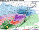
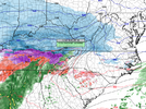
Not a fan of the RGEM moving the sleet line north at 18z

So I’m curious about this kind of solution from the RGEM for Atlanta… it has us getting almost 12 hrs of 33-34° rain before switching over to 29° ZR for 7hrs then back to rain.

All that rain the first 12hrs wouldn’t have evaporated by the time we get below freezing, so would that freeze too?

And same at the end, we dip below freezing just a few hours later from the cold front
 
I assume the models put out ice accretion based solely on their assumed qpf and if they register it as frz rain? So .5” qpf falls as freezing rain it shows .5” accrual on the maps?
 
I assume the models put out ice accretion based solely on their assumed qpf and if they register it as frz rain? So .5” qpf falls as freezing rain it shows .5” accrual on the maps?
Some maps show how much freezing rain fell and some show accrual. It’s very unintuitive so I think the ones that show how much fell (not accrual) mislead 90% of people that see them
 
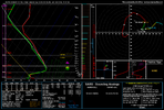
Don't know if it was mentioned today, but a lot of that sleet showing up on the RDPS maps is freezing rain. Sounding here is from the Greensboro area - that's a +5 deg warm nose...should be freezing rain, not sleet...and it gets warmer aloft from here

View attachment 187767

View attachment 187768
I hadn’t had a chance to look at soundings. Wow
 
Don't know if it was mentioned today, but a lot of that sleet showing up on the RDPS maps is freezing rain. Sounding here is from the Greensboro area - that's a +5 deg warm nose...should be freezing rain, not sleet...and it gets warmer aloft from here

View attachment 187767

View attachment 187768
No, that is most definitely sleet! .... With 925's that cold, hydrometers cannot reach the ground before re-freezing. Matter of fact, that is cold enough for a second dendric growth layer. Trust me it will be sleet 100% of the time with a sounding that cold below 850.
 
ILM still on the "we have no clue either" train for SENC/NESC.

Confidence in what happens Sunday remains exceptionally low as
major, MAJOR differences exist between the colder 12z GFS and NAM
versus the warmer 00/06z/12z ECMWF, Canadian, and latest multi-model
ensemble blend. The arctic front may, if the warmer cluster of
models is correct, push back onshore Sunday afternoon allowing air
temps to spike into the 60s. On the other hand, the colder 12z
GFS/NAM look more like the old-school conceptual idea of how
Carolina ice storms operate with shallow but very dense and
stubborn arctic air unwilling to yield even in the face of
impressive warm advection overhead. The difference in weather
impacts between these two model camps cannot be overstated.
Until model agreement improves, Sunday`s current forecast can be

considered an unlikely midpoint between two opposing solutions.
 
Don't know if it was mentioned today, but a lot of that sleet showing up on the RDPS maps is freezing rain. Sounding here is from the Greensboro area - that's a +5 deg warm nose...should be freezing rain, not sleet...and it gets warmer aloft from here

View attachment 187767

View attachment 187768
But it falls into a surface temps in the teens with a minimum temp of around 10 off the surface and a subfreezing layer that is thousands of feet deep. No way that is freezing rain.
 
Don't know if it was mentioned today, but a lot of that sleet showing up on the RDPS maps is freezing rain. Sounding here is from the Greensboro area - that's a +5 deg warm nose...should be freezing rain, not sleet...and it gets warmer aloft from here

View attachment 187767

View attachment 187768
Serious question. That sounding shows the temp going sharply back freezing at 850mb down to a 2m temp of 17. Is that not enough time for a rain drop to refreeze? I ask this seriously because I remember in January 2004 during that Super CAD, at my house in Concord with daytime temps right around 20 with ZR forecasted. Instead what fell was this frozen mist that accumulated more like sleet and didnt accrue on trees
 
I made calls for two hours. Around 2 PM Home Depot in Winston Salem said they were expecting an emergency shipment of 90 (6500w) of Generators. Drove straight there and got a paper voucher (#26 for me). They had arranged a seating area with water, coffee, donuts and pizza.

I'll be with my brother and fam as they have a whole home Gen. for there 3,500 sq ft home.

The Gen is for my two dogs that will stay in an unheated detached garage there as one of my dogs doesn't play well with other pets. They have Dogs and cats. I literally just got home. Oh, what we do for our pets.

If nothing happens I'll just leave it boxed and put it out in my building.
 
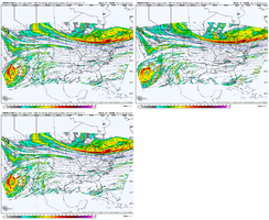
I hate to even post this but areas around atlanta northward will have the worst wind gusts..it's there on every model. Even assuming it's a touch overdone it's bad. To make matters worse...after having gusts from one direction the winds will do a 180 out of the northwest with the passage of the cold front monday...which will compound the problem.

View attachment 187764
I hadn't considered the changing wind direction. Pines with excess ice loading on the east-facing side, then 20-30mph winds from the NW can't be a good recipe. Particularly for hill tops.

The reinforcing Arctic airmass from the NW comes into the Georgia area overnight Sunday into Monday morning. Areas that don't manage to melt off accumulations in the brief, slightly above period Sunday afternoon and evening (if that even occurs) will have a harrowing night.
 
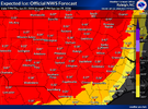
Honest question. Does NWS give a prediction that’s lower end of totals? High enough to bring awareness and prepare people but keep it conservative enough to not bust and have to back track?


Sent from my iPhone using Tapatalk
 
Honest question. Does NWS give a prediction that’s lower end of totals? High enough to bring awareness and prepare people but keep it conservative enough to not bust and have to back track?


Sent from my iPhone using Tapatalk

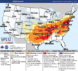
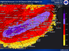
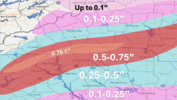
All the percentages to your hearts content. These maps are NBM-based
 
Didnt augusta get over 1 inch of ice accumulation in 2014? Yes, some places in the Augusta area had over an inch. Lets not forget the 1973 GA ice storm. Some areas had 4 inches of ice.

Back when I was 8 I was in the March 2014 ice storm, branches fell on power lines near my house and caused a fire, after that my house had no power for 3 days.
I have been thru several ice storms in Ga. Most of them I had no electricty for 1 week. That was the average. One time I had no electricty for 2 1/2 weeks. In fact our whole street had no electricity for 2 1/2 weeks so it not an individual house. And this was in a Gwinnett County subdivision. Not out in farm country. Just remembers on the 2 1/2 weeks with electricty. The ice covered trees fell on the power lines and literally broke several poles in 2. Who would think ice storms could break telephone poles.
 
Last edited:
Back
Top