Btownheel
Member
2.3” QPF and counting at GSO on the 12z RGEM, all-frozen, at the end of its run, and it’s not over yet.

Just keep that HP and wedge strong and deep. I’d be pretty juiced to see what a 6 inch sleet bomb looks like.
Sent from my iPhone using Tapatalk


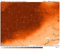


 Just kinda click around on there. It’s under zoomed ice probabilities

