-
Hello, please take a minute to check out our awesome content, contributed by the wonderful members of our community. We hope you'll add your own thoughts and opinions by making a free account!
You are using an out of date browser. It may not display this or other websites correctly.
You should upgrade or use an alternative browser.
You should upgrade or use an alternative browser.
Wintry January 23rd-27th 2026
- Thread starter SD
- Start date
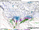
Show a map showing ice accruals from the AIFS too if it has one (it might be a scary sight for RDU).Does anyone have the AIFS Ens Mean snowfall map for 6z? Since it’s the top performing model right now and the temperatures look like a fair assessment on pivotal, I think the snow map would be worth a look for all of us.
Forevertothee
Member
Looks to be colder in the traditional CAD areas, as well. More knowledgable posters, agree?CMC a tick south but might just be a tick slower...either way, take any south tick we can get
View attachment 186952
NBAcentel
Member
packfan98
Moderator
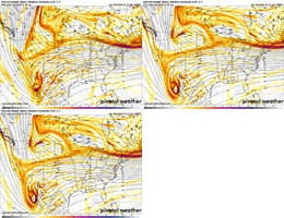
hard agree with all of thisThe Baja low is something we need to fix, but I think it's important to remember the other issue now.. And that's the Northern stream energy that has been trending towards digging West more. So it's almost like that is offsetting the slow release of the baja low. It's almost like the NS is waiting for the baja low so they can fire off in tandem & ruin all of our hopes & dreams in the Southeast.
That's why even though the GFS improves with the Baja low situation, it still amped to high hell.
This is a great read. I was just seeing this. It's something new we need to watch with the timing of everything cold source wise.That slowing trend is actually starting to help us out by allowing the wedge to entrench more prior to onset of precipitation, regardless of how it goes after View attachment 186963
iGRXY
Member
My thoughts as a whole for the southeast:
Slower ULL eject means a flatter onset and everything is slower for the CAD to build in. I think we can get a front end thump of snow or it’s at least on the table east of the apps. 2-6” would be guess without pinning down exact locations. Then we eventually transition to sleet and get 2-5”. As the Baja ejects we pump the heights and we quickly transition to an ice event in the upstate and spit of I40. And it’ll be nasty accruals. 0.5-1” is what I think. That’s absolutely terrifying
Slower ULL eject means a flatter onset and everything is slower for the CAD to build in. I think we can get a front end thump of snow or it’s at least on the table east of the apps. 2-6” would be guess without pinning down exact locations. Then we eventually transition to sleet and get 2-5”. As the Baja ejects we pump the heights and we quickly transition to an ice event in the upstate and spit of I40. And it’ll be nasty accruals. 0.5-1” is what I think. That’s absolutely terrifying
Blue_Ridge_Escarpment
Member
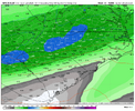
More qpf this run than 0ZWouldn't take much on the CMC to get central NC into the sub 1" down to maybe 0.5-.7". once these north trends start they don't stop
View attachment 186965
This makes so much more sense synoptically than the Canadian. But as we know, the Canadian doesn't care about meteorology.AIGFS is steady as she goes with the CAD into N. GA. N. Ga goes sub-freezing Saturday evening and remains so for the duration of the storm. It hands of the SLP to the baroclinic zone off of the Ga. Coast rather than plowing an Apps runner as one would expect in a strong CAD situation.
View attachment 186962
It would also favor more sleet than freezing rain for many.
Fair assumption, I think the 2" is most likely to happen with the thump. The ice and sleet WILL become an issue though and it's not going anywhere with this CAD in place.My thoughts as a whole for the southeast:
Slower ULL eject means a flatter onset and everything is slower for the CAD to build in. I think we can get a front end thump of snow or it’s at least on the table east of the apps. 2-6” would be guess without pinning down exact locations. Then we eventually transition to sleet and get 2-5”. As the Baja ejects we pump the heights and we quickly transition to an ice event in the upstate and spit of I40. And it’ll be nasty accruals. 0.5-1” is what I think. That’s absolutely terrifying
ukmet looking better so far. also holding baja wave west at hour 57. montana shortwave is faster, about the same dig. frankly i don think this run is going to bring rain to kentucky this time
That indicates the lack of frozen precipitation cover modeled there.lol, even has a warm nose in Ala then
packfan98
Moderator
CMC looks like it shifted the heaviest precip south vs. last runWouldn't take much on the CMC to get central NC into the sub 1" down to maybe 0.5-.7". once these north trends start they don't stop
View attachment 186965
Attachments
NBAcentel
Member
Stormsfury
Member
With the Slower Baja feature, I think the other most important thing is to get that northern stream energy out ahead and further east a little quicker.ukmet looking better so far. also holding baja wave west at hour 57. montana shortwave is faster, about the same dig. frankly i don think this run is going to bring rain to kentucky this time
I seem to recall the UKMET being pretty bad at modeling CAD situations in the past? Is that still true? I suppose even if it's bad with surface temps, the details, etc. it still may be useful in a general synoptic context, anyways.ukmet looking better so far. also holding baja wave west at hour 57. montana shortwave is faster, about the same dig. frankly i don think this run is going to bring rain to kentucky this time
Stormsfury
Member
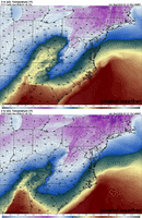
Just your average 25 degree temp drop in Charleston lol. Feel the wedge! Likely will be seeing continued colder adjustments on the UKie in future runsYeah we ain’t escaping this one boys. Sorry View attachment 186970
i know doomerism is still en vogue but outside of the gfs, which was an outlier, modeling has either held serve or ticked south this cycle. the baja low placement is trending on our side. i don't think we're going back to our glory runs but there are reasons for optimism
lexxnchloe
Member
If the EURO comes south maybe things will look better tomorrow.
Would love to see the euro trend stop and reverse. It’s so relieving to see the models holding the Baja back icli know doomerism is still en vogue but outside of the gfs, which was an outlier, modeling has either held serve or ticked south this cycle. the baja low placement is trending on our side. i don't think we're going back to our glory runs but there are reasons for optimism
SimeonNC
Member
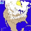
I'm still confident that a lot of NC will see more sleet than what occurred in December 2002Here was the snow depth on December 6, 2002View attachment 186966
Depends how strong that CAD and warm nose areI'm still confident that a lot of NC will see more sleet than what occurred in December 2002
SimeonNC
Member
I was half asleep when I read the update but didn't GSP mention the possibility of watches going up today for the area?
Forevertothee
Member
They did say MAY go up before the end of next cycle, yes.I was half asleep when I read the update but didn't GSP mention the possibility of watches going up today for the area?
Cad Wedge NC
Member
Temps will be a lot colder at the surface this time than they were in that one. As much as 10 degrees in some areas.Depends how strong that CAD and warm nose are
To be serious, the western trend with the north stream in the 3-5 day range is what sucked us back in to the last threat to only yank the rug out and trend back east.
They are already out for folks to our west, so I can't imagine FFC, GSP, RAH, etc. don't throw out watches today. There's almost no way this isn't a major winter storm of some type for much of their coverage areas.I was half asleep when I read the update but didn't GSP mention the possibility of watches going up today for the area?

Man the UKMet is definitely a improvement and seems to be definitely something to that SW trend in the Baja Low that half of the element that helps people get a flatter snowier solution for AL/GA area it still cuts because the Northern stream still lingers and eventually absorbs it BUT you can see here if the Northern stream is 100 miles further East and a tick faster this is very GFS like perhaps even more so of a flatter look


