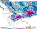
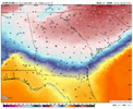
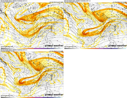
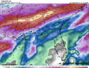
Man, the north trend reversing slightly might actually be the worst case scenario in the triangle. Since I'm a met student, I've got a lot of questions about this and I just say "be prepared to survive where you are on Saturday until Wednesday without power"
-
Hello, please take a minute to check out our awesome content, contributed by the wonderful members of our community. We hope you'll add your own thoughts and opinions by making a free account!
You are using an out of date browser. It may not display this or other websites correctly.
You should upgrade or use an alternative browser.
You should upgrade or use an alternative browser.
Wintry January 23rd-27th 2026
- Thread starter SD
- Start date
Not far from me. I’m excited personally . Do you think it’ll come south any?Not interested in being just south of the main axis of modeled ZR...
View attachment 186900
ICON holding steady on significant ZR for metro ATL with temps in the mid 20’s. Ticked slightly warmer compared to 0z
packfan98
Moderator
I would get that in order just in case. Really thinking about driving to my parents' place in MD where there will be mostly snow because I can't imagine NC State having class at all next week really if my fears come trueas someone without a generator.... real talk, what is my best Survival Plan? im starting to get extremely anxious
Makeitsnow
Member
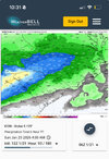
That would still be a hell of a lot of freezing rain. I sincerely hope we trend away from it, no one in their right mind would want a crippling ice storm.But the NW trend isn’t just leading to much less modeled ZR. It’s also leading to much less qpf, which is an important contributor to lessening the amount of ZR:
View attachment 186902
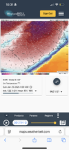
at any rate, the icon is actually a few degrees colder at the surface than the prior runs.
rburrel2
Member
Icon doubled down at the surface… even colder.
Keep the warming trend coming!ICON holding steady on significant ZR for metro ATL with temps in the mid 20’s. Ticked slightly warmer compared to 0z
NEGaweather
Member

Sent from my iPhone using Tapatalk
Downeastnc
Member
as someone without a generator.... real talk, what is my best Survival Plan? im starting to get extremely anxious
Hope that they can get power back on in less than a day or so. If we get a major ice storm that crashes the power grid with the kinda temps we see in the models after the storm it will be bad very very bad.
I suggest at the minimum have a way to cook outside and food that can be cooked that way. The upside is you can put perishables outside in a cooler and they wont spoil etc. Then its all about keeping warm, if you have a generator have a space heater you can run on it and then basically shut all your doors move everything imto the room you plan on staying in and try to keep that room warm. Wear plenty of layers etc....
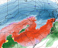
Here's snow depth. I would assume everything south of Virginia is sleet:Here's the ICON. I sure miss the flatter looks we were getting.
View attachment 186908
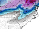
rburrel2
Member
The 12z ICON has RDU at 16 at the onset dropping to 15 soon thereafter. GSO drops into the LOW TEENS. 
Makeitsnow
Member
buckinbronco
Member
I think it could. 6z WeatherNext/Euro/AIFS all either stopped going north or moved south a tick (WN with the most notable tick south). I'd say thru 0z tonight is probably when we're really honing in on the track, and then it'll handoff some to tracking p-type corridors, which I would imagine probably verify a bit south of where they end up when you wake up tomorrow.Not far from me. I’m excited personally . Do you think it’ll come south any?
Its the sleet south of the freezing rain for me12z ICON at hour 96:
View attachment 186907
I would have to assume most of the precip we get is sleet (as modeled).The 12z ICON has RDU at 16 at the onset dropping to 15 soon thereafter. GSO drops into the LOW TEENS.
I believe there are two components here
1) initializing errors. The arctic circle energy is in a weird spot for models near Russia/Alaska and far away from solid upper air analysis AND on the edge of satellite coverage. Pacific/baja wave have better sampling due to satellite, but still not over land and far from land-based soundings
2) CAD-handling errors.
So I firmly believe we’ll see more big changes over the coming runs. These could be changes that push the storm further north, or back south.
Yeah, people melting down over the snowfall chances need to be careful because this is a catastrophic storm for most of us as modeled, and the impression you’d get from some of these posts is that we’re going to get a cold rain. If this happens as shown, I think this would be the most severe storm in the Carolinas since at least 2002 (and this could even surpass that). The QPF combined with the surface temps is insane. I’ve not seen anything like this before. Maybe it will moderate before verification but as it’s showing now this is a historic storm.
I do think IP may save some given you’re not going to need as deep of a cold surface layer to refreeze when the temperature is 15!!!
I would assume most of the precip for central NC would be sleet.Its the sleet south of the freezing rain for me
Does this account for ZR?Here's snow depth. I would assume everything south of Virginia is sleet:
View attachment 186909
GFS can do what it wants at 12z i don't really care a ton, if anything it'll probably keep correcting to the euros. really just looking for any major changes from Euro/AIFS
Im a student, 3 years into my degree. I do not claim knowing everything but its comments like "We are only getting a cold rain" that can mislead the public. If you don't know something just stay quiet
OK, for clarification, this is a weather forum where we discuss things that we see. I don't care what the public thinks of my posts.
I don't think so. But I've noticed that the snow depth maps tend to include sleet.Does this account for ZR?
Btownheel
Member
Yeah, people melting down over the snowfall chances need to be careful because this is a catastrophic storm for most of us as modeled, and the impression you’d get from some of these posts is that we’re going to get a cold rain. If this happens as shown, I think this would be the most severe storm in the Carolinas since at least 2002 (and this could even surpass that). The QPF combined with the surface temps is insane. I’ve not seen anything like this before. Maybe it will moderate before verification but as it’s showing now this is a historic storm.
I do think IP may save some given you’re not going to need as deep of a cold surface layer to refreeze when the temperature is 15!!!
A.). Good to see you again. Didn’t realize most on AmWx had shifted over here.
B.). I refuse to believe we get zr here with surface temps at 20 or below. To get there means it’s thicker and that’s pinger fest, at least for us north of 40 types.
Sent from my iPhone using Tapatalk
rburrel2
Member
If the icon verified. Georgia has a worse economic disaster from this storm than it did from Helene.If you aren't an ice monger, pray the ICON is smoking something:
View attachment 186917
That is sleet all the way to ATL then if that is the case?I don't think so. But I've noticed that the snow depth maps tend to include sleet.
Bruh, the 12z ICON drops 3”+ liquid of all frozen on Atlanta. Can’t be right, but that’s literal insanity. Most destructive ice storm in the history of the southeast, rivaling that catastrophic ice storm in Quebec back in 1998.
Do you mind sharing the weathernext trend over the last few runs with the precip and temp contour maps? My system has a manual downloader for it and I’m out of town so haven’t had a chance to run it.I think it could. 6z WeatherNext/Euro/AIFS all either stopped going north or moved south a tick (WN with the most notable tick south). I'd say thru 0z tonight is probably when we're really honing in on the track, and then it'll handoff some to tracking p-type corridors, which I would imagine probably verify a bit south of where they end up when you wake up tomorrow.
WolfpackHomer91
Member
Bruh, the 12z ICON drops 3”+ liquid of all frozen on Atlanta. Can’t be right, but that’s literal insanity. Most destructive ice storm in the history of the southeast, rivaling that catastrophic ice storm in Quebec back in 1998.
Wish it would drop 3-5” ALL FROZEN QpF right on my house in 15 degree temps. Again I wanna live through something historic
Sent from my iPhone using Tapatalk
JimRussell
Member
From BMX:
Let's talk about the uncertainty...
We have several different models we examine for weather. Each model is initialized differently, putting different weights on different parameters. So when the models run their algorithms, because they initialize differently, we can get widely different results.
When models are in agreement (generally), or have consistency, for many days out in advance before a big, impactful system, this tends to lead us to higher confidence. If models, generated differently using different weighting and different algorithms, agree, then surely that means the event will occur....right?
Sometimes.
Every now and then, one of the models picks up data that causes it to produce different output. This could be wonky data that gets ingested and causes something different. Or it could be that the model really is picking up on something in the pattern that the others aren't catching yet.
Up until last night, the low pressure causing all this rain was expected to be across the state, which would cause plenty of cold air for the rain to change to freezing rain, snow, and sleet. Last night, one of the models starting showing a vastly different solution, and pushed that low much farther north. This would prevent enough cold air from changing the rain to the snow/sleet/freezing rain. This would change the impacts significantly.
We're not advertising this widely for many reasons:
1. It JUST changed, so our confidence is low. We would need to see if the other models fall into agreement, or that model moves it's way back to what it was showing.
2. If we start advertising "little to no impacts" and then the model changes for the worse, that is MUCH harder to advertise the worsening conditions than to go the other way.
3. Looking at the environment, there could be enough cooling as the precip falls, or other environmental considerations, that colder temps could be seen, colder than what the models are showing at the surface.
So what can you do? Stay aware of the weather and know that this is a complicated system (winter in AL is by default complicated). We'll update you with any and all changes. And know we're watching every data ingestion, every raw data product, sounding, graph, chart, and measurement like a hawk.
If the low moves north and we end up with mostly rain (and maybe some storms), then consider this an exercise in preparation. If the low remains south enough to experience wintry weather, then we'll have some advance notice.
Generally been moving north with everything else as of late. 6z was the first one to make any move south and could be a blip:Do you mind sharing the weathernext trend over the last few runs with the precip and temp contour maps? My system has a manual downloader for it and I’m out of town so haven’t had a chance to run it.
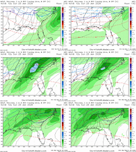
Makeitsnow
Member
icon has about an inch of rain falling friday but it still has close to 4 inches total around gainesville. However, i believe a lot of that would be sleet based on boundary layer temps but to the south....between atlanta and lagrange, macon, etc...it would mostly be freezing rainIf the icon verified. Georgia has a worse economic disaster from this storm than it did from Helene.
You’re well over 2” all frozen, so not too shabby, either.Wish it would drop 3-5” ALL FROZEN QpF right on my house in 15 degree temps. Again I wanna live through something historic
Sent from my iPhone using Tapatalk
Stormsfury
Member
Another huge warning shots. More consolidated TPV over the lakes. Baja feature held significantly back. Hmmm
Yes, with the upper air temps as modeled.That is sleet all the way to ATL then if that is the case?
kinda think we're passed warning shots at this point we're taking rubber slugs to the chestAnother huge warning shots. More consolidated TPV over the lakes. Baja feature held significantly back. Hmmm

