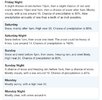
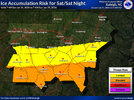
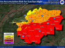
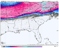
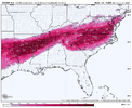
Do you have a link? Need hopium.WPC cautions the northern trend of the modeling could be a slight mirage
Sent from my iPhone using Tapatalk
-
Hello, please take a minute to check out our awesome content, contributed by the wonderful members of our community. We hope you'll add your own thoughts and opinions by making a free account!
You are using an out of date browser. It may not display this or other websites correctly.
You should upgrade or use an alternative browser.
You should upgrade or use an alternative browser.
Wintry January 23rd-27th 2026
- Thread starter SD
- Start date
WSNC
Member
Brent
Member
NEGaweather
Member
KATL forecast Discussion
Saturday into Sunday we will begin to see the overall troughing
pattern begin to dive south into the southeastern U.S. while the low
pressure system currently off the Pacific begins to push inland.
This setup creates an atmospheric river from the Mexican Pacific
coast, across the entire southern U.S., and out across to the
Carolinas beginning Fri afternoon. The timing of how this Pacific low
pressure system moves is going to in turn factor into how long we
are expecting potential impacts. Current timing has this system
moving rapidly across the south states through the weekend and up
the eastern seaboard and pulling out of GA Monday morning/early
afternoon.
Some things to talk about with this event. This is shaping up to be
a potentially high impact event with moderate to major impacts. With
this amount of model consistency in the overall setup we are gaining
confidence that this could be a long duration event as well. With
initiation as early as Saturday afternoon and wintry precip looking
to extend into Sunday night/Mon morning. At this point we are
confident that wintry precip will affect north Georgia for areas
along and north of I-20. The area south of I-20 down to Macon and
Columbus are a little more uncertain but models are consistently
forecasting wintry precip for this area as well. A few factors into
how much/what type of wintry precip we receive are the influence of
the wedge expected to take shape and then how far north the front
pushes. When it comes to the wedge, current thinking is that snow
will be the main precip type for far north Georgia and wintry
mix/freezing rain will become the main concern for the remainder of
the north Georgia including the ATL/AHN areas. There is still a
decent shot that we see this freezing rain transition to more of a
snow event as we get into late Sunday and Monday but that is still
uncertainty.
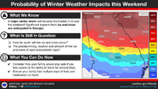
Focusing on the probabilistic information for now.
--> 40-50% chance for 0.5" or greater of ice accumulation through
the weekend for the areas north of I-20.
--> 25-30% chance for 0.75" or greater of ice accumulation through
the weekend for the areas north of I-20.
--> 15-20% chance for 1" or greater of ice accumulation through the
weekend for the areas north of I-20.
--> 30-45% chance for 2" or greater of snow accumulation through the
weekend for the areas north of I-20.
For now the main thing to focus on is being prepared for a
potentially high impact event this weekend. We will likely see more
changes over the coming days but please make sure you have a plan to
endure this event which could include power outages.
Once this system exits the area Monday, a good portion of north GA
will continue to see impacts as Temps Mon are not expected to get to
much above freezing. Any accumulations that linger will most likely
continue through Tue when temps are expected to get up into the
upper 30s to near 40.
Sent from my iPhone using Tapatalk
CNCsnwfan1210
Member
We’re not dealing with a marginal cold airmass folks, an airmass capable of producing an impressive CAD with a continuous supply of cold air. I know what the Euro/UK depicted, but this is far from being settled.
Sent from my iPhone using Tapatalk
Sent from my iPhone using Tapatalk
ChattaVOL
Member
From WPC:
So how confident are we in this trend, and will it continue or
revert back to earlier runs, is the big question. Given the nearly
unanimous trend in this direction, and at least a couple model
runs in a row showing such a trend, it does seem like this shift
has some merit. However, overall run to run consistency has shown
pretty large swings with the exact handling of both the southern
and northern stream energy. Suspect that the exact details of these
features is far from settled upon...especially the northern stream
energy which is currently strung out across much of western Canada
into the arctic. Thus tend to think that the unanimous model trend
could be a slight mirage and suggests more confidence in a
solution than there actually is at this point. Either way, it
should be stressed that in just about every outcome we get a
widespread and major winter storm with many areas getting
significant impacts regardless of these exact details. These
details are, however, important for exactly where the maximum snow
and ice totals occur. The current WPC QPF and temperatures were
derived before much of this 00z guidance was available, and thus is
a bit south of the new consensus. As described above, no guarantee
we dont see a shift back south in later models...but assuming some
persistence in the 06z/12z models then the WPC update today would
likely shift north to at least some extent.
Sent from my iPhone using Tapatalk
WSNC
Member
It ticked.. literally ticked South.
ChattaVOL
Member
Do you have a link? Need hopium.
Sent from my iPhone using Tapatalk
packfan98
Moderator
Folks I would not write this storm off this is going to be a dangerous storm for some. Somebody is going to get rocked with heavy snow sleet and freezing rain with power outages. The bigger story is the cold coming after. Going to be an interesting 2 days of model runs. Keep the faith!
Last edited:
Cad Wedge NC
Member
I have a hard time believing any freezing rain at 15 degrees. Guess I will see something I have never seen before.
Fountainguy97
Member
I think snow and sleet is probably a safe bet for the foothills. Cad is going to press up against the mountains and keep us colder longer aloft. May end as some drizzle I've seen that plenty of times.I have a hard time believing any freezing rain at 15 degrees. Guess I will see something I have never seen before.
NE GA and Western SC look like ground zero for ZR. jmo.
NCWeatherNow
Member
NCHighCountryWX
Member
- Joined
- Dec 28, 2016
- Messages
- 699
- Reaction score
- 1,918
packfan98
Moderator
Good morning folks. We kindly ask you not to copy and paste the entire NWS discussion here. Feel free to use snippets, summaries, or post the direct links for folks. Thanks!
CNCsnwfan1210
Member
Better trend here on the UKMET with more separation from the Baja low and weaker trough out west, also colder press over SE Canada.
Sent from my iPhone using Tapatalk
packfan98
Moderator
rburrel2
Member
The more this dumps out west, the stronger the wedge trends at the surface. Mainly bc it leads to stronger high pressure.
CAD areas are not escaping a catastrophic ice storm. There will be battle lines of course, but I’d side with overpeformance on surface cold penetration with this CAD. Places like Atlanta to Augusta to Columbia will have big ice totals, my two cents.
CAD areas are not escaping a catastrophic ice storm. There will be battle lines of course, but I’d side with overpeformance on surface cold penetration with this CAD. Places like Atlanta to Augusta to Columbia will have big ice totals, my two cents.
packfan98
Moderator
Well, the features look a tick better at hr53 on the 6z euro. Little stronger vortex further south. Baja energy a little more separated. Let’s see where it goes.
rburrel2
Member
And colder at the surface…. Again.AIFS says bye to the snow.
View attachment 186827
rburrel2
Member
rburrel2
Member
Encouraging to see the NAM try to create a little more separation between the Baja low and the trough out west. While the NAM is trash in the long rage it is useful to see how how it is handling things early on.
LongRanger
Member
So what's your thinking for areas up our way North of 85?The more this dumps out west, the stronger the wedge trends at the surface. Mainly bc it leads to stronger high pressure.
CAD areas are not escaping a catastrophic ice storm. There will be battle lines of course, but I’d side with overpeformance on surface cold penetration with this CAD. Places like Atlanta to Augusta to Columbia will have big ice totals, my two cents.
packfan98
Moderator
6z euro has stopped the north trend for now it looks like. Northern stream out west rotates differently and doesn’t get as involved with the southern energy as much as 0z. Still looks worse than 18z though. Interesting 12z runs today.
rburrel2
Member
Cross your fingers we hold on to sleet as long as possible. But I think everyone in cad country flips to ice at some point on SundaySo what's your thinking for areas up our way North of 85?
LongRanger
Member
Do you think we see any snow at all up here or mainly just sleet?Cross your fingers we hold on to sleet as long as possible. But I think everyone in cad country flips to ice at some point on Sunday
Let’s hope this true
packfan98
Moderator
We have a thread to ask your In My Backyard posts like this. Please use it instead of posting here. Thanks!Do you think we see any snow at all up here or mainly just sleet?
rburrel2
Member
rburrel2
Member
There will be a window for snow there Saturday afternoon, but if the system is too amped all the precip will be too far north and west. I wouldn’t count on any snow right now. But it could trend back the other way, yall definitely aren’t out of the game completely for snow, yet. Odds are low thoughDo you think we see any snow at all up here or mainly just sleet?
packfan98
Moderator
WXinCanton
Member
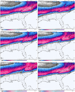
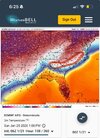
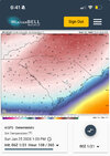
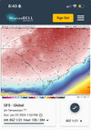
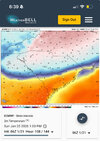
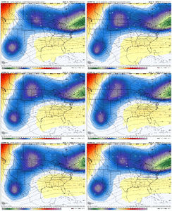
You can add the Icon to the cold camp as well. I have a feeling we are going to see some crazy stuff when we get in full range of the hi res CAMS.One of these is wrong. Can you guess which one?
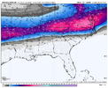
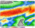
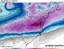
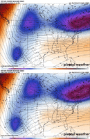
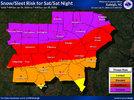
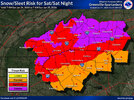
View attachment 186830View attachment 186831View attachment 186832View attachment 186833
iGRXY
Member
People living by the surface depiction on these models are going to get hurt. Use logic. Models underestimate and erode marginal CAD events. This is a legit 1040+ HP and more importantly than just looking at the surface maps it’s sitting over the coldest anomalies. You will not erode the CAD even in Atlanta, Ne Georgia, and absolutely not in the far western upstate like the euro wants to do. What it will cause it more likely of more ZR on the back half the upstate. Where we could end up with 3-5” or sleet and 0.5-0.75” of ZR

