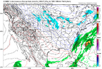
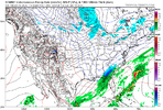
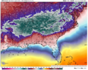
Problem with that is it’s a catastrophe in the triangle with iceHave to put a lot of weight towards the euro. I would expect the GFS/ICON to follow soon (maybe 6z). Hopefully the models meet more in the middle. Would love to see the 6z euro back off some.
-
Hello, please take a minute to check out our awesome content, contributed by the wonderful members of our community. We hope you'll add your own thoughts and opinions by making a free account!
You are using an out of date browser. It may not display this or other websites correctly.
You should upgrade or use an alternative browser.
You should upgrade or use an alternative browser.
Wintry January 23rd-27th 2026
- Thread starter SD
- Start date
I would have to think the 00z Euro would have a lot more IP in NC than what it shows (which is almost all-ZR on the clown maps). In my experience, the ZR maps tend to verify as partially IP. For example, at the start the Euro has RDU starting with the surface at 21 degrees, but has it as ZR. 850s are 0C and 925s are -7C. Pretty sure that's going to be IP (or maybe even wet snow?...though there may be a layer warmer than 850mb), not ZR. Probably is IP to ZR, which would cut down on the catastrophic ZR maps we see.
That's what they're supposed to do, but it often seems we just see them wildly swinging and following the operational model when push comes to shove.This is completely bizarre. I thought ensembles mitigated this sort of wild swinging thing? I haven't been paying attention on that level, so maybe it was there all along? Or do we have a garbage in, garbage out situation?
Tsappfrog20
Member
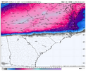
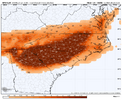
Anyone have the latest euro freezing rain map
Sent from my iPhone using Tapatalk
Sent from my iPhone using Tapatalk
Think someone posted earlier. I remember being shocked and then shocked again cuz it still showed power outage accumulating ice for me.Anyone have the latest euro freezing rain map
Sent from my iPhone using Tapatalk
Edit:
Here’s one:
View attachment 186780
Might as well show this
Anyone have the latest euro freezing rain map
Sent from my iPhone using Tapatalk
Chase posted it (see below). I personally think some of this would be IP, particularly in the Carolinas, but it would be the most significant winter storm in much of the Carolinas in a decade-plus, snow or no snow.
View attachment 186780
Might as well show this
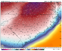
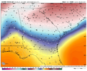
It should be noted the 00z AI Euro is colder than the Euro. It keeps RDU around 20 for most of the storm (never even getting close to above freezing) and GSO in the teens, and there is some snow at the start. Moreover, it looks like it has a major ice storm for NE GA (ATL itself looks to be on the edge).
EDIT: Check out this panel from the middle of the storm...close to 0.5" of liquid equivalent has fallen in much of C NC in the six hours preceding this, and another 0.3"+ in the six hours after. Teens also into the Charlotte metro, mid-teens for Greensboro, and 20s into NE GA into the ATL area. The warmest it ever gets in RDU for the storm is 23! 21 for GSO. 24 for CLT.
EDIT2: Adding a panel for the same time for our GA peeps:
EDIT: Check out this panel from the middle of the storm...close to 0.5" of liquid equivalent has fallen in much of C NC in the six hours preceding this, and another 0.3"+ in the six hours after. Teens also into the Charlotte metro, mid-teens for Greensboro, and 20s into NE GA into the ATL area. The warmest it ever gets in RDU for the storm is 23! 21 for GSO. 24 for CLT.

EDIT2: Adding a panel for the same time for our GA peeps:

Last edited:
ChattaVOL
Member
BHS1975
Member
The AIs have been killing it have they not?It should be noted the 00z AI Euro is colder than the Euro. It keeps RDU around 20 for most of the storm (never even getting close to above freezing) and GSO in the teens, and there is some snow at the start. Moreover, it looks like it has a major ice storm for NE GA (ATL itself looks to be on the edge).
EDIT: Check out this panel from the middle of the storm...close to 0.5" of liquid equivalent has fallen in much of C NC in the six hours preceding this, and another 0.3"+ in the six hours after. Teens also into the Charlotte metro, mid-teens for Greensboro, and 20s into NE GA into the ATL area. The warmest it ever gets in RDU for the storm is 23! 21 for GSO. 24 for CLT.
View attachment 186793
EDIT2: Adding a panel for the same time for our GA peeps:
View attachment 186795
ChattaVOL
Member
I wouldn’t say “killing it”, but they have been proving their worth.The AIs have been killing it have they not?
Keep in mind. This is chaos. There will never be a perfect AI model. It would have to account for its own entropy contribution to the system it is trying to predict.
Yertmoo
Member
URGENT - WINTER WEATHER MESSAGE
National Weather Service Huntsville AL
215 AM CST Wed Jan 21 2026
ALZ001>010-016-TNZ076-096-097-212100-
/O.NEW.KHUN.WS.A.0001.260124T0000Z-260126T0000Z/
Lauderdale-Colbert-Franklin AL-Lawrence-Limestone-Madison-Morgan-
Marshall-Jackson-DeKalb-Cullman-Moore-Lincoln-Franklin TN-
Including the cities of Cowan, Scottsboro, Sheffield, Fort Payne,
Florence, Huntsville, Russellville, Decatur, Albertville, Estill
Springs, Moulton, Sewanee, Red Bay, Lynchburg, Athens,
Winchester, Boaz, Arab, Guntersville, Fayetteville, Rainsville,
Town Creek, Tuscumbia, Cullman, Muscle Shoals, and Decherd
215 AM CST Wed Jan 21 2026
...WINTER STORM WATCH IN EFFECT FROM FRIDAY EVENING THROUGH SUNDAY
AFTERNOON...
* WHAT...Moderate to heavy accumulations of snow, sleet, or ice are
expected Friday night through Saturday night. Snow and sleet
accumulations of at least 2 to 3 inches. Ice accumulations above
one quarter of an inch. Locally higher amounts possible.
* WHERE...Portions of north central, northeast, and northwest
Alabama and southern middle Tennessee.
* WHEN...From Friday evening through Sunday afternoon.
* IMPACTS...Expect power outages and tree damage due to ice
accumulations. Travel could be impossible.
PRECAUTIONARY/PREPAREDNESS ACTIONS...
Persons should consider delaying all travel. If travel is absolutely
necessary, drive with extreme caution. Consider taking a winter
storm kit along with you, including such items as tire chains,
booster cables, flashlight, shovel, blankets and extra clothing.
Also take water, a first aid kit, and anything else that would help
you survive in case you become stranded.
CNCsnwfan1210
Member

Over 300 HDOBS went into the 00Z GFS only from the Baja low data mission, but it may take a few more model cycles to see a notable impact on model run solutions FWIW.
Sent from my iPhone using Tapatalk
CNCsnwfan1210
Member

This is not even a trend really, but noticing at least a small attempt of a separation process of the Baja low and the western trough and also the ridge downstream over the SE not quite as pronounced as vs the 00z run, just noticing tiny differences here.
Sent from my iPhone using Tapatalk
NCWeatherNow
Member

This is not even a trend really, but noticing at least a small attempt of a separation process of the Baja low and the western trough and also the ridge downstream over the SE not quite as pronounced as vs the 00z run, just noticing tiny differences here.
Sent from my iPhone using Tapatalk
Why is it separating
CNCsnwfan1210
Member
Why is it separating
My guess is the trough over the Dakotas/southern Canada was weaker this run and, it’s not fully separated but if the trough would continue to weaken, I’d think you would see more of that separation from the Baja low. Also a minor difference with the ridge off the west coast is further east on the 06z run.
Sent from my iPhone using Tapatalk
CNCsnwfan1210
Member

A little bit more cold press with the TPV over Canada, and some separation from the Baja low
Sent from my iPhone using Tapatalk
CNCsnwfan1210
Member

A little bit more cold press with the TPV over Canada, and some separation from the Baja low
Sent from my iPhone using Tapatalk
Also trough over the west is weaker
Sent from my iPhone using Tapatalk
CNCsnwfan1210
Member

Not really much change at the surface though from the 00z, snow over TN and northern half of NC, ice from SC to TX
Sent from my iPhone using Tapatalk
CNCsnwfan1210
Member

7pm Saturday night 06z GFS
Sent from my iPhone using Tapatalk
Forevertothee
Member
GFS not backing down.
7pm Saturday night 06z GFS
Sent from my iPhone using Tapatalk
CNCsnwfan1210
Member

Still has that miller B transfer low look to it with a new low forming off the coast
Sent from my iPhone using Tapatalk
Like I said a few days ago. The GFS is not a really great model imo. Too many times I’ve seen it live on a hill and die on that same hill even through 84 hours.
I’d much rather live in the euro/cmc/UKMET camp than bank on a GFS on an island.
I’d much rather live in the euro/cmc/UKMET camp than bank on a GFS on an island.
WSNC
Member
It has slowly come north some with the overall shield. I think this is a case where GFS is playing catch up right now.. it needs a few more cycles to be caught up
WSNC
Member
Forevertothee
Member
NWS GSP
Winter Watch most likely to be issued in next cycle
Key message 3: A winter storm system is likely to impact the area this
weekend but details regarding precipitation amounts and type remain
uncertain. Confidence continues to increase that moderate overall
winter storm impacts could lead to hazardous travel and power
outages.
All eyes are looking at the potential weekend winter storm
forecasted to sweep across a wide swath of the south, from the
central CONUS to the Carolinas. Confidence continues to increase
that a storm system would likely impact the CWA Saturday and into
Sunday. The questions remaining are exactly what kind of
precipitation falls, quantity and how these p-types impact the area.
What we know at this point is there is high confidence of a strong
and cold air mass spilling into the central portion of the U.S. and
spreading eastward by Friday. Moisture in the south stretches ahead
of the frontal boundary, meaning wintry precipitation forms along
this boundary. Now, this is where the uncertainty remains as there
are many factors that will change and directly influence this system
for our area. Current guidance continues to trend at a wide swath of
p-types, including snow, ice, and sleet. Let`s talk snow first.
Current guidance from a variety of models are shifting snow further
to the north, meaning at this time, the higher totals could be over
the mountains and into parts of the NC Piedmont, along and north of
I-40. Probability for 12" of snow or higher is 30-40%. Depending on
where the transition zone sets up will highly influence this
potential for larger snow amounts.
Now for the less thrilling part of winter: sleet and ice potential.
At this time, this appears to be the primary p-type for areas south
of I-40, including Upstate SC, northeast Georgia and into the
southern portions of the NC Piedmont. Current trends are placing
more of the ice just to the south and sleet right in the middle,
affecting a larger chunk of the CWA. This doesn`t mean snow won`t
occur, but there is likely to be a transition from snow into the
mixed precip. Current model soundings show a weak snow profile for
Saturday before an elevated warm nose develops, indicating more of a
sleet event. However, ice probabilities are still 40-50% Saturday
night into Sunday. Though it`s too earlier for deterministic
amounts, current guidance shows a 50-60% chance for ice
accumulations of 0.25" or greater essentailly southward from the
NC/SC stateline. The confidence is increasing that warning criteria
for ice and snow will be met this weekend. For this, a Winter Storm
Watch for the entire area is likely to be issued in the coming
forecast cycle.
Details will continue to be thoroughly looked over with each
forecast cycle leading up to this weekend, but preparation should
begin at this time. Regardless of the individual p-types, the
important thing to note is there will be plenty of QPF with this
storm. Wintry precip, whether it`s ice, sleet, or snow are going to
have widespread impacts from travel constraints, air travel
disruptions and power outages, especially in the locations where ice
occurs. Preparations should start being made for these impacts and
any disruptions to the power grid now.
Key message 4: Dangerously cold wind chills may develop Monday night
into Tuesday morning which could result in hypothermia or frostbite
if precautions are not taken. Snowpack may linger through early next
week due to cold temperatures, which may keep travel issues and
power outages around.
CNCsnwfan1210
Member
It has slowly come north some with the overall shield. I think this is a case where GFS is playing catch up right now.. it needs a few more cycles to be caught up
It’s a complex setup, I’ll give it that. It’s still a wait and see, interesting few model cycles ahead.
Sent from my iPhone using Tapatalk
Snowflowxxl
Member
Gfs is slowly caving here. Feel bad for the Mets, gonna look stupid back tracking
Forevertothee
Member
Discussion from NWS CAE (Columbia)
Key Message 2: The trend continues towards a potentially significant
winter storm this weekend.
Overview: The forecast thinking has not changed much for the weekend
system with potential for a highly impactful winter storm
continuing. The overall synoptic pattern is quite consistent across
all guidance with a deep digging trough off the NE CONUS,
strong confluence and an associated strong surface high in the
central- eastern CONUS, and an ejecting cutoff shortwave in the
SW CONUS. This patterns sets up a broad overrunning scenario as
the arctic high digs southeastward presenting an all-hazards
impactful winter storm potential for much of the southern and
eastern US, including GA and SC as strong cold air damming sets
up.
Trends and Forecast Challenges: While some disagreements continue,
guidance remains in above-typical agreement over the potential
impacts from this system given the 72-96 hour window, with historic
analogs and climatology concurring; this setup distinctly favors
mixed precip with snow-sleet-freezing rain-rain potential. A subtle
shift in some of the 18z guidance and more evident in much of the
00z guidance is a northerly shift in the axis of heaviest qpf,
thanks to a slightly more amplified flow and associated low pressure
development; this also pushes the surface edge of the CAD dome
north. This trend in guidance is seemingly driven by a very
subtle slowing of Pacific cutoff ejection and positioning of the
broad surface high; aircraft recon early Wednesday morning
should help improve this sampling, but not until the 12z
guidance. Thanks to this trend, the GEFS has steadily become
more and more of a cold- southerly outlier compared now with the
ECE, Canadian Ensemble, and AI suite being warmer- northerly.
As noted previously, shifts in the handling of both of the low
level cold air and the Pacific cutoff are expected as these are
two of the most notoriously difficult meteorological features
for guidance to handle. The current trends, and anticipating
typical model biases, reinforce the thinking that the I20
corridor will potentially lie along a steep gradient zone for
qpf and therefore potential winter impacts.
Potential Impacts: A range of impacts continues to be possible from
this system, ranging from a notable ice storm to a inconvenience-
nuisance event with a gradient of impacts across SC and eastern GA
looking more likely. A mix of precip-types is expected, but trends
over the last 24 hours suggest snow is less likely for central SC
and eastern GA. Confidence remains high that much of, if not the
entire, area will see at least some wintry weather from late
Saturday-Sunday, however specific geographic impacts remains unclear.
Based on the guidance trends, confidence is increasing that the I20
corridor will lie along the gradient of impacts; the probabilistic
WSSI for moderate impacts summarizes this well, with ~60-80%
chance north of I20 and then ~20-40% chance south of I20. While
details in the spatial impacts are still unclear, the high end
ceiling for this system remains, with notable ice storm potential
and lingering cold weather behind the system extending impacts
in time.
Summary: Guidance remains in fairly good agreement over much of this
forecast but subtle differences result in a range of impact
potential. Confidence is already fairly high that many areas of SC
and eastern GA will see at least some winter weather this weekend
but a gradient of impacts is likely geographically. Unlike many
southern winter events, the ceiling for this event is very high with
significant impact potential.
ChattaVOL
Member

Sent from my iPhone using Tapatalk
Fountainguy97
Member
I know it's bleak in here. And rightfully so. BUT the northern stream is still a jumble mess. We still have time for trends.
Case in point the 06z UK just came back east with the northern piece a good bit.(more separation)
Case in point the 06z UK just came back east with the northern piece a good bit.(more separation)
CNCsnwfan1210
Member
06z Icon was icy for northern and central GA and the Carolinas, the entire storm.
Sent from my iPhone using Tapatalk
Sent from my iPhone using Tapatalk
The ICON continues to be stupid cold.06z Icon was icy for northern and central GA and the Carolinas, the entire storm.
Sent from my iPhone using Tapatalk
CNCsnwfan1210
Member
WPC cautions the northern trend of the modeling could be a slight mirage
Sent from my iPhone using Tapatalk
Sent from my iPhone using Tapatalk
Cad Wedge NC
Member
GSP going with the snowy/mix solution. Guess they are not believing the EURO/UK either .... or they have some data we don't.
Cad Wedge NC
Member
Friday Night
A slight chance of rain before 2am, then a chance of snow. Mostly cloudy, with a low around 23. Chance of precipitation is 30%.
Saturday
Snow, mainly after noon. High near 28. Chance of precipitation is 80%.
Saturday Night
Snow before 8pm, then snow, freezing rain, and sleet. Low around 15. Chance of precipitation is 100%.
Sunday
Snow, freezing rain, and sleet before 1pm, then a chance of freezing rain and sleet between 1pm and 4pm, then a chance of freezing rain after 4pm. High near 27. Chance of precipitation is 80%.
Sunday Night
A chance of snow and freezing rain before 10pm, then a chance of freezing rain between 10pm and 1am. Mostly cloudy, with a low around 18. Chance of precipitation is 40%.
ChattaVOL
Member

Sent from my iPhone using Tapatalk

