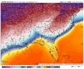
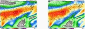
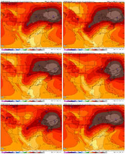
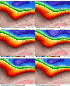
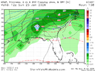
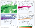
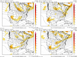
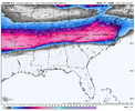
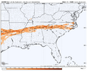
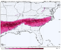
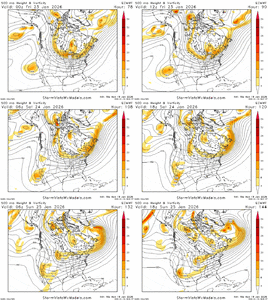
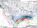
I think we’ll see a correction north once we get inside 72 hours, but until then I don’t really see anything to stop a south trend as long as models are spitting out 1048, 1050+ highs. I do suspect that those are overdone a bit, but even if we have a 1044 mb, there’s gonna be a limit to how far north this system goes.Well if we keep going south that could be a problem. I was not in the camp that this south trend would hold… I would still typically favor going north around hour 90 but dang models are consistently going south .. yall wanted a dominate high pressure .. well it’s coming and it might be screwing the upper south before too long..
Might have to eat my words about this thing going north
-
Hello, please take a minute to check out our awesome content, contributed by the wonderful members of our community. We hope you'll add your own thoughts and opinions by making a free account!
You are using an out of date browser. It may not display this or other websites correctly.
You should upgrade or use an alternative browser.
You should upgrade or use an alternative browser.
Wintry January 23rd-27th 2026
- Thread starter SD
- Start date
BKWRN29
Member
No it won’t hold. This thing will make many changes before we get a grasp on the location. Bottom line, someone’s gonna get something.One thing that seems worrisome is that there's no way the bullseye holds for 5 days straight. That's not possible. Right?
blueheronNC
Member
AI folding, wow. I guess it has no “precedent” in the dataset when it’s been so long. Do tail events get underpredicted by AI when it’s not part of the trained scope of outcomes?
Truly rare events in the training set are things like intense cyclones that are globally rare.AI folding, wow. I guess it has no “precedent” in the dataset when it’s been so long. Do tail events get underpredicted by AI when it’s not part of the trained scope of outcomes?
CAD/HP situations like these are incredibly common around the globe, so how rare it is HERE is not relevant to the model training. The model doesn't see 'snow event in North Carolina' or 'Strong HP pushing across the plains' in training, but rather just 'snow event' or 'strong HP'.
In other words, the AIFS and other AI models aren't emulating historical weather events, they are implicitly emulating the PDEs that govern the atmosphere.Truly rare events in the training set are things like intense cyclones that are globally rare.
CAD/HP situations like these are incredibly common around the globe, so how rare it is HERE is not relevant to the model training. The model doesn't see 'snow event in North Carolina' or 'Strong HP pushing across the plains' in training, but rather just 'snow event' or 'strong HP'.
Of course, no storm details are set in stone thus far out, but, I think we can have a little more confidence in this set up that there may not be drastic changes. For one, we are not dealing with a few degrees of tilt in the trough axis to drastically affect the surface like that last “storm”. And two, it is not a phased system where we have to worry if two packets of energy fuse at the last second.No it won’t hold. This thing will make many changes before we get a grasp on the location. Bottom line, someone’s gonna get something.
What I’ve seen today is every model coalescing more around a consensus and shaving fringes off of the confidence interval of what could happen. With a small south shift right now with that consensus. It’s a nudge towards consensus but idk if I would call this a “fold”, it’s holding on to the structure of what it sees wellAI folding, wow. I guess it has no “precedent” in the dataset when it’s been so long. Do tail events get underpredicted by AI when it’s not part of the trained scope of outcomes?
packfan98
Moderator
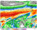
Juicy18z euro looking roughly the same to me at a glance. gonna be big ice totals again:
View attachment 185884
Blue_Ridge_Escarpment
Member
18Z Euro tries to bring in some snow Friday morning to NC
Webberweather53
Meteorologist
I wish I could recall the storm, but I know for a fact there is a storm where the GSO RAOB had a warm nose aloft but was saturated with very cold near-surface temps below -12c and GSO was reporting snow not FZRA despite a classic FZRA sounding. For some reason December 2002 is a guess at GSO, but I'd have to check obs and soundings. Point being to @Webberweather53 suggestion, it definitely has happened with a very cold low-level air mass before in NC.
Yeah that was the storm! Dr Lackmann talked about this in my synoptic class nearly a decade ago and it was because the rain that fell into the cold nose froze so fast it shattered, and the shattered remnants of the now ice nuclei recombined back into small snow dendrites before they hit the ground. I’ve seen this happen a few times over the years
packfan98
Moderator
I mean, at some point we'll hit a ceiling...right?
Seeing the E-AIFS fold to old-school EMCF and GFS models following a southward trend over multiple runs is astounding, especially considering the precipitation amounts it's spitting out!
wow
Member
See what the AI GFS did with it...
Synoptic is now taught by a different professor (took it lest semester) but Lackmann did a guest lecture here and he knows his winter weather stuffYeah that was the storm! Dr Lackmann talked about this in my synoptic class nearly a decade ago and it was because the rain that fell into the cold nose froze so fast it shattered, and the shattered remnants of the now ice nuclei recombined back into small snow dendrites before they hit the ground. I’ve seen this happen a few times over the years
packfan98
Moderator
I just answered this above in more detail, but the short answer is “no”@bouncycorn could the ai models be doing poorly bc this set up is so anomalous? And since they only have data back to 1980, they just don’t have tons of data points on how this plays out?
packfan98
Moderator
ChattaVOL
Member
Do we care about timing at all on this?
GFS has this coming in around 12 hours earlier than the EURO.
Sent from my iPhone using Tapatalk
GFS has this coming in around 12 hours earlier than the EURO.
Sent from my iPhone using Tapatalk
iwantsouthernsnow123
Member
Euro 18z is more suppressed, but has a more dominate SER/Warm nose primarily at the 700mb layer. 18z runs use old data however so it's more important to see 00z
rusrius
Member
if these maps all continue showing these crazy numbers when would the watches and warnings begin being issued for GA/SC/NC?
Any nighttime snow is key to avoid the strong January sun spann talks aboutDo we care about timing at all on this?
GFS has this coming in around 12 hours earlier than the EURO.
Sent from my iPhone using Tapatalk
View attachment 185859
gfs tried to get northern stream involved
What effect does this have on it? Does this act to effectively inject more cold air into the system?
Max Velocity says that the models will have a tough time in the south because it doesn't usually snow in the south. Because it's so rare, they can't figure it out well.In other words, the AIFS and other AI models aren't emulating historical weather events, they are implicitly emulating the PDEs that govern the atmosphere.
packfan98
Moderator
BAM weather said that the slower Euro would give it time to gain strength and come north. Doesn’t look like that’s being depicted now. The euro has been know to hold energy too long in the south west too. Don’t know if that’s in play with this or not.Do we care about timing at all on this?
GFS has this coming in around 12 hours earlier than the EURO.
Sent from my iPhone using Tapatalk
dsaur
Member
Is the zr going to be Macon south, Griffin south, Atl. south, Gainesville, south. Chattanooga south?? Most folks want snow, some crazy people want sleet, and hardly anyone, except the innocent, or deranged want zr, lol. Something wintery is becoming ineluctable, but we aren't there yet. and zr is always part of the mix.the cold high, and please bear with me, vertically is shaped like a shield volcano. so think of the structure of the cold air shaped like this. this is stupid but it's the only way i could think of how to describe it
View attachment 185848
this doesn't change. that low level cold bleeding in will always be a feature. zr is always going to be around with this setup- no way to get rid of it, it's just pinning down where that zone is.
Unfortunately max is mistaken.Max Velocity says that the models will have a tough time in the south because it doesn't usually snow in the south. Because it's so rare, they can't figure it out well.
I would suspect by Wednesday afternoon if trends do not make abrupt turnsif these maps all continue showing these crazy numbers when would the watches and warnings begin being issued for GA/SC/NC?
wow
Member
packfan98
Moderator
Do you have a graphic for that?Euro 18z is more suppressed, but has a more dominate SER/Warm nose primarily at the 700mb layer. 18z runs use old data however so it's more important to see 00z
Forevertothee
Member
Devasting look for Upstate to the Midlands and Pee Dee. I have to think this would be more sleet.Totals through the last frame with much more to go.
View attachment 185889View attachment 185890View attachment 185891
GEFS with almost 36 hours of snow across the Carolinas...
View attachment 185856View attachment 185858
Does SV put out maps with GEFS mean amounts of sleet and ZR? If so, please post if you get the chance for the 18Z GEFS.

