a_gilmore88
Member
I still can’t believe what I’m seeing with these maps. This is fantasy land stuff, inside 150 hrs.


A B xfer off MB. Perfect track


remember...the models over do Freezing rain...so it would lately be sleet for some area but not depicted on here.
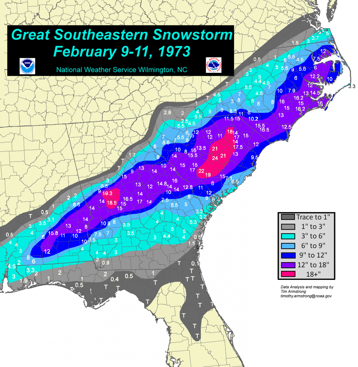
We can only dream of this scenario. I was not alive, but my parents still talk about the 14inches they got in Aiken, SC... This event looking to hand us a little freezing rain in reality.Could this end up like 1973? Setup is probably way different, that is over my pay grade lol.
That I-20 cutoff is brutalAvert your eyes North Georgia weenies. Gonna be hard to top this run moving forward
This storm is feeling like a hybrid of January ‘88 and possibly Feb ‘73. ‘88 was all overrunning from west to east so more areas west were impacted. ‘73 was just a cold Deep South Miller A, although the recent AI GFS Kylo just posted brings this in as a possible desert.Could this end up like 1973? Setup is probably way different, that is over my pay grade lol.

right. but we have a very strong push of colder as the last system did not.All the models trended a bit too south with this last event before going back north. Not the same thing but it happens a lot.
Get a leeside meso L to pop and it will go boom in WNC.I mentioned this last night, but often the best storms for the northern GA and the western/central Carolinas follow this script. Model latch onto a storm signal, trend south up to 48-72 hours of an event and then correct north some leading up to go time. Also, and I’m sure Webb and others will mention this more in the coming days, but in an overrunning precip event like what is being depicted, moisture will be quite a bit more expansive to the north. than what’s being shown
Obviously that’s always something to watch out for when we get into the CAM’s rangeGet a leeside meso L to pop and it will go boom in WNC.
Though I’d love to see that GFS run, this trending south and out of sight are the least of my worries. It trending south and colder is the positive takeaway - of course, I could be wrongAmazing GFS run again. Guys how far south can it go?
January ‘88 also had some Lee side meso low enhancement. I was living west of Gastonia, recorded over a foot there with lollipops near 18 inches just west towards Shelby.Get a leeside meso L to pop and it will go boom in WNC.
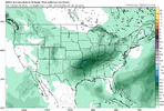
Avert your eyes North Georgia weenies. Gonna be hard to top this run moving forwardView attachment 185837
 www.facebook.com
Yeah nobody on here should be worried about over suppression...not even in the Virgina guys.Though I’d love to see that GFS run, this trending south and out of sight are the least of my worries. It trending south and colder is the positive takeaway - of course, I could be wrong
yes it could but we are 4 to 5 days out. you want a flatter solution (more like overcoming). we want this system not to be so amped so we can limted the WAA.Is it possible this could trend further south and colder to completely get rid of the ZR so everyone gets either sleet/snow only?

Yup. Grew up in Forest City and had over 11" in that Storm. Still in the County.January ‘88 also had some Lee side meso low enhancement. I was living west of Gastonia, recorded over a foot there with lollipops near 18 inches just west towards Shelby.
yes it could but we are 4 to 5 days out. you want a flatter solution (more like overcoming). we want this system not to be so amped so we can limted the WAA.