• Hello, please take a minute to check out our awesome content, contributed by the wonderful members of our community. We hope you'll add your own thoughts and opinions by making a free account!

Wintry January 23rd-27th 2026

idk if the general public will realize the bullet we dodged. They’ll just ----- about having to buy a generator. Still a chance they’ll need it next weekend. Stay tuned
Indeed, if this would have been all ZR like models indicated we woulda been screwed. Thankfully that didn’t happen. Last hurdle will be the wind overnight regarding potential power outages.
 
Indeed, if this would have been all ZR like models indicated we woulda been screwed. Thankfully that didn’t happen. Last hurdle will be the wind overnight regarding potential power outages.
Does anyone have a forecast for the winds? Im nervous about that. Our trees are loaded with ice
 
I do wonder if this "surge" of warm air is ever going to materialize. It sure ain't there at the surface unless we swing all the way around and get a fetch off the ocean for a few hours. The wedge just seems immovable.
I don't think it is, at least not as soon as predicted. I was supposed to be at freezing by now and we just dropped a degree to 26F with that potent line coming at us.
 
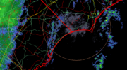
This little band of something is pushing through fairly quickly and looking at surface velocity map it's what is pushing all of our fog back east towards the coast. I've come down from 35.4 on the PWS to back in the 33.2. NWS had us forecast getting into the upper 40s today.

View attachment 189206

We are still sitting at 32 though its the warm side of 32 since a lot of the ice is melting on the ground....still we were suppose to go above freezing around 9am and get to 42...and yet

Fog/Mist
32°F
0°C
Humidity100%
Wind SpeedCalm
Barometer29.90 in
Dewpoint32°F (0°C)
Visibility0.75 mi
Last update25 Jan 5:15 pm EST
 
Indeed, if this would have been all ZR like models indicated we woulda been screwed. Thankfully that didn’t happen. Last hurdle will be the wind overnight regarding potential power outages.
I just told my wife we are at halftime. Need to make it through the winds the next 36 hours and the brutal cold tomorrow night.

But absolutely feel like we dodged the bullet in the first half with so much sleet cutting into the freezing rain totals.

—30—
 
Sleet has saved the day more often than not in Charlotte since 2002. I’m hoping and praying that’s the case this time around, or we get dry slotted. My family living in what some would consider the inner city, there are repercussions of long term power outages that probably aren’t even being considered at the moment, similar to when a hurricane hits a major city (looting, etc.) This could get bad on many levels.
Dodged one heck of a bullet on this one. Over performing CAD is a beautiful thing.
 
Wrapped up here. ZR was so much less than modeled for this area. Sleet held on longer that expected and the lack of precipitation all helped. If it would have been a snowstorm, I would be mad. But it wasn't and I'm not.
 
I do wonder if this "surge" of warm air is ever going to materialize. It sure ain't there at the surface unless we swing all the way around and get a fetch off the ocean for a few hours. The wedge just seems immovable.
Still holding steady at 28. This line hasn’t risen our temps a degree
 
Want to point out euro for days said this was a 33 degree rain. 23.4 and dumping sleet in this band
Even the 18z Euro had us warming to 27 degrees by now. It's 21. Disaster considering that's hr 5 on the model.

The 12z run had us at 31 now, even further off.

And basically every run prior to that had this as rain, as you said.
 
I had about 2 inches of snow before we flipped to pinged about 10:30 PM last night. Had about 3.5 inches of sleet on top of the snow that packed it down to about .5 so sitting with right at 4" combined. Only had a very little liquid rain and the slightest glaze possible. 11 was my low and currently at 18.

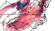
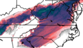
I think we are going to miss the NAM. Go back and look at 12z runs to the 13th hour and look how much closer to reality it was WRT ZR totals. Just as an example, this is the NAM vs the RRFS for the same run and timeframe.

1769384635228.png
1769384715112.png
These are ZR QPF. I saw some scary FRAMs too from HRRR and RGEM so to me, NAM had a better handle on the CAD and showing many of us Sleet for most of the storm. Thanks to everyone for all the info you share on this forum!!
 
Indeed, if this would have been all ZR like models indicated we woulda been screwed. Thankfully that didn’t happen. Last hurdle will be the wind overnight regarding potential power outages.
The sleet absolutely saved me from a lot more ice last night. i've never been so happy the earlier model runs showing huge totals were wrong. I told everyone there were only two outs....we get a lot of sleet and/or the precip totals didn't pan out..and somehow we got both. I won't claim victory until we get through those winds though. But if most of us can manage to get by without losing power this was about as good of a freezing rain event as you can get...enough to make it pretty but not enough to do a lot of damage. And that sleet bomb this afternoon was fun as hell. I enjoyed the hell out of that.

Eeit add the back edge of the rain is holding on longer than expected. In fact the hrrr is holding on for another couple hours. Its light but temp is 31.6...so its adding up...grrrr I am testing my luck

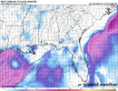
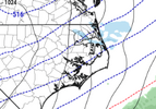
btw, here is where the surface low end up going...damn near to the florida border. The wedge always wins up against low pressure.

1slp.png
 
Last edited:
cb763326b459a8d9d74791460f251650.jpg


Sent from my iPhone using Tapatalk
 
Back
Top