-
Hello, please take a minute to check out our awesome content, contributed by the wonderful members of our community. We hope you'll add your own thoughts and opinions by making a free account!
You are using an out of date browser. It may not display this or other websites correctly.
You should upgrade or use an alternative browser.
You should upgrade or use an alternative browser.
Wintry Jan 23-27 Winter Storm Obs
- Thread starter Rain Cold
- Start date
packfan98
Moderator
That's great! Were you expecting it?Absolutely dumping here, now between 0.5-0.7”
packfan98
Moderator
If your temperature is below 32, then it's freezing rain.Just poured here for like a minute or two at 30.5°, but it’s just regular rain, despite it supposed to be ZR.
Sctvman
Member
bud006
Member
27.7° and sleet with some freezing rain just started again. Looks like quick burst, with another one on radar moving from SW to NE through Atlanta and headed this way.
All eyes on the big line of heavy precip to the west, and what our temps are when it gets here early afternoon. If we hold below freezing here, the impacts are going to accelerate.
—30—
All eyes on the big line of heavy precip to the west, and what our temps are when it gets here early afternoon. If we hold below freezing here, the impacts are going to accelerate.
—30—
Same temp here as it is up top of beech mtn currently.
15
15
Windergawx
Member
pretty much a non event here. temp27 nothing on radar winds coming from wsw
You think sleet could mix in with the heavy band?
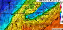
Regarding the 925 layer. This from the NWS RDU discussion.
If the cold nose maintains ice nucleation, even as cold nose
temperatures warm to minus 6-8C this afternoon, then additional
sleet and less complex crystal habits may further delay a changeover
to freezing rain and ultimately yield additional, light frozen
accumulation at the expense of freezing rain.
WEATHERBOYROY
Member
Temperature falling fast in west alabama . Bankston on fayette county fell from 56 degrees to 38 degrees in 48 minutes!
Back to sleet here. Lulls have more frz
Btownheel
Member
Regarding the 925 layer. This from the NWS RDU discussion.
If the cold nose maintains ice nucleation, even as cold nose
temperatures warm to minus 6-8C this afternoon, then additional
sleet and less complex crystal habits may further delay a changeover
to freezing rain and ultimately yield additional, light frozen
accumulation at the expense of freezing rain.
Think it’s been so long since we had a true mega CAD that it even surprised the NWS pros. This is as powerful as I can ever remember. Made it to 14 last night.
Sent from my iPhone using Tapatalk
ForsythSnow
Moderator
27.9/26.7
0.5 - 0.75" sleet accumulated
Glaze to 0.05" of ZR so far.
0.5 - 0.75" sleet accumulated
Glaze to 0.05" of ZR so far.
WxBlue
Meteorologist
Reports out of Transylvania County of 0.35-0.45" of ice. They have 2k out of power now.
whoa nelly they are going to get a tonReports out of Transylvania County of 0.35-0.45" of ice. They have 2k out of power now.
Makeitsnow
Member
btw temp is still dropping here. have just reached a new low of 24.8 (was 25.6 an hour ago) on my elevated station (12 feet) . 2 meter sensor is 25.5. Athens has just reached a new low of 26. Temps are 21 at greenwood so wouldn't surprise me to to drop a little bit more before solar insolation does it's thing.
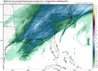
interested to see if we can mist/drizzle ZR during the lull in widespread precip. I am not fully sold on that final band being very efficient in ZR productionGonna be a lull here soon. But in case yall thought we were done here you go View attachment 188971
See @bouncycorn ‘s comment above (might be the other thread). Technically sure, it’s “freezing rain”, but it’s not acting like standard freezing rain because the droplets are so warm, it’s just quite wet.If your temperature is below 32, then it's freezing rain.
Gonna be a good case study bc idk if I’ve ever seen anything like that anywhere. Either way it still looks like .1” hour precip rates there at the endinterested to see if we can mist/drizzle ZR during the lull in widespread precip. I am not fully sold on that final band being very efficient in ZR production
34 and rain here. So close I can smell it.
rburrel2
Member
25 here and all freezing rain now. A noticeable sag to the trees and I measured 1/10th inch of accretion on an elevated flat surface. My finally sleet total was 1 1/4 inches
My 925 is above freezing but I'm getting mainly sleet, once again I say some serious meteorology going on out there
Sent from my A600DL using Tapatalk
It’s crazy because this idea was being thrown around a day or two ago. Scorching temps above but so cold most of us sleeted all night
broken025
Member
Wow way more sleet than I expected
rburrel2
Member
I lied. It’s all sleet again…
JP152
Member
time to go for a 19 degree sleet walk to get a feel for the current conds! can't waste a rare chance like this
iGRXY
Member
Something interesting is you can see those strands of precip in west Alabama and Georgia start building in as soon as they get to Atlanta. Likely from increased elevation aiding in lift and this is where the WAA meets the CAD dome helping precip to blossom
And that is what has helped us in staying away from those damaging ice totals thank goodness and keep the lights on(Afternoon round notwithstanding)It’s crazy because this idea was being thrown around a day or two ago. Scorching temps above but so cold most of us sleeted all night
Sent from my A600DL using Tapatalk
Sctvman
Member
rburrel2
Member
Yea we’re not done. 1/2 inch ice totals still on the table, imo.Something interesting is you can see those strands of precip in west Alabama and Georgia start building in as soon as they get to Atlanta. Likely from increased elevation aiding in lift and this is where the WAA meets the CAD dome helping precip to blossom
Makeitsnow
Member
I was wondering if those yellow cores in those showers was sleet. hrrr keeps cold 925mb temps down to the ne burbs into the afternoon so sleet looks like a possibility in those heavier showers until then.27.7° and sleet with some freezing rain just started again. Looks like quick burst, with another one on radar moving from SW to NE through Atlanta and headed this way.
All eyes on the big line of heavy precip to the west, and what our temps are when it gets here early afternoon. If we hold below freezing here, the impacts are going to accelerate.
—30—

Put my test puffer jacket on, all sleet atm. 15/13
Looks like just short of 1/8th inch if freezing rain on the trees. Looks like a lot of sleet stuck to the ice
LukeBarrette
im north of 90% of people on here so yeah
Meteorology Student
Member
2024 Supporter
2017-2023 Supporter
Sent from my A600DL using Tapatalk
Never seen more snow like sleet in my life. Falls a little more gracefully than sleet. Crazy
8miles
Member
All sleet in Statesville rn


