SegTindo
Member
So is it better to be on the SE side or the NW side? because from what I’m understanding it’s better to be on the NW side
Sent from my iPhone using Tapatalk
Sent from my iPhone using Tapatalk
You would need to be on the NW side on this one for your location. I need the same NW side to be better also. Making big gains tonight with NW trend.So is it better to be on the SE side or the NW side? because from what I’m understanding it’s better to be on the NW side
Sent from my iPhone using Tapatalk

Sent from my iPhone using Tapatalk
Where is this
06z NAM is probably going to be...interesting, then.
Bryson city NC. Forecast called for elevations 3500+ to get mainly snow with very minor accumulation below that but this has been snow from the jump. We are sitting at 31/27 and by the looks of the radar have at least 2 hours of light snow to go. Just really glad our spur of the moment plan worked out. Was concerned about frontal moisture being sufficient but it certainly has. Not gonna be big snow but we may have 1” by 6 am.
Sent from my iPhone using Tapatalk
I’m up so might as well stay up for it and hate myself in the morning when it doesn’t give me what I want06z NAM is probably going to be...interesting, then.
FFC pulling the trigger on a WWA for middle Georgia
Yeah this is reminding me a bit of the Gulf storm last year... It wasn't ours but somehow we got a dusting out of nowhere haha
Been watching for days to see if we can do it. Crazy to see it finally happeningSome of the moisture goes as far back to East TN now. Now that's what we have been looking for right there. Keep the good trends going today.
Awesome brother. Good luckJan 2025 Gulf Coast storm 2.0. Just like that storm, I slowly watched the green contour(.1 QPF) slowly advance northwest over my backyard. Ended up with about 1.3-1.5 inches of snow after being modeled to get nothing the day before. Kind of wild to see the same thing may be playing out. I'm just miles away from at least .1 QPF contour now.
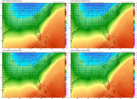
View attachment 184523
Idk if we’re still talking about this but here’s the 06z GFS I can’t tell if it shifted or not
Sent from my iPhone using Tapatalk

Looking better down there Mitch. Reel in her buddy. Great trends overnight.
Looking good down your way right now Jimmy. Hopefully totals go up as the day goes on. We all deserve it around these parts.“The mountains will slow down the colder air moving
into the area as the precip develops, likely leading to just a
cold rain at the onset of the precip around midnight or shortly
after in the Piedmont zones. However, evaporational cooling
should help temperatures to drop during the night and likely
a window of opportunity for the cold air to get into the area
just in time for a transition over the snow, especially along
and northwest of I-85 through daybreak Sunday and even taking on
this transition a little further south and east of I-85 shortly
after daybreak. Ground temperatures will be above freezing and QPF
will be relatively light, so only little to no snow accumulations
are expected. However, some of the CAMs, in particular the NAM
indicates a narrow deformation band developing where the axis of
heaviest precip occurs. In this case, a surprise half inch to an
inch plus can`t be totally ruled out”
GSP says someone’s about to cook here
Trying man. But the warm bubble has me worried. Really worried. We are right in the corridor.Looking better down there Mitch. Reel in her buddy. Great trends overnight.
And cooling offAI’s waking up View attachment 184526

