iGRXY
Member
 CMC already trending further westCMC already trending further west
So anyway this thing start developing earlier since it is a Miller A and getting more people on the western section in the game? (North/Cental Mississippi and Alabama)This is turning into a negative tilted Miller A, not overrunning at all. Low starts bombing off the coast.
![soundings-[33.75,-83.75]-gfs-snku_024h-imp-us_se-2026011500-84.png](https://southernwx.nyc3.digitaloceanspaces.com/data/attachments/183/183580-740d44c7eb8a66474fdbfe0d4b25bd21.jpg "soundings-[33.75,-83.75]-gfs-snku_024h-imp-us_se-2026011500-84.png")
Yep. I went from far western outskirts, to front row bullseye in one day. No more room left to wiggle. .70 qpf at that. Funny how it always comes back to thermals 1st, qpf 2cndWe really need the euro to stay suppressed, this is about to be in eastern Arkansas by the time it gets here
 This will likely be significantly more amped. The SER already stronger
and then for those of us RIGHT along 85, it is the fun (aka not so fun) waiting game of "will i be on the right or wrong side of the r/s line this time?:This storm like 90% of these type setups will have a Cutoff around I85. If you're above there you will get Nailed, Below 85 Likely Cold Rain.
What do you think is a reasonable worst-case scenario for where the rain/snow line could end up if everything kept trending west up until the event as seen in past events?
OK. All set, that's enough NW trend.View attachment 183556
I don't like the Atlantic ridge creepin closer
I think it depends on the trough axis and where it pivots. More people are definitely in this to the west. I’m hoping here further east the base of the trough will still swing though hard enough to give us a good snowy finish, even if the storm starts further west.So anyway this thing start developing earlier since it is a Miller A and getting more people on the western section in the game? (North/Cental Mississippi and Alabama)


OK, but how is this storm as depicted on the GFS overrunning? Looks nothing like that. The low drops sub 1000 past Hatteras, so like any nor’easter the rain snow line will be determined by the surface low path.The orientation may be more n-s are the trough sharpens but it's not going to slow down and bomb out as there is still not enough separation and the next wave kicks it out to sea.
The GFS has SOME credibility here just because the Synoptics supports more precip. The precip comes through early to mid morning for the upstate so it’s not as significant of an issue. Also odds are this speeds up some with the WAA being the driverJust some things to keep in mind, the GFS is showing what could happen with the right dig but beware of the maps. It's the GFS and has been by itself for the most part. Even if does happen, remember that cold is always a concern here... always. Also, for the upstate in particular, it portrays the snow coming through during the daytime rather than the evening or night.
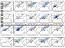
HOLY **** THAT'S ONE AMPED GEFS MEAN!
Sent from my iPhone using Tapatalk
that's one way to get a nice blizzardSent from my iPhone using Tapatalk
Wrong runAIGFS: No discernible trend over the past three runs.
View attachment 183576
Don't like being in the bullseye 3 days out. I can't see this trending back SE again. If I were in TN I'd be feeling pretty good about my chances 3 days from now