You could be a chaser. Live on the edge a little bit.Honestly that would be fun and lots of school, but would be hard to let go my career at the chemical plant a supervisor
-
Hello, please take a minute to check out our awesome content, contributed by the wonderful members of our community. We hope you'll add your own thoughts and opinions by making a free account!
You are using an out of date browser. It may not display this or other websites correctly.
You should upgrade or use an alternative browser.
You should upgrade or use an alternative browser.
Pattern Jammin January 2024
- Thread starter SD
- Start date
tennessee storm
Member
Picknic outdoors anyone ?Can’t just cancel winter when stuff like this can happen. View attachment 142959View attachment 142960
NBAcentel
Member
Could have done that a couple days ago in the subzero temps you just experiencedPicknic outdoors anyone ?
NBAcentel
Member


I left Boone too early. Should have stayed another day or two. It's been snowing all night.
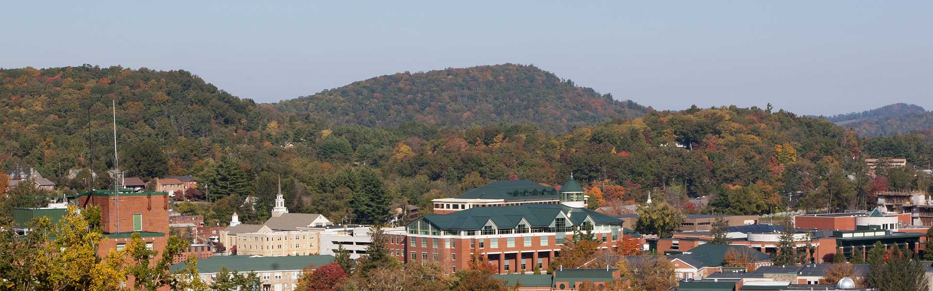
 www.resortcams.com
King Street Boone NC Webcam - Resort Cams
Located in the heart of downtown Boone, NC, the King Street cam gives a live, streaming view of current happenings and events taking place in the most popular town in the High Country.
www.resortcams.com
CNCsnwfan1210
Member
I'll take #21 please lol

Sent from my SM-A136U1 using Tapatalk

Sent from my SM-A136U1 using Tapatalk
6z GFS real close around D10-11, but it's D10-11 and the GFS. Seems I've seen this movie already this winter but there is the slightest chance of sneaking something in around that time frame I guess
Got down to 11 this morning with a minimum wind chill of -2.
With a few flurries lingering until just after midnight, have now logged 5 calendar days out of 7 with at least a trace of wintry precip here.

With a few flurries lingering until just after midnight, have now logged 5 calendar days out of 7 with at least a trace of wintry precip here.
tennessee storm
Member
Winter can leave now. We had enough of it here …. Tired of zero lows night and teens for highs .
Drizzle Snizzle
Member
I know you’re looking forward to highs in the 60s next week.Winter can leave now. We had enough of it here …. Tired of zero lows night and teens for highs .
NCHighCountryWX
Member
- Joined
- Dec 28, 2016
- Messages
- 700
- Reaction score
- 1,921
NOUS42 KGSP 201431
PNSGSP
GAZ010-017-018-026-028-029-NCZ033-035>037-048>053-056>059-062>065-068>072-
082-501>510-SCZ008>014-019-101>109-210231-
Public Information Statement
National Weather Service Greenville-Spartanburg SC
931 AM EST Sat Jan 20 2024
...SNOWFALL REPORTS...
Location Amount Time/Date Lat/Lon
...North Carolina...
...Avery County...
1 ENE Sugar Mountain 8.0 in 0415 PM 01/19 36.13N/81.84W
Banner Elk 1.3 W 6.2 in 0600 AM 01/20 36.16N/81.90W
1 NNE Banner Elk 6.0 in 0621 PM 01/19 36.18N/81.86W
1 WSW Banner Elk 4.0 in 0130 PM 01/19 36.16N/81.89W
Plumtree 0.5 W 2.0 in 0700 AM 01/20 36.03N/82.02W
Linville Falls 0.5 SW 0.8 in 0715 AM 01/20 35.95N/81.95W
...Buncombe County...
2 WNW Weaverville 5.0 in 0500 PM 01/19 35.71N/82.59W
3 SW Woodfin 3.1 in 0949 PM 01/19 35.61N/82.63W
Weaverville 5.6 E 2.5 in 0700 AM 01/20 35.71N/82.46W
Leicester 1.5 in 0655 PM 01/19 35.65N/82.69W
Leicester 3.7 SSE 1.5 in 0700 AM 01/20 35.60N/82.68W
2 WSW Woodfin 1.3 in 0401 PM 01/19 35.62N/82.62W
Leicester 4.5 SW 1.3 in 0700 AM 01/20 35.62N/82.76W
Leicester 2 SE 1.2 in 0700 AM 01/20 35.63N/82.68W
2 WNW Downtown Asheville 1.0 in 0230 PM 01/19 35.58N/82.58W
Weaverville 0.7 SW 1.0 in 0700 AM 01/20 35.69N/82.57W
Asheville 7.3 SSW 0.7 in 0700 AM 01/20 35.50N/82.61W
2 SE Woodfin 0.5 in 1200 PM 01/19 35.62N/82.57W
Candler 0.5 in 0200 PM 01/19 35.54N/82.69W
Asheville 1.2 NNW 0.5 in 0700 AM 01/20 35.59N/82.55W
Black Mountain 2.1 W 0.3 in 0700 AM 01/20 35.62N/82.37W
Asheville 3.8 E 0.2 in 0700 AM 01/20 35.58N/82.48W
Candler 1.9 ESE 0.2 in 0730 AM 01/20 35.52N/82.66W
Fairview 1.4 WSW T in 0700 AM 01/20 35.51N/82.43W
...Burke County...
Jonas Ridge 1.4 S 5.2 in 0700 AM 01/20 35.95N/81.89W
...Haywood County...
4 WSW Maggie Valley 4.0 in 0333 PM 01/19 35.50N/83.16W
2 ENE Maggie Valley 0.5 in 0700 AM 01/20 35.54N/83.05W
Waynesville 1.0 NW 0.4 in 0700 AM 01/20 35.49N/83.01W
Waynesville 0.7 ENE T in 0700 AM 01/20 35.49N/82.99W
...Henderson County...
Fletcher 2.4 SW T in 0700 AM 01/20 35.41N/82.53W
Laurel Park 1.5 W T in 0730 AM 01/20 35.31N/82.53W
Lake Lure 6.0 WNW T in 0800 AM 01/20 35.48N/82.30W
Gerton 0.4 SW T in 0800 AM 01/20 35.48N/82.35W
East Flat Rock 0.5 NNE T in 0800 AM 01/20 35.29N/82.41W
...Madison County...
Marshall 5.0 in 0700 AM 01/20 35.80N/82.67W
Marshall 13.6 NNW 4.5 in 0800 AM 01/20 35.98N/82.77W
15 NNE Marshall 2.7 in 0700 AM 01/20 36.01N/82.62W
Hot Springs 1.0 in 0700 AM 01/20 35.89N/82.82W
Leicester 6.5 WNW 0.9 in 0700 AM 01/20 35.70N/82.80W
...McDowell County...
Old Fort 4.9 SW T in 0800 AM 01/20 35.58N/82.23W
...Mitchell County...
1 SE Buladean 5.8 in 0700 AM 01/20 36.09N/82.17W
Buladean 1.3 ESE 5.2 in 0800 AM 01/20 36.10N/82.17W
Little Switzerland 2.5 in 0900 AM 01/20 35.85N/82.09W
2 SE Bakersville 1.0 in 0800 AM 01/20 35.99N/82.13W
...Swain County...
Wesser 1.7 SE 0.2 in 0710 AM 01/20 35.32N/83.56W
...Yancey County...
5 NNE Faust 5.0 in 0900 PM 01/19 35.98N/82.50W
5 SSW Burnsville 4.9 in 0800 AM 01/20 35.84N/82.34W
5 NW Mount Mitchell State Pa 3.0 in 0815 AM 01/20 35.83N/82.33W
Burnsville 4.6 N 2.0 in 0700 AM 01/20 35.98N/82.29W
Burnsville 1.5 WNW 1.7 in 0700 AM 01/20 35.92N/82.32W
Celo 2 S 0.9 in 0700 AM 01/20 35.83N/82.18W
Bald Creek 1.2 NW 0.5 in 1000 AM 01/19 35.92N/82.44W
&&
**METADATA**
:1/20/2024,0715 AM, NC, Avery, Linville Falls 0.5 SW, , , 35.9544, -81.952, SNOW_24, 0.8, Inch, COCORAHS, 24 hour snowfall,
:1/20/2024,0700 AM, NC, Avery, Plumtree 0.5 W, , , 36.0278, -82.0169, SNOW_24, 2, Inch, COCORAHS, 24 hour snowfall,
:1/19/2024,0130 PM, NC, Avery, 1 WSW Banner Elk, , , 36.1565, -81.8878, SNOW_24, 4, Inch, Cocorahs, 24 hour snowfall,
:1/19/2024,0621 PM, NC, Avery, 1 NNE Banner Elk, , , 36.1808, -81.8642, SNOW_24, 6, Inch, Public, 24 hour snowfall,
:1/20/2024,0600 AM, NC, Avery, Banner Elk 1.3 W, , , 36.159, -81.896, SNOW_24, 6.2, Inch, COCORAHS, 24 hour snowfall,
:1/19/2024,0415 PM, NC, Avery, 1 ENE Sugar Mountain, , , 36.1326, -81.8441, SNOW_24, 8, Inch, Trained Spotter, 24 hour snowfall,
:1/20/2024,0700 AM, NC, Buncombe, Fairview 1.4 WSW, , , 35.5142, -82.426, SNOW_24, 0.001, Inch, COCORAHS, 24 hour snowfall,
:1/20/2024,0700 AM, NC, Buncombe, Asheville 3.8 E, , , 35.5793, -82.4808, SNOW_24, 0.2, Inch, COCORAHS, 24 hour snowfall,
:1/20/2024,0730 AM, NC, Buncombe, Candler 1.9 ESE, , , 35.5234, -82.6623, SNOW_24, 0.2, Inch, COCORAHS, 24 hour snowfall,
:1/20/2024,0700 AM, NC, Buncombe, Black Mountain 2.1 W, , , 35.6171, -82.3681, SNOW_24, 0.3, Inch, COCORAHS, 24 hour snowfall,
:1/19/2024,1200 PM, NC, Buncombe, 2 SE Woodfin, , , 35.6165, -82.5663, SNOW_24, 0.5, Inch, Trained Spotter, 24 hour snowfall,
:1/19/2024,0200 PM, NC, Buncombe, Candler, , , 35.5375, -82.686, SNOW_24, 0.5, Inch, Public, 24 hour snowfall,
:1/20/2024,0700 AM, NC, Buncombe, Asheville 1.2 NNW, , , 35.5909, -82.5549, SNOW_24, 0.5, Inch, COCORAHS, 24 hour snowfall,
:1/20/2024,0700 AM, NC, Buncombe, Asheville 7.3 SSW, , , 35.5038, -82.6059, SNOW_24, 0.7, Inch, COCORAHS, 24 hour snowfall,
:1/19/2024,0230 PM, NC, Buncombe, 2 WNW Downtown Asheville, , , 35.5814, -82.5832, SNOW_24, 1, Inch, Public, 24 hour snowfall,
:1/20/2024,0700 AM, NC, Buncombe, Weaverville 0.7 SW, , , 35.6882, -82.5652, SNOW_24, 1, Inch, COCORAHS, 24 hour snowfall,
:1/20/2024,0700 AM, NC, Buncombe, Leicester 2 SE, , , 35.6263, -82.6763, SNOW_24, 1.2, Inch, COCORAHS, 24 hour snowfall,
:1/19/2024,0401 PM, NC, Buncombe, 2 WSW Woodfin, , , 35.624, -82.6244, SNOW_24, 1.3, Inch, Public, 24 hour snowfall,
:1/20/2024,0700 AM, NC, Buncombe, Leicester 4.5 SW, , , 35.6184, -82.763, SNOW_24, 1.3, Inch, COCORAHS, 24 hour snowfall,
:1/19/2024,0655 PM, NC, Buncombe, Leicester, , , 35.6531, -82.6907, SNOW_24, 1.5, Inch, Public, 24 hour snowfall,
:1/20/2024,0700 AM, NC, Buncombe, Leicester 3.7 SSE, , , 35.6035, -82.6814, SNOW_24, 1.5, Inch, COCORAHS, 24 hour snowfall,
:1/20/2024,0700 AM, NC, Buncombe, Weaverville 5.6 E, , , 35.7077, -82.4592, SNOW_24, 2.5, Inch, COCORAHS, 24 hour snowfall,
:1/19/2024,0949 PM, NC, Buncombe, 3 SW Woodfin, , , 35.607, -82.6259, SNOW_24, 3.1, Inch, Public, 24 hour snowfall,
:1/19/2024,0500 PM, NC, Buncombe, 2 WNW Weaverville, , , 35.7086, -82.591, SNOW_24, 5, Inch, Other Federal, 24 hour snowfall,
:1/20/2024,0700 AM, NC, Burke, Jonas Ridge 1.4 S, , , 35.952, -81.8918, SNOW_24, 5.2, Inch, COCORAHS, 24 hour snowfall,
:1/20/2024,0700 AM, NC, Haywood, Waynesville 0.7 ENE, , , 35.4884, -82.9868, SNOW_24, 0.001, Inch, COCORAHS, 24 hour snowfall,
:1/20/2024,0700 AM, NC, Haywood, Waynesville 1.0 NW, , , 35.4932, -83.0127, SNOW_24, 0.4, Inch, COCORAHS, 24 hour snowfall,
:1/20/2024,0700 AM, NC, Haywood, 2 ENE Maggie Valley, , , 35.5389, -83.0467, SNOW_24, 0.5, Inch, COCORAHS, 24 hour snowfall,
:1/19/2024,0333 PM, NC, Haywood, 4 WSW Maggie Valley, , , 35.4969, -83.1556, SNOW_24, 4, Inch, Trained Spotter, 24 hour snowfall,
:1/20/2024,0700 AM, NC, Henderson, Fletcher 2.4 SW, , , 35.4059, -82.5272, SNOW_24, 0.001, Inch, COCORAHS, 24 hour snowfall,
:1/20/2024,0730 AM, NC, Henderson, Laurel Park 1.5 W, , , 35.3084, -82.5274, SNOW_24, 0.001, Inch, COCORAHS, 24 hour snowfall,
:1/20/2024,0800 AM, NC, Henderson, Lake Lure 6.0 WNW, , , 35.4754, -82.3042, SNOW_24, 0.001, Inch, COCORAHS, 24 hour snowfall,
:1/20/2024,0800 AM, NC, Henderson, Gerton 0.4 SW, , , 35.476, -82.353, SNOW_24, 0.001, Inch, COCORAHS, 24 hour snowfall,
:1/20/2024,0800 AM, NC, Henderson, East Flat Rock 0.5 NNE, , , 35.291, -82.4143, SNOW_24, 0.001, Inch, COCORAHS, 24 hour snowfall,
:1/20/2024,0700 AM, NC, Madison, Leicester 6.5 WNW, , , 35.6955, -82.7991, SNOW_24, 0.9, Inch, COCORAHS, 24 hour snowfall,
:1/20/2024,0700 AM, NC, Madison, Hot Springs, , , 35.8936, -82.8233, SNOW_24, 1, Inch, COOP, 24 hour snowfall,
:1/20/2024,0700 AM, NC, Madison, 15 NNE Marshall, , , 36.0084, -82.6182, SNOW_24, 2.7, Inch, COCORAHS, 24 hour snowfall,
:1/20/2024,0800 AM, NC, Madison, Marshall 13.6 NNW, , , 35.9821, -82.7672, SNOW_24, 4.5, Inch, COCORAHS, 24 hour snowfall,
:1/20/2024,0700 AM, NC, Madison, Marshall, , , 35.8036, -82.6658, SNOW_24, 5, Inch, COOP, 24 hour snowfall,
:1/20/2024,0800 AM, NC, McDowell, Old Fort 4.9 SW, , , 35.5788, -82.2345, SNOW_24, 0.001, Inch, COCORAHS, 24 hour snowfall,
:1/20/2024,0800 AM, NC, Mitchell, 2 SE Bakersville, , , 35.989, -82.128, SNOW_24, 1, Inch, COCORAHS, 24 hour snowfall,
:1/20/2024,0900 AM, NC, Mitchell, Little Switzerland, , , 35.8503, -82.0932, SNOW_24, 2.5, Inch, Emergency Mngr, 24 hour snowfall,
:1/20/2024,0800 AM, NC, Mitchell, Buladean 1.3 ESE, , , 36.1022, -82.1726, SNOW_24, 5.2, Inch, COCORAHS, 24 hour snowfall,
:1/20/2024,0700 AM, NC, Mitchell, 1 SE Buladean, , , 36.092, -82.175, SNOW_24, 5.8, Inch, COCORAHS, 24 hour snowfall,
:1/20/2024,0710 AM, NC, Swain, Wesser 1.7 SE, , , 35.3183, -83.5645, SNOW_24, 0.2, Inch, COCORAHS, 24 hour snowfall,
:1/19/2024,1000 AM, NC, Yancey, Bald Creek 1.2 NW, , , 35.9232, -82.4388, SNOW_24, 0.5, Inch, COCORAHS, 24 hour snowfall,
:1/20/2024,0700 AM, NC, Yancey, Celo 2 S, , , 35.8263, -82.1837, SNOW_24, 0.9, Inch, COOP, 24 hour snowfall,
:1/20/2024,0700 AM, NC, Yancey, Burnsville 1.5 WNW, , , 35.921, -82.3233, SNOW_24, 1.7, Inch, COCORAHS, 24 hour snowfall,
:1/20/2024,0700 AM, NC, Yancey, Burnsville 4.6 N, , , 35.982, -82.2852, SNOW_24, 2, Inch, COCORAHS, 24 hour snowfall,
:1/20/2024,0815 AM, NC, Yancey, 5 NW Mount Mitchell State Park, , , 35.8297, -82.3285, SNOW_24, 3, Inch, COCORAHS, 24 hour snowfall,
:1/20/2024,0800 AM, NC, Yancey, 5 SSW Burnsville, , , 35.8386, -82.3414, SNOW_24, 4.9, Inch, COCORAHS, 24 hour snowfall,
:1/19/2024,0900 PM, NC, Yancey, 5 NNE Faust, , , 35.9772, -82.4955, SNOW_24, 5, Inch, Trained Spotter, 24 hour snowfall,
Observations are collected from a variety of sources with varying
equipment and exposures. We thank all volunteer weather observers
for their dedication. Not all data listed are considered official.
TNweathergurl62
Member
It is winter TS! You will get your severe fun in March and April! We have had a blast all week sledding, bonfires, and snow cream!Winter can leave now. We had enough of it here …. Tired of zero lows night and teens for highs .
Another 8” up above Banner Elk. What a damn weekNOUS42 KGSP 201431
PNSGSP
GAZ010-017-018-026-028-029-NCZ033-035>037-048>053-056>059-062>065-068>072-
082-501>510-SCZ008>014-019-101>109-210231-
Public Information Statement
National Weather Service Greenville-Spartanburg SC
931 AM EST Sat Jan 20 2024
...SNOWFALL REPORTS...
Location Amount Time/Date Lat/Lon
...North Carolina...
...Avery County...
1 ENE Sugar Mountain 8.0 in 0415 PM 01/19 36.13N/81.84W
Banner Elk 1.3 W 6.2 in 0600 AM 01/20 36.16N/81.90W
1 NNE Banner Elk 6.0 in 0621 PM 01/19 36.18N/81.86W
1 WSW Banner Elk 4.0 in 0130 PM 01/19 36.16N/81.89W
Plumtree 0.5 W 2.0 in 0700 AM 01/20 36.03N/82.02W
Linville Falls 0.5 SW 0.8 in 0715 AM 01/20 35.95N/81.95W
...Buncombe County...
2 WNW Weaverville 5.0 in 0500 PM 01/19 35.71N/82.59W
3 SW Woodfin 3.1 in 0949 PM 01/19 35.61N/82.63W
Weaverville 5.6 E 2.5 in 0700 AM 01/20 35.71N/82.46W
Leicester 1.5 in 0655 PM 01/19 35.65N/82.69W
Leicester 3.7 SSE 1.5 in 0700 AM 01/20 35.60N/82.68W
2 WSW Woodfin 1.3 in 0401 PM 01/19 35.62N/82.62W
Leicester 4.5 SW 1.3 in 0700 AM 01/20 35.62N/82.76W
Leicester 2 SE 1.2 in 0700 AM 01/20 35.63N/82.68W
2 WNW Downtown Asheville 1.0 in 0230 PM 01/19 35.58N/82.58W
Weaverville 0.7 SW 1.0 in 0700 AM 01/20 35.69N/82.57W
Asheville 7.3 SSW 0.7 in 0700 AM 01/20 35.50N/82.61W
2 SE Woodfin 0.5 in 1200 PM 01/19 35.62N/82.57W
Candler 0.5 in 0200 PM 01/19 35.54N/82.69W
Asheville 1.2 NNW 0.5 in 0700 AM 01/20 35.59N/82.55W
Black Mountain 2.1 W 0.3 in 0700 AM 01/20 35.62N/82.37W
Asheville 3.8 E 0.2 in 0700 AM 01/20 35.58N/82.48W
Candler 1.9 ESE 0.2 in 0730 AM 01/20 35.52N/82.66W
Fairview 1.4 WSW T in 0700 AM 01/20 35.51N/82.43W
...Burke County...
Jonas Ridge 1.4 S 5.2 in 0700 AM 01/20 35.95N/81.89W
...Haywood County...
4 WSW Maggie Valley 4.0 in 0333 PM 01/19 35.50N/83.16W
2 ENE Maggie Valley 0.5 in 0700 AM 01/20 35.54N/83.05W
Waynesville 1.0 NW 0.4 in 0700 AM 01/20 35.49N/83.01W
Waynesville 0.7 ENE T in 0700 AM 01/20 35.49N/82.99W
...Henderson County...
Fletcher 2.4 SW T in 0700 AM 01/20 35.41N/82.53W
Laurel Park 1.5 W T in 0730 AM 01/20 35.31N/82.53W
Lake Lure 6.0 WNW T in 0800 AM 01/20 35.48N/82.30W
Gerton 0.4 SW T in 0800 AM 01/20 35.48N/82.35W
East Flat Rock 0.5 NNE T in 0800 AM 01/20 35.29N/82.41W
...Madison County...
Marshall 5.0 in 0700 AM 01/20 35.80N/82.67W
Marshall 13.6 NNW 4.5 in 0800 AM 01/20 35.98N/82.77W
15 NNE Marshall 2.7 in 0700 AM 01/20 36.01N/82.62W
Hot Springs 1.0 in 0700 AM 01/20 35.89N/82.82W
Leicester 6.5 WNW 0.9 in 0700 AM 01/20 35.70N/82.80W
...McDowell County...
Old Fort 4.9 SW T in 0800 AM 01/20 35.58N/82.23W
...Mitchell County...
1 SE Buladean 5.8 in 0700 AM 01/20 36.09N/82.17W
Buladean 1.3 ESE 5.2 in 0800 AM 01/20 36.10N/82.17W
Little Switzerland 2.5 in 0900 AM 01/20 35.85N/82.09W
2 SE Bakersville 1.0 in 0800 AM 01/20 35.99N/82.13W
...Swain County...
Wesser 1.7 SE 0.2 in 0710 AM 01/20 35.32N/83.56W
...Yancey County...
5 NNE Faust 5.0 in 0900 PM 01/19 35.98N/82.50W
5 SSW Burnsville 4.9 in 0800 AM 01/20 35.84N/82.34W
5 NW Mount Mitchell State Pa 3.0 in 0815 AM 01/20 35.83N/82.33W
Burnsville 4.6 N 2.0 in 0700 AM 01/20 35.98N/82.29W
Burnsville 1.5 WNW 1.7 in 0700 AM 01/20 35.92N/82.32W
Celo 2 S 0.9 in 0700 AM 01/20 35.83N/82.18W
Bald Creek 1.2 NW 0.5 in 1000 AM 01/19 35.92N/82.44W
&&
**METADATA**
:1/20/2024,0715 AM, NC, Avery, Linville Falls 0.5 SW, , , 35.9544, -81.952, SNOW_24, 0.8, Inch, COCORAHS, 24 hour snowfall,
:1/20/2024,0700 AM, NC, Avery, Plumtree 0.5 W, , , 36.0278, -82.0169, SNOW_24, 2, Inch, COCORAHS, 24 hour snowfall,
:1/19/2024,0130 PM, NC, Avery, 1 WSW Banner Elk, , , 36.1565, -81.8878, SNOW_24, 4, Inch, Cocorahs, 24 hour snowfall,
:1/19/2024,0621 PM, NC, Avery, 1 NNE Banner Elk, , , 36.1808, -81.8642, SNOW_24, 6, Inch, Public, 24 hour snowfall,
:1/20/2024,0600 AM, NC, Avery, Banner Elk 1.3 W, , , 36.159, -81.896, SNOW_24, 6.2, Inch, COCORAHS, 24 hour snowfall,
:1/19/2024,0415 PM, NC, Avery, 1 ENE Sugar Mountain, , , 36.1326, -81.8441, SNOW_24, 8, Inch, Trained Spotter, 24 hour snowfall,
:1/20/2024,0700 AM, NC, Buncombe, Fairview 1.4 WSW, , , 35.5142, -82.426, SNOW_24, 0.001, Inch, COCORAHS, 24 hour snowfall,
:1/20/2024,0700 AM, NC, Buncombe, Asheville 3.8 E, , , 35.5793, -82.4808, SNOW_24, 0.2, Inch, COCORAHS, 24 hour snowfall,
:1/20/2024,0730 AM, NC, Buncombe, Candler 1.9 ESE, , , 35.5234, -82.6623, SNOW_24, 0.2, Inch, COCORAHS, 24 hour snowfall,
:1/20/2024,0700 AM, NC, Buncombe, Black Mountain 2.1 W, , , 35.6171, -82.3681, SNOW_24, 0.3, Inch, COCORAHS, 24 hour snowfall,
:1/19/2024,1200 PM, NC, Buncombe, 2 SE Woodfin, , , 35.6165, -82.5663, SNOW_24, 0.5, Inch, Trained Spotter, 24 hour snowfall,
:1/19/2024,0200 PM, NC, Buncombe, Candler, , , 35.5375, -82.686, SNOW_24, 0.5, Inch, Public, 24 hour snowfall,
:1/20/2024,0700 AM, NC, Buncombe, Asheville 1.2 NNW, , , 35.5909, -82.5549, SNOW_24, 0.5, Inch, COCORAHS, 24 hour snowfall,
:1/20/2024,0700 AM, NC, Buncombe, Asheville 7.3 SSW, , , 35.5038, -82.6059, SNOW_24, 0.7, Inch, COCORAHS, 24 hour snowfall,
:1/19/2024,0230 PM, NC, Buncombe, 2 WNW Downtown Asheville, , , 35.5814, -82.5832, SNOW_24, 1, Inch, Public, 24 hour snowfall,
:1/20/2024,0700 AM, NC, Buncombe, Weaverville 0.7 SW, , , 35.6882, -82.5652, SNOW_24, 1, Inch, COCORAHS, 24 hour snowfall,
:1/20/2024,0700 AM, NC, Buncombe, Leicester 2 SE, , , 35.6263, -82.6763, SNOW_24, 1.2, Inch, COCORAHS, 24 hour snowfall,
:1/19/2024,0401 PM, NC, Buncombe, 2 WSW Woodfin, , , 35.624, -82.6244, SNOW_24, 1.3, Inch, Public, 24 hour snowfall,
:1/20/2024,0700 AM, NC, Buncombe, Leicester 4.5 SW, , , 35.6184, -82.763, SNOW_24, 1.3, Inch, COCORAHS, 24 hour snowfall,
:1/19/2024,0655 PM, NC, Buncombe, Leicester, , , 35.6531, -82.6907, SNOW_24, 1.5, Inch, Public, 24 hour snowfall,
:1/20/2024,0700 AM, NC, Buncombe, Leicester 3.7 SSE, , , 35.6035, -82.6814, SNOW_24, 1.5, Inch, COCORAHS, 24 hour snowfall,
:1/20/2024,0700 AM, NC, Buncombe, Weaverville 5.6 E, , , 35.7077, -82.4592, SNOW_24, 2.5, Inch, COCORAHS, 24 hour snowfall,
:1/19/2024,0949 PM, NC, Buncombe, 3 SW Woodfin, , , 35.607, -82.6259, SNOW_24, 3.1, Inch, Public, 24 hour snowfall,
:1/19/2024,0500 PM, NC, Buncombe, 2 WNW Weaverville, , , 35.7086, -82.591, SNOW_24, 5, Inch, Other Federal, 24 hour snowfall,
:1/20/2024,0700 AM, NC, Burke, Jonas Ridge 1.4 S, , , 35.952, -81.8918, SNOW_24, 5.2, Inch, COCORAHS, 24 hour snowfall,
:1/20/2024,0700 AM, NC, Haywood, Waynesville 0.7 ENE, , , 35.4884, -82.9868, SNOW_24, 0.001, Inch, COCORAHS, 24 hour snowfall,
:1/20/2024,0700 AM, NC, Haywood, Waynesville 1.0 NW, , , 35.4932, -83.0127, SNOW_24, 0.4, Inch, COCORAHS, 24 hour snowfall,
:1/20/2024,0700 AM, NC, Haywood, 2 ENE Maggie Valley, , , 35.5389, -83.0467, SNOW_24, 0.5, Inch, COCORAHS, 24 hour snowfall,
:1/19/2024,0333 PM, NC, Haywood, 4 WSW Maggie Valley, , , 35.4969, -83.1556, SNOW_24, 4, Inch, Trained Spotter, 24 hour snowfall,
:1/20/2024,0700 AM, NC, Henderson, Fletcher 2.4 SW, , , 35.4059, -82.5272, SNOW_24, 0.001, Inch, COCORAHS, 24 hour snowfall,
:1/20/2024,0730 AM, NC, Henderson, Laurel Park 1.5 W, , , 35.3084, -82.5274, SNOW_24, 0.001, Inch, COCORAHS, 24 hour snowfall,
:1/20/2024,0800 AM, NC, Henderson, Lake Lure 6.0 WNW, , , 35.4754, -82.3042, SNOW_24, 0.001, Inch, COCORAHS, 24 hour snowfall,
:1/20/2024,0800 AM, NC, Henderson, Gerton 0.4 SW, , , 35.476, -82.353, SNOW_24, 0.001, Inch, COCORAHS, 24 hour snowfall,
:1/20/2024,0800 AM, NC, Henderson, East Flat Rock 0.5 NNE, , , 35.291, -82.4143, SNOW_24, 0.001, Inch, COCORAHS, 24 hour snowfall,
:1/20/2024,0700 AM, NC, Madison, Leicester 6.5 WNW, , , 35.6955, -82.7991, SNOW_24, 0.9, Inch, COCORAHS, 24 hour snowfall,
:1/20/2024,0700 AM, NC, Madison, Hot Springs, , , 35.8936, -82.8233, SNOW_24, 1, Inch, COOP, 24 hour snowfall,
:1/20/2024,0700 AM, NC, Madison, 15 NNE Marshall, , , 36.0084, -82.6182, SNOW_24, 2.7, Inch, COCORAHS, 24 hour snowfall,
:1/20/2024,0800 AM, NC, Madison, Marshall 13.6 NNW, , , 35.9821, -82.7672, SNOW_24, 4.5, Inch, COCORAHS, 24 hour snowfall,
:1/20/2024,0700 AM, NC, Madison, Marshall, , , 35.8036, -82.6658, SNOW_24, 5, Inch, COOP, 24 hour snowfall,
:1/20/2024,0800 AM, NC, McDowell, Old Fort 4.9 SW, , , 35.5788, -82.2345, SNOW_24, 0.001, Inch, COCORAHS, 24 hour snowfall,
:1/20/2024,0800 AM, NC, Mitchell, 2 SE Bakersville, , , 35.989, -82.128, SNOW_24, 1, Inch, COCORAHS, 24 hour snowfall,
:1/20/2024,0900 AM, NC, Mitchell, Little Switzerland, , , 35.8503, -82.0932, SNOW_24, 2.5, Inch, Emergency Mngr, 24 hour snowfall,
:1/20/2024,0800 AM, NC, Mitchell, Buladean 1.3 ESE, , , 36.1022, -82.1726, SNOW_24, 5.2, Inch, COCORAHS, 24 hour snowfall,
:1/20/2024,0700 AM, NC, Mitchell, 1 SE Buladean, , , 36.092, -82.175, SNOW_24, 5.8, Inch, COCORAHS, 24 hour snowfall,
:1/20/2024,0710 AM, NC, Swain, Wesser 1.7 SE, , , 35.3183, -83.5645, SNOW_24, 0.2, Inch, COCORAHS, 24 hour snowfall,
:1/19/2024,1000 AM, NC, Yancey, Bald Creek 1.2 NW, , , 35.9232, -82.4388, SNOW_24, 0.5, Inch, COCORAHS, 24 hour snowfall,
:1/20/2024,0700 AM, NC, Yancey, Celo 2 S, , , 35.8263, -82.1837, SNOW_24, 0.9, Inch, COOP, 24 hour snowfall,
:1/20/2024,0700 AM, NC, Yancey, Burnsville 1.5 WNW, , , 35.921, -82.3233, SNOW_24, 1.7, Inch, COCORAHS, 24 hour snowfall,
:1/20/2024,0700 AM, NC, Yancey, Burnsville 4.6 N, , , 35.982, -82.2852, SNOW_24, 2, Inch, COCORAHS, 24 hour snowfall,
:1/20/2024,0815 AM, NC, Yancey, 5 NW Mount Mitchell State Park, , , 35.8297, -82.3285, SNOW_24, 3, Inch, COCORAHS, 24 hour snowfall,
:1/20/2024,0800 AM, NC, Yancey, 5 SSW Burnsville, , , 35.8386, -82.3414, SNOW_24, 4.9, Inch, COCORAHS, 24 hour snowfall,
:1/19/2024,0900 PM, NC, Yancey, 5 NNE Faust, , , 35.9772, -82.4955, SNOW_24, 5, Inch, Trained Spotter, 24 hour snowfall,
Observations are collected from a variety of sources with varying
equipment and exposures. We thank all volunteer weather observers
for their dedication. Not all data listed are considered official.
Stormlover
Member
Average GFS bias 7 days out shows quite the warm bias 
- Joined
- Jan 23, 2021
- Messages
- 4,603
- Reaction score
- 15,199
- Location
- Lebanon Township, Durham County NC

NBAcentel
Member
It’s a Step down process 
iGRXY
Member
Nothing like it still being 26 and feels like it’s 12 at 1 in the afternoon
Flotown
Member
we might go 2 weeks without going below freezing again after sunday..crazy turn around
Drizzle Snizzle
Member
Parts of Georgia aren’t forecast to have another freeze through March 4th if accuweather is right.we might go 2 weeks without going below freezing again after sunday..crazy turn around
It’s probably right.Parts of Georgia aren’t forecast to have another freeze through March 4th if accuweather is right.
Piece of advice….the Accuweather 45 day forecast is hot garbage. That thing said I would go the whole month of December without a freeze… I had 14Parts of Georgia aren’t forecast to have another freeze through March 4th if accuweather is right.
GoDuke
Member
 Moving quickly to phase 7!
JustinWx24
Member


JustinWx24
Member
Late Jan 2005 ice storm showing up on the modeling!
olhausen
Member
I remember one December places in Alabama got a huge snow. Chattanooga had some bangers also before their drought. Clarksville just west of me also use to kill it. There was a reason they called Nashville a snow hole. The city had some horrible snow droughts for many years until 2015. If I hit 10 inches this season it will be the 3rd time in 4 years of 10 plus on the season. I’ve now had a 6,7 and 8 inch snowstorm in the last 3 winters. I’m just saying it’s more likely a pattern that will eventually shift for other areas. We will pay for all this snow in Nashville at some point. Until then I’ll enjoy every second of it.Just curious...what location 200 miles of you got 8-10" paste bombs, and when did it happen?
olhausen
Member
We just had historic December tornadoes a month ago. Hopefully no severe this spring!It is winter TS! You will get your severe fun in March and April! We have had a blast all week sledding, bonfires, and snow cream!
That was another storm with a short window during an overall mild stretch.Late Jan 2005 ice storm showing up on the modeling!
- Joined
- Jan 5, 2017
- Messages
- 3,796
- Reaction score
- 6,038
Looks like I'm not breaking above the freezing mark today. About to slide down from here, 29.8 now.
Looks like 32 will be it for me today… have just dipped back down 31 and the dewpoint is now 3. The winds are dying off so I think I might go a bit lower than GSP’s forecast 13 tonight.
33/22 today doubt we get below 22 by midnight to set a new low. Currently 33/2 if winds were going to go fully calm single digits would be a slam dunk but with wind continuing we probably end up around 15
- Joined
- Jan 23, 2021
- Messages
- 4,603
- Reaction score
- 15,199
- Location
- Lebanon Township, Durham County NC
Winds kept the temps up last night so we only got to 23. However, the high has only been 30. A seven degree diurnal range is pretty impressive with no snow pack and full sun.
ForsythSnow
Moderator
30.2 was the high here. Already back down to 25.9. If I were to take a guess our low will probably bottom out around 8 or 9 tonight given how we hit 9.9 earlier this week and look just a degree or two colder than that.
28.6 for the high here. I was actually working outside in t-shirt for awhile. I think I have gotten used to the cold now.30.2 was the high here. Already back down to 25.9. If I were to take a guess our low will probably bottom out around 8 or 9 tonight given how we hit 9.9 earlier this week and look just a degree or two colder than that.
I’m still 20 minutes till sunset and have already dropped to 28… if the wind go calm tonight, watch out.
GoDuke
Member

Nice! But is the +PNA too far east here?
21f and dropping quickly.
I’m thinking we might get colder than earlier in the week. I’m 22/8.21f and dropping quickly.
Agreed~I’m thinking we might get colder than earlier in the week. I’m 22/8.
This winter at least has a true winter feel to it. I just checked....19/3 so yes sir. We are heading down tonight.

