Carolina Sky
Member
And you have to pay extra to see it on Peacock. Bonus!Saturday night playoff game kc air temp is below zero, wind chill-20. If you like watching Millionaires freeze their butts off,tune in.
And you have to pay extra to see it on Peacock. Bonus!Saturday night playoff game kc air temp is below zero, wind chill-20. If you like watching Millionaires freeze their butts off,tune in.
Looks real good. So show me that fizzle out into nothing boys.
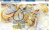
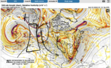
On the next frame it’s snow from I-77 east in NC and the most eastern portions of the SC upstate. Probably not a lot but it’s under 528 line so it would probably be some higher ratio stuff. A second area of precip holds back over the southern half of Alabama and Georgia with a stripe of snow on its north… it drops down and looks like it evolves into the coastal that fires up 36 hours later bring snow to the coastal sectionsLooks real good. So show me that fizzle out into nothing boys.
From the canonical -NAO perspective, this one certainly fits the bill. Still doesn't mean we can't score twice though!Congrats to those in NW Piedmont, Apps and western SE sections will be in order for the first system. This one around the 21st will be ours on the east side. Right where we want it 8-9 days out
View attachment 141672
believe in the table setter theory.Are any of the upcoming systems going to be a happy ending for areas in central GA (just north of I-20 line)?
Are any of the upcoming systems going to be a happy ending for areas in central GA (just north of I-20 line)?
My area does much better with solid cold levels already in place versus timing from cold delivery from the northwest. I can almost guarantee the cold will not make it far enough southeast to produce snow, sleet or freezing rain. It will just be plain ole rain in Atlanta south. Alpharetta, White and Gainesville, GA and points northwest might be cold enough. Out west near Buchanan, Dallas to Kennesaw will have a shot, too. They have some elevation to help them. Everyone else in GA can start looking to the 20th for another possible chance (though the 0z Euro said it will be a cutter).believe in the table setter theory.
I'm autistic and have trouble with idioms sometimes, what does table setter theory mean?believe in the table setter theory.
The first one misses but sets the tone. The second one hits & brings the glory.I'm autistic and have trouble with idioms sometimes, what does table setter theory mean?


