• Hello, please take a minute to check out our awesome content, contributed by the wonderful members of our community. We hope you'll add your own thoughts and opinions by making a free account!

Tropical Invest 91L

Satellite imagery appears to suggest two competing circulations with the broader weak circulation. One is likely an MLC, near 28N and 83W, and the other near 25.5N and 84.5W. Again, just eyeballing visible imagery.

Should this system consolidate farther south than previously thought, that would make things far more interesting.
 
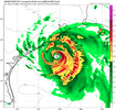
Alright then. In a normal summer I would say no but yeah it hasn't stopped raining out here yet... I mean it's supposed to but it was supposed to do a lot of things 😜 hmon_ref_91L_41.png
 
The 12Z UKMET was the 4th full run (full runs are at 0Z/12Z) that developed this into a mainly W moving full fledged TS. The last 2 runs developed it into a TD by early tomorrow morning!

NEW TROPICAL CYCLONE FORECAST TO DEVELOP AFTER 18 HOURS

FORECAST POSITION AT T+ 18 : 27.1N 84.9W


LEAD CENTRAL MAXIMUM WIND

VERIFYING TIME TIME POSITION PRESSURE (MB) SPEED (KNOTS)

-------------- ---- -------- ------------- -------------

1200UTC 19.07.2026 24 27.5N 84.9W 1010 25

0000UTC 20.07.2026 36 28.1N 85.2W 1006 28

1200UTC 20.07.2026 48 28.2N 86.0W 1004 30

0000UTC 21.07.2026 60 28.1N 86.1W 1002 33

1200UTC 21.07.2026 72 28.4N 86.1W 1000 38

0000UTC 22.07.2026 84 29.2N 86.2W 997 50

1200UTC 22.07.2026 96 29.6N 86.9W 998 51

0000UTC 23.07.2026 108 29.3N 87.8W 996 52

1200UTC 23.07.2026 120 28.9N 88.8W 999 44

0000UTC 24.07.2026 132 28.7N 90.0W 999 40

1200UTC 24.07.2026 144 29.0N 92.0W 1001 36

0000UTC 25.07.2026 156 29.3N 94.2W 1004 37

1200UTC 25.07.2026 168 CEASED TRACKING
 
Back
Top