Cary_Snow95
Member
Yeah it has been winding it up. Also the farthest eastFWIW the para GFS has been consistently showing this getting into the 960-970s at peak strength.
Literally went to another tab for a bit and came back to see that this is apparently an 80mph hurricane now. In the span of an hour we already exceeded the maximum intensity forecast...
FWIW the para GFS has been consistently showing this getting into the 960-970s at peak strength.


Maximum sustained winds have increased to near 80 mph (130 km/h)
with higher gusts. Little change in strength is forecast during
the next 48 hours.
Yeah ok NHC they only strengthen it 5 mph lol
Even with that change it was still east of 18z
Ukmet is likely a major into NC 947 mb and then it basically hits NJ
TROPICAL STORM ISAIAS ANALYSED POSITION : 20.0N 71.3W
ATCF IDENTIFIER : AL092020
LEAD CENTRAL MAXIMUM WIND
VERIFYING TIME TIME POSITION PRESSURE (MB) SPEED (KNOTS)
-------------- ---- -------- ------------- -------------
0000UTC 31.07.2020 0 20.0N 71.3W 1002 44
1200UTC 31.07.2020 12 21.4N 73.6W 997 49
0000UTC 01.08.2020 24 23.0N 75.4W 992 57
1200UTC 01.08.2020 36 24.7N 77.1W 987 60
0000UTC 02.08.2020 48 25.9N 78.0W 980 61
1200UTC 02.08.2020 60 27.2N 78.4W 975 61
0000UTC 03.08.2020 72 28.6N 78.8W 968 69
1200UTC 03.08.2020 84 30.0N 78.9W 967 69
0000UTC 04.08.2020 96 31.8N 78.3W 959 77
1200UTC 04.08.2020 108 34.7N 77.1W 947 74
0000UTC 05.08.2020 120 38.8N 74.8W 964 70
1200UTC 05.08.2020 132 42.8N 71.6W 978 57
0000UTC 06.08.2020 144 45.9N 68.9W 996 33


Much slower than gfs tooEuro barely not hitting FL pretty much the same been closer to FL than the GFS and UkmetView attachment 45549
Definitely expanding wind field looking for Carolina landfall possible SC from 0Z Euro.I love watching these things develop, the core is warming and expanding and this allows the wind field to expand and capitalize on the pressure drops.....then the process will repeat, crazy that the Euro/Icon have weaker TS and the HMON/Ukie Cat 3 runs......being I have skin in the game those difference matter a wee little bit.....
After models overnight it’s safe to say the shift west along the coast is not done yet.Lots of strong Euro ens that match up pretty well with the Ukie/HMON 00Z runs....
After models overnight it’s safe to say the shift west along the coast is not done yet.
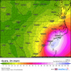
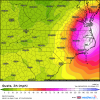
6z 12k Nam, 3k Nam, and also the Icon, shifted west and ride the coast now.Is there a point where we start watching the 3km NAM? Because anything near that would not be good.
