Downeastnc
Member
At least 985mb
Probably gonna see precip really blossom here as the interaction occurs, starting to see hints of that
Looks like I may be sitting pretty then just west of 95!Tropical band will congeal with the front and work East. Hence those 6” + totals being realized in short order tonight for areas along and just west of 95. And, really what looks like a hybrid transition inland over the NC and VA as Isaias sustains strength, guidance has suggested this for several days.
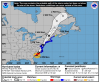
View attachment 45979

I think this is it. Should say SE Wake.LOVE my tempest, post the link once you have it set up.
Already an observed tornado over Bald Head Island.Train of rotating storms getting ready to come on shore.View attachment 45980


Train of rotating storms getting ready to come on shore.View attachment 45980

CC drop tooYeah strong couplets.

Sent from my iPhone using Tapatalk

If it was to run I-95, that would give us more rain. Looking at radar, it looks like a North Myrtle Beach hit; as long as it continues the NNE track.


What's considered landfall, when the outer-wall first hits land or when the center passes?