
It may have leveled off for now, but by the way it's tracking (eastward), isn't it tracking the way it needs to so far to avoid the worst impacts of the shear and for any weakening before landfall to be slight?
Right.
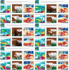

It may have leveled off for now, but by the way it's tracking (eastward), isn't it tracking the way it needs to so far to avoid the worst impacts of the shear and for any weakening before landfall to be slight?

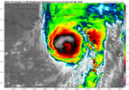
I'd be curious how large the TS wind field ends up getting ultimately. It's grown massively in the last day.Wouldn't be surprised to see this possibility crack 120-125kts looking at IR. This thing is cranking.
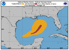
I'd be curious how large the TS wind field ends up getting ultimately. It's grown massively in the last day.
View attachment 198669

What’s your assessment of how the day evolves in Tuscaloosa tomorrow based on recent trends?Gonna be moving every vehicle into the large open field. I'm not car hunting again because of a tree.

This storm, given the pressure gradient, will bring near-tropical storm gusts all the way to the coastal Carolinas IMO. Nothing crazy, but still.I'd be curious how large the TS wind field ends up getting ultimately. It's grown massively in the last day.
View attachment 198669


What’s your assessment of how the day evolves in Tuscaloosa tomorrow based on recent trends?
You think power outages are a given that side of the state?I think it depends on how fast they can clean up fallen trees and restore power.

You think power outages are a given that side of the state?

If the storm continues to trend east, Tuscaloosa may end up on the west side of the remaining core of the storm as it move through the state. May not be as great of storm damage if that were to occur possibly.I think it depends on how fast they can clean up fallen trees and restore power.

If the storm continues to trend east, Tuscaloosa may end up on the west side of the remaining core of the storm as it move through the state. May not be as great of storm damage if that were to occur possibly.
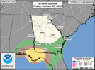
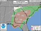
Hard to believe as fast as this thing will be moving, they have the tornado risk dropping off below Atlanta.10% tornado probabilities for the Florida panhandle today and threat expands north into tomorrow. SPC mentioned consideration for adding a CIG1 for saturday. WSBTV got to be sweating bullets about the possibility of having to break in for tornado warnings tomorrow evening.View attachment 198672
View attachment 198673

Hard to believe as fast as this thing will be moving, they have the tornado risk dropping off below Atlanta.
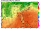


It’s likely largely related to the dewpoints falling off notably as one approaches the S ATL metro due to the wedge’s influence:
2PM EDT Saturday
View attachment 198677

Sheer is about to unravel the SW side. It's weakening time!How he handles this dry slot rotating around will be the difference between a cat 3/4 and cat 2.
View attachment 198675

Pretty big difference between the GFS and the Euro for the exact same time tomorrow afternoon. Although I wonder if the Euro is struggling to resolve the wedge. Ive seen it play out enough times to never bet aginst the wedge winning out!It’s likely largely related to the dewpoints falling off notably as one approaches the S ATL metro due to the wedge’s influence:
2PM EDT Saturday
View attachment 198677
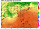
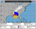
The EURO remains too far west. It's notable that the long forecast bend to the NNW following landfall, as the interaction with the approaching shortwave from Texas is no longer shown in the NHC official forecast. I'm sure this, along with the increased intensity of the storm, is why N. Georgia has had the high-wind warning hoisted.Pretty big difference between the GFS and the Euro for the exact same time tomorrow afternoon. Although I wonder if the Euro is struggling to resolve the wedge. Ive seen it play out enough times to never bet aginst the wedge winning out!View attachment 198679


Wait what?!They got Glenn Burns out of retirement and covering the storm on Channel 2!
