A few towers starting to fire up in the SW quadrant we will see where they goI dunno that dry air has really put the brakes on IMO the entire NE quad on the core has warmed up a lot almost no hot towers clouds warming in all sectors etc....
View attachment 198687

-
Hello, please take a minute to check out our awesome content, contributed by the wonderful members of our community. We hope you'll add your own thoughts and opinions by making a free account!
You are using an out of date browser. It may not display this or other websites correctly.
You should upgrade or use an alternative browser.
You should upgrade or use an alternative browser.
Tropical Hurricane Isaias
- Thread starter SD
- Start date

NoSnowATL
Member
Feels weird being on the bad side for once. 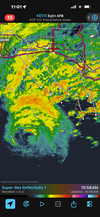

Tsappfrog20
Member
Feels weird being on the bad side for once. View attachment 198690
Your not too far from some friends of mine who are in Chipley
Sent from my iPhone using Tapatalk

Downeastnc
Member
A few towers starting to fire up in the SW quadrant we will see where they go
Watching the IR loop on tropical its pretty evident that its finally getting the effects of the dry air and shear....looks much worse now than just 45 mins ago....lots of warming tops and limited new storm development....also radar looks less scary its weakening just a matter of how much before landfall.

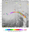
HHs getting 115knt Flight level so far.

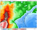
GFS went east a bit

ForsythSnow
Moderator
Pressure still falling too. It seems like it's not even weakening despite the IR appearance.
Downeastnc
Member
Pressure still falling too. It seems like it's not even weakening despite the IR appearance.
Could end up where the flight level winds are much higher than what they see at the surface, without the strong storms they wont mix down as well. Had that happen here a few times, Isabel had a pressure here of 955 and we only gusted to 50 with 100 knts a few thousand ft up because the SW eyewall had no storms to get them down. The IR loop certainly doesnt scream strengthening storm....

Looks like it's trying to cover the dry slot. Also looks like eye is warming.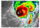
Tsappfrog20
Member
It continues to shift East with Landfall
Sent from my iPhone using Tapatalk
Sent from my iPhone using Tapatalk
Not good for the mountains.
Downeastnc
Member
Looks like Isaias is attempting an ERC!
Sent from my iPhone using Tapatalk
Yeah looks funny on radar like there were or are two centers that are merging...again its long range on the radar so its hard to tell...
90 knts at the surface in the NE eyewall that first pass....
Tsappfrog20
Member
Yeah looks funny on radar like there were or are two centers that are merging...again its long range on the radar so its hard to tell...
90 knts at the surface in the NE eyewall that first pass....
Yea it’s trying to do something.
Sent from my iPhone using Tapatalk

Solid CAT 3. 961 splash, so it's likely peaked