• Hello, please take a minute to check out our awesome content, contributed by the wonderful members of our community. We hope you'll add your own thoughts and opinions by making a free account!

Tropical Hurricane Idalia

It is going west for landfall but farther south and east up in the Carolinas. The Euro has it back offshore close to Georgetown now.
Ok I’ve just looked at the 12z Euro out to hour 57 and that is not the case. It still has it exiting right about Myrtle Beach, maybe just tad north of there. Also, GSP hasn’t put out their afternoon discussion yet, but they have gone ahead issues a Flash Flood Watch for the SC Upstate and the southern NC Piedmont for 2-4 inches of rainfall expected.
 
I definitely could see 2-4" all across the upstate as we get some additional upslope my way and heavier returns back towards the southeast. Don't be surprised to see a line of 3-6" from Greenwood to Union and back towards Rock hill either.
 
I definitely could see 2-4" all across the upstate as we get some additional upslope my way and heavier returns back towards the southeast. Don't be surprised to see a line of 3-6" from Greenwood to Union and back towards Rock hill either.
Also I still don’t think that the EURO/UK combo is doing a very good job at expanding precip on the NW side. There’s a lot of dynamics at play that should spread rain back to the mountains at least for a time.
 
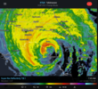
NAM 3k picking up on heavier amounts in Central NC...probably why GSP is waiting on Disco and hoisting FFW.
Yes…. I expect the 3k NAM and the HRRR as it gets closer will start to pick on heavier rain further to the north and west of the center.
 
Postel just posted this...leaning a bit left....bigger ramifications further north (Central SC/NC)
 

Attachments

  • Screenshot 2023-08-29 at 3.31.50 PM.png
    Screenshot 2023-08-29 at 3.31.50 PM.png
    799.2 KB · Views: 96
10L_tracks_latest.png
 
Postel just posted this...leaning a bit left....bigger ramifications further north (Central SC/NC)
One thing to be careful of is, though it's easy to extrapolate a more westward and northward inland track, based on a more current westerly motion (and even a bit more of a westerly landfall) than the official forecast plot indicates, shortly after landfall, most models make a hard right and still eventually end up pretty close to the same track.

That doesn't mean the precip shield won't be somewhat more expansive to the north than some models might be showing currently. It's just that the center probably doesn't get as far north as central SC or anything like that, even if it's looking more west right now.

It's going to be interesting to see if the 3K keeps a similar precip depiction as far north and west as the image above over the next couple of runs. My guess is that it corrects the corridor of heavy rain to the south.
 
Back
Top