lexxnchloe
Member
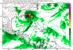
943mb landfall. Maybe low end cat4ICON is much slower but is likely a major at landfall. Some huge changes at 500mb as early as 72 hours View attachment 151411

943mb landfall. Maybe low end cat4ICON is much slower but is likely a major at landfall. Some huge changes at 500mb as early as 72 hours View attachment 151411

That GFS run is a bit too close to Tampa
Yeah there are some crazy timing differences between modelsEven though the Icon and GFS have similar landfall locations/strengths, the GFS landfall is a whopping 60 hours earlier (Thu evening) vs Icon (Sun morning).
Can you post the precip map when it is ready please?Euro is quicker and into Apalachicola on Thursday nightView attachment 151418
Euro is quicker and into Apalachicola on Thursday nightView attachment 151418
Looks to be the eastern outlier as the rest of the 0Z suite came in and now 6Z
Is their some kind of curse over Atlanta?
