• Hello, please take a minute to check out our awesome content, contributed by the wonderful members of our community. We hope you'll add your own thoughts and opinions by making a free account!

Tropical Hurricane Dorian

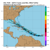
I wouldn't be surprised if this beats 98L to Dorian honestly, still think the NHC is lowballing a bit while 98L is gonna be over land tomorrow. Also the small storms can form faster

Showers and thunderstorms associated with a small area of low
pressure located about 1050 miles east of the Windward Islands are
showing some signs of organization. Environmental conditions appear
conducive for additional development, and a tropical depression is
likely to form over the weekend or early next week while the low
moves westward to west-northwestward at 10 to 15 mph. Conditions
appear less favorable for development when the low reaches the
Lesser Antilles and eastern Caribbean Sea by the middle of next
week.
* Formation chance through 48 hours...medium...60 percent.
* Formation chance through 5 days...high...70 percent.
 
0z Euro is head on into the Shredder at 144

the remnants look to be headed towards Florida at 168

it should be noted again that the Euro hasn't even been showing a storm at all til now and has been very poor lately
 
Last edited:
Development chances have risen to 70/80 now.

Showers and thunderstorms associated with a small area of low
pressure located about 950 miles east of the Windward Islands are
showing some signs of organization. Environmental conditions appear

conducive for additional development, and a tropical depression is
likely to form during the next day or two while the low moves
westward to west-northwestward at 10 to 15 mph. Conditions appear

less favorable for development when the low reaches the Lesser
Antilles and eastern Caribbean Sea by the middle of next week.

* Formation chance through 48 hours...high...70 percent.
* Formation chance through 5 days...high...80 percent.
 
As always, will be interesting to see if this thing can somehow avoid or survive the graveyard

The 12z gfs brings it into the islands as 1009mb but it should be stronger than that if the NHC is correct. Does the typical translation of a stronger system being pulled more poleward at least give the idea it could be further north and missing the greater antilles any weight? Guess we will see what future runs do........the ukmet has done well over the last couple seasons. Especially with Florence's track last year so its interesting to see what it shows.
 
The 12z gfs brings it into the islands as 1009mb but it should be stronger than that if the NHC is correct. Does the typical translation of a stronger system being pulled more poleward at least give the idea it could be further north and missing the greater antilles any weight? Guess we will see what future runs do........the ukmet has done well over the last couple seasons. Especially with Florence's track last year so its interesting to see what it shows.
I agree if it's a stronger system, it goes further north and possibly intensifies. I think Phil stated this option earlier. We shall sea....
 
Back
Top