Nice phil thanks
-
Hello, please take a minute to check out our awesome content, contributed by the wonderful members of our community. We hope you'll add your own thoughts and opinions by making a free account!
You are using an out of date browser. It may not display this or other websites correctly.
You should upgrade or use an alternative browser.
You should upgrade or use an alternative browser.
Tropical Hurricane Dorian
- Thread starter Metwannabe
- Start date
Henry2326
Member
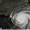
SUMMARY OF 400 PM EDT...2000 UTC...INFORMATION
----------------------------------------------
LOCATION...27.6N 78.6W
ABOUT 70 MI...110 KM N OF FREEPORT GRAND BAHAMA ISLAND
ABOUT 105 MI...165 KM E OF FORT PIERCE FLORIDA
MAXIMUM SUSTAINED WINDS...110 MPH...175 KM/H
PRESENT MOVEMENT...NW OR 325 DEGREES AT 5 MPH...7 KM/H
MINIMUM CENTRAL PRESSURE...959 MB...28.32 INCHES
Cadi40
Member
I may be wrong but Dorian looks to be developing a new eye on IR.
But think Katrina...still hit with a CAT 5 storm surge despite weakening. Large storm and a lot of water nowhere to go but inland. I think the weakening is a mute point given its growing and likely to have major hurricane characteristics.It's going to hit land at this point. At least it's not a major anymore, so the impacts will be a lot less of what was initially expected. Still a large storm, so coastal areas will have the most issues as well as up in the coastal counties of NC and SC. I wouldn't rule out SAV having the same.
Cadi40
Member
I don’t think Dorian is going to weaken anymore than it already has, and if so it will be minimal. There’s no reason why he shouldn’t at the very least be able to reorganize itself. You guys have to take into account how long this storm has been rotating, it has so much inertia and power that it’s impacts will not stop just stop at the coast. It’s a very intense storm regardless of the category.
Sent from my SM-G950U using Tapatalk
Henry2326
Member
To your point, look what Harvey did as a tropical storm....But think Katrina...still hit with a CAT 5 storm surge despite weakening. Large storm and a lot of water nowhere to go but inland. I think the weakening is a mute point given its growing and likely to have major hurricane characteristics.
Henry2326
Member
Sent from my SM-G950U using Tapatalk
T-2 and consensus is approaching.
NAM also looks to be more in line with other models
Shaggy
Member
From Raleigh NWS......sounds like winds are gonna be a problem not only for eastern piedmont,sandhills and coastal plains but even TS gusts into the triangle.
Late Thursday night Hurricane Dorian will be located just
northeast of Cape Fear, NC with dangerous winds continuing
across the Coastal Plain and Sandhills of North Carolina. Some
impacts could be significant with possible damage to roofing and
siding materials. Rainfall totals from Dorian will be 2 to 6
inches with locally higher amounts possible. On the northwestern
edge of Dorian rainfall amounts will quickly fall off due to
dry air being entrained from an approaching cold front. For
example, amounts across the Triad will likely only be a couple
of hundredths of an inch with 1 to 3 inches possible over the
Triad.
FWIW, NAM shifts west it is under 48hrs so not as horrible at this range

Sent from my SM-G950U using Tapatalk

Sent from my SM-G950U using Tapatalk
12Z Euro is ~70 miles from where I live late tomorrow night. Solid TS force winds. 9" of rain.
To compare, Matthew was 40 miles from where I live (I had evacuated) when the highest winds near the center were 105 mph and lowest SLP was 955 mb. H winds were 60 from center and TS winds were 185 from center. I'm crossing my fingers it at least stays out this 70 mile distance.
To compare, Matthew was 40 miles from where I live (I had evacuated) when the highest winds near the center were 105 mph and lowest SLP was 955 mb. H winds were 60 from center and TS winds were 185 from center. I'm crossing my fingers it at least stays out this 70 mile distance.
Last edited:
FWIW the Euro has an increase of wind over the triad. MBY seems to get fringed via rainfall but I'm a little concerned about gusty winds moving my lawn furniture.
View attachment 23025
View attachment 23026
Fortunately, the Euro tends to have winds a good bit too high over land. But I don't like seeing this, regardless.
I’ve been burnt too many times to trust euro wind maps. I’m generally expecting a swift breeze from Raleigh to Charlotte West.
pcbjr
Member
Larry,12Z Euro is ~70 miles from where I live late tomorrow night. Solid TS force winds. 9" of rain.
To compare, Matthew was 40 miles from where I live (I had evacuated) when the highest winds near the center were 100 mph and lowest SLP was 953 mb. I'm crossing my fingers it at least stays out this 70 mile distance.
Be safe (as with everyone else!). Let me know when it's over, and if need be I'll figure out a way to ship you an order of Sonny's!
Phil
I know everyone has a story about that one time a model was correct for their area, but real talk, Euro was very accurate with Irma up here. It picked up on the pressure gradient well.I’ve been burnt too many times to trust euro wind maps. I’m generally expecting a swift breeze from Raleigh to Charlotte West.


