00z runs gonna have everyone back on board and the northerners in pain.
-
Hello, please take a minute to check out our awesome content, contributed by the wonderful members of our community. We hope you'll add your own thoughts and opinions by making a free account!
You are using an out of date browser. It may not display this or other websites correctly.
You should upgrade or use an alternative browser.
You should upgrade or use an alternative browser.
Misc General Banter Thread
- Thread starter Rain Cold
- Start date
SCREW THE 18Z WE WILL FIGHT BACK AND WE WILL WIN WEENIES!


On the topic of weather data, does anyone know if weather balloon launches ever went back to a "normal" schedule after so many jobs were cut in the spring and summer? If I remember right the northern plains area was especially hard hit by reductions. That's where our HP is coming from.
BKWRN29
Member
It’s over now.
Shadypines33
Member
- Joined
- Jan 5, 2017
- Messages
- 3,771
- Reaction score
- 5,974
A lot of grasping for straws in the storm thread. I'm relieved to be under the greens now!
LongRanger
Member
Just issued....
National Weather Service Greenville-Spartanburg SC
859 PM EST Tue Jan 20 2026
GAZ010-017-018-026-028-029-NCZ033-035>037-048>053-056>059-062>065-
068>072-082-501>510-SCZ008>014-019-101>109-220200-
Rabun-Habersham-Stephens-Franklin-Hart-Elbert-Avery-Alexander-
Iredell-Davie-Madison-Yancey-Mitchell-Swain-Haywood-Buncombe-Catawba-
Rowan-Graham-Northern Jackson-Macon-Southern Jackson-Transylvania-
Henderson-Cleveland-Lincoln-Gaston-Mecklenburg-Cabarrus-Union-
Caldwell Mountains-Greater Caldwell-Burke Mountains-Greater Burke-
McDowell Mountains-Eastern McDowell-Rutherford Mountains-
Greater Rutherford-Polk Mountains-Eastern Polk-Cherokee-York-
Anderson-Abbeville-Laurens-Chester-Greenwood-Oconee Mountains-
Pickens Mountains-Greenville Mountains-Greater Oconee-
Greater Pickens-Central Greenville-Southern Greenville-
Northern Spartanburg-Southern Spartanburg-
859 PM EST Tue Jan 20 2026
This Hazardous Weather Outlook is for northeast Georgia, Piedmont
North Carolina, western North Carolina and Upstate South Carolina.
.DAY ONE...Tonight.
Hazardous weather is not expected at this time.
.DAYS TWO THROUGH SEVEN...Wednesday through Monday.
Confidence is increasing that significant wintry precipitation will
occur over the area this weekend. Hazardous travel and power outages
are possible and may linger into early next week depending on how
fast wintry precipitation melts. Additionally, cold wind chills may
develop Monday night into Tuesday morning and a Cold Weather
Advisory may be needed. Make sure to stay up to date with the latest
information regarding the forecast as this is an evolving system.
.SPOTTER INFORMATION STATEMENT...
Hazardous Weather Outlook
Hazardous Weather OutlookNational Weather Service Greenville-Spartanburg SC
859 PM EST Tue Jan 20 2026
GAZ010-017-018-026-028-029-NCZ033-035>037-048>053-056>059-062>065-
068>072-082-501>510-SCZ008>014-019-101>109-220200-
Rabun-Habersham-Stephens-Franklin-Hart-Elbert-Avery-Alexander-
Iredell-Davie-Madison-Yancey-Mitchell-Swain-Haywood-Buncombe-Catawba-
Rowan-Graham-Northern Jackson-Macon-Southern Jackson-Transylvania-
Henderson-Cleveland-Lincoln-Gaston-Mecklenburg-Cabarrus-Union-
Caldwell Mountains-Greater Caldwell-Burke Mountains-Greater Burke-
McDowell Mountains-Eastern McDowell-Rutherford Mountains-
Greater Rutherford-Polk Mountains-Eastern Polk-Cherokee-York-
Anderson-Abbeville-Laurens-Chester-Greenwood-Oconee Mountains-
Pickens Mountains-Greenville Mountains-Greater Oconee-
Greater Pickens-Central Greenville-Southern Greenville-
Northern Spartanburg-Southern Spartanburg-
859 PM EST Tue Jan 20 2026
This Hazardous Weather Outlook is for northeast Georgia, Piedmont
North Carolina, western North Carolina and Upstate South Carolina.
.DAY ONE...Tonight.
Hazardous weather is not expected at this time.
.DAYS TWO THROUGH SEVEN...Wednesday through Monday.
Confidence is increasing that significant wintry precipitation will
occur over the area this weekend. Hazardous travel and power outages
are possible and may linger into early next week depending on how
fast wintry precipitation melts. Additionally, cold wind chills may
develop Monday night into Tuesday morning and a Cold Weather
Advisory may be needed. Make sure to stay up to date with the latest
information regarding the forecast as this is an evolving system.
.SPOTTER INFORMATION STATEMENT...
Don't come here. It hasn't snowed in northern Spartanburg county more than a dusting in over 4 years now! And starting to look like it won't now eitherMove to east to Florence SC or the NC coastal plains, or move to Landrum SC and the foothills upstate if you want snow. The midlands of SC/GA are terrible for winter weather. Too far inland for the coastal stuff that develops.
People will never trust the news again after they are showing 90% chance of a half inch of ice accumulation in Atlanta and then we get cold rain
LongRanger
Member
- Joined
- Jan 5, 2017
- Messages
- 3,771
- Reaction score
- 5,974
Yes, yes it is. We should have enough rain to float that sucker easy!
Disappointed in the latest runs. Of course, the GFS was great, but I agree with others that it is most likely wrong --> Greg Fishel talked earlier today about its cold bias for setups like this. But many of us are still looking at a huge storm. We've seen these storms trend to the north at this time span to then trend slightly back south before go time. I have a feeling we're looking at a large sleet storm from the up state into NC. That would be a win for me. I would gladly take 2+" of QPF as sleet. and maybe we can get a little snow to start and end.
I posted this tweet about 3 years ago and I think it's relevant to what you're asking here. This kind of thing can happen when you get giant arctic air masses like this so close to the Rockies.
Not to discount this in any way because I’m sure it’s true, but this has to be one of the dumbest ways iv seen us find a way to screw up a winter storm. I mean this just sounds so ridiculous when I read it lol.
Storm5
Member
This thread will be popping next 24 hours
Yeah, lets just go ahead and blow up the yellowstone caldera. Let it take all of the Rockies with it to alleviate this problem.Not to discount this in any way because I’m sure it’s true, but this has to be one of the dumbest ways iv seen us find a way to screw up a winter storm. I mean this just sounds so ridiculous when I read it lol.
SnowNiner
Member
This thread will be popping next 24 hours
I’d probably say the next 4 hours. 0z runs should tell the tale to me. If they continue to go north and amped, it’s done imo. There’s no SE trend imo, it’ll keep going.
Which is sad considering our blocking and a 50/50 low.
feel like i need a "new met" tag vs the other mets so ppl know how much to trust me
LukeBarrette
im north of 90% of people on here so yeah
Meteorology Student
Member
2024 Supporter
2017-2023 Supporter
lol and to think I will get the Met tag here soon in May. Probably need to start acting like one LOLfeel like i need a "new met" tag vs the other mets so ppl know how much to trust me
i've tried to be more professional but not overstep my knowledge at my age. last thing i want to do is start talking down to people because i got a degreelol and to think I will get the Met tag here soon in May. Probably need to start acting like one LOL
LukeBarrette
im north of 90% of people on here so yeah
Meteorology Student
Member
2024 Supporter
2017-2023 Supporter
Yeah I agree. I get carried away sometimes and gotta work on it.i've tried to be more professional but not overstep my knowledge at my age. last thing i want to do is start talking down to people because i got a degree
If you talk positive Charlotte snow chances you immediately have my respect and reverencei've tried to be more professional but not overstep my knowledge at my age. last thing i want to do is start talking down to people because i got a degree
lusting4Adusting
Member
You realize this didn't go to shat till you finally showed up. Lol...and I'll take the blame too cause I was wondering where the hell you were.This thread will be popping next 24 hours
How old is Mini 5 these days?
- Joined
- Jan 23, 2021
- Messages
- 4,602
- Reaction score
- 15,197
- Location
- Lebanon Township, Durham County NC
I mean you graduated so soon ago you probably still got that new adult smellfeel like i need a "new met" tag vs the other mets so ppl know how much to trust me
- Joined
- Jan 23, 2021
- Messages
- 4,602
- Reaction score
- 15,197
- Location
- Lebanon Township, Durham County NC
The degree hanging on your wall says you got that right thoi've tried to be more professional but not overstep my knowledge at my age. last thing i want to do is start talking down to people because i got a degree
GeorgiaGirl
Member
If I'm being honest...the 0z NAM in its fantasy land actually looks like it's trending to this phased bomb at H5.
Placed in banter as it's where it belongs lmao.
Placed in banter as it's where it belongs lmao.
my dog loves itI mean you graduated so soon ago you probably still got that new adult smell
Can’t even get a long range nam snow for clt
Maybe sooner!This thread will be popping next 24 hours
I fully expect to wake up tomorrow to a massive Ohio Valley and New England snowstorm.
I spent a lot of money on groceries for a Cold Rain. Hopefully it comes back tomorrow. Be the ultimate bust.
Same, my friend. And heaters and a generator.
NWG_WX14
Member
NAM was getting a good cold push and I think it was going to snow atleast to start in most of NC. But still 84 hour NAM
lexxnchloe
Member
Hopefully you picked alot of Vodka. Vodka cold is the only cold we will get.I spent a lot of money on groceries for a Cold Rain. Hopefully it comes back tomorrow. Be the ultimate bust.
Will you Please post a 10,000 hr tropical storm map threat.Not a good trend. The high is further NW than 18Z. That will in response allow the warm air to also be further NW
Got mineHopefully you picked alot of Vodka. Vodka cold is the only cold we will get.
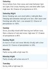
Don’t blow it Brent! Good luck!I have no words at TWC's forecast View attachment 186641
Everyone gets snow these days but SC and NCDon’t blow it Brent! Good luck!


