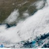
I’m very impressed how it picked up Pilot MTN and the brushy mtns in Surry/Wilkes where 1-3” fell.
-
Hello, please take a minute to check out our awesome content, contributed by the wonderful members of our community. We hope you'll add your own thoughts and opinions by making a free account!
You are using an out of date browser. It may not display this or other websites correctly.
You should upgrade or use an alternative browser.
You should upgrade or use an alternative browser.
Wintry February 19-21, 2020 Winter Storm
- Thread starter Six Mile Wx
- Start date
snowlover91
Member
Which one of these is not like the othersView attachment 36125View attachment 36126View attachment 36128
The 12km NAM struggled a lot with this one, way too amped but the 3km NAM was very good on this. Here’s the forecast from 12z Wednesday, a touch too far north but the overall totals are pretty close when using Kuchera. Highest report I’ve seen is 5.1” so far. Also I added the snow depth map from it. Perhaps a blend of these two would yield a very good result?


Webberweather53
Meteorologist
Here's my preliminary post-analysis of this evident in NC. There's a lot of spatial inhomogeneities to the snowfall amounts, several localized bands are evident, the most obvious one that sticks out to me is the band of higher amounts that extends from southeast Charlotte towards Montgomery & Moore counties.

Shaggy
Member
Love this storm. None is melting out of the trees yet.
Attachments
Snow doing work and taking all the sun's energy, still sitting at 31°
Yeah, we're definitely not hitting our forecast high here. The coldest night of the winter will be tonight.Snow doing work and taking all the sun's energy, still sitting at 31°
Regardless, tons of snow is melting under the severe sun angle.
Coldest night for me yet this winter is 23, well actually in November I dipped into the teens, but that's unheard. Could make a run at it tonightYeah, we're definitely not hitting our forecast high here. The coldest night of the winter will be tonight.
Regardless, tons of snow is melting under the severe sun angle.
Shaggy
Member
Yeah, we're definitely not hitting our forecast high here. The coldest night of the winter will be tonight.
Regardless, tons of snow is melting under the severe sun angle.
My 4yr old is seemingly more interested in the development of these long icicles than the snow ?
Downeastnc
Member
Here's my preliminary post-analysis of this evident in NC. There's a lot of spatial inhomogeneities to the snowfall amounts, several localized bands are evident, the most obvious one that sticks out to me is the band of higher amounts that extends from southeast Charlotte towards Montgomery & Moore counties.
View attachment 36141
That’s a really fcking accurate map for far NE NC. Good job bro. Good job.
snowlover91
Member
Closeup of the snow cover. You can really see the lower elevations in the mountains.
View attachment 36160
Almost looks likes those clouds that are streaming on top/south of the snow are developing from the snow cover itself, damn that’s cool
Webberweather53
Meteorologist
Shaggy
Member
Here's a finalized version of the map for this winter storm in NC & one for SC too.
View attachment 36163
View attachment 36162
On another forum a guy is reporting 5 inches of snow in both Bath and Washington NC.
B
Brick Tamland
Guest
Looks like it did end up about half of what the NAM was showing. It's crazy that the short range models get the totals wrong so often when they are the ones that should be the best for short range forecasting. Although, it did get the location correct with regards to which areas would see the most amounts.
Looks like it did end up about half of what the NAM was showing. It's crazy that the short range models get the totals wrong so often when they are the ones that should be the best for short range forecasting. Although, it did get the location correct with regards to which areas would see the most amounts.
I ran a test a year or so ago about rainfall forecasts via the models. I'm pretty sure the GEFS or something did the best, but I can't remember. That was before the FV3 upgrade if it's so, though.
@Webberweather53 , what caused the Euro to continually keep the surface reflection of that low so weak? I'm wondering if that is a major reason why it refused to get precipitation up to NC for the longest time? I know from memory that a lot of runs just kinda had a barely weak surface low (if one at all) moving on OTS.
Bannerdude
Member
I was in a relative screw zone. Nice. ?RAH's first draft of snow totals in central NC
Shaggy
Member
I was in a relative screw zone. Nice. ?
That matches pretty close for western pitt county near PGV. I was just under 4 after compaction and that 3.8 is just barely west of me. Lines up perfectly.
Shaggy
Member
Please forgive me for one more weenie post. One of the coolest things about today has been this morphing of snow covered trees to the dangling ice formations on the branches. It literally looks like the trees were decorated for Christmas. It's almost like the snow melted slowly since we've been 32 all day and as they melted they formed the ice hanging off the branches. I tried to get a video as best I could. Not sure I've seen this before. Usually the trees melt first with big chunks of snow splatting the ground.


