-
Hello, please take a minute to check out our awesome content, contributed by the wonderful members of our community. We hope you'll add your own thoughts and opinions by making a free account!
You are using an out of date browser. It may not display this or other websites correctly.
You should upgrade or use an alternative browser.
You should upgrade or use an alternative browser.
- Joined
- Jan 23, 2021
- Messages
- 3,875
- Reaction score
- 12,248
- Location
- Lebanon Township, Durham County NC
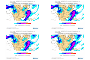
Probably a whole lot of sleet in the following frames of that 6z euro
Brent
Member
- Joined
- Jan 23, 2021
- Messages
- 3,875
- Reaction score
- 12,248
- Location
- Lebanon Township, Durham County NC
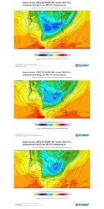
6z EPS ticked colder as well
Ice ice. Pattern, feature placements all pointing to heavy icing  snow will pushed to the north and west but even they likely ice some
Not to sound like a broken record but for NC the precip falls with temps in the 20s, this isn't some 31/32 marginal icing event. There is most likely going to be a corridor of significant icing issues
- Joined
- Jan 23, 2021
- Messages
- 3,875
- Reaction score
- 12,248
- Location
- Lebanon Township, Durham County NC
This is looking like many storms around here. SN -> IP -> ZR -> SN
WolfpackHomer91
Member
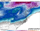
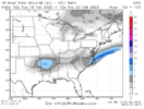
MOGREPS still looked solid although it was a touch warmer, southern fringes here would be ip/zr
View attachment 168889
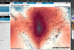
Attractive LP placement For sure
This is why a significant winter event seems likely and imo icing is becoming a potential bigger issue.
Agree...the icing potential is a little concerning but we are still 5 days away so will see.This is why a significant winter event seems likely and imo icing is becoming a potential bigger issue.
Brent getting 0 degree snow while we slapbox one another for a mixed bag in the Carolinas
SimeonNC
Member
This might be the first legitimate February winter storm threat in nearly a decade.
With the amount of sleet shown on the Canadian and UK, I would like to see an all sleet event. It's been a while. Many years back I remember somebody getting mad because they had switched to snow after many hours of sleet.This is looking like many storms around here. SN -> IP -> ZR -> SN
Bigedd09
Member
Yeah for sure, but maybe for Eastern NC.This might be the first legitimate February winter storm threat in nearly a decade.
Just eastern NC? You have sound reasoning for that?Yeah for sure, but maybe for Eastern NC.
Bigedd09
Member
From what I'm seeing, it seems as if it's trending to a late bloomer. That favors ENCJust eastern NC? You have sound reasoning for that?
Yeah I wouldn’t discount a late bloomer whiff but it is certainly not the favored outcome atm. I’d still be more worried about an inland tracking low right now
I'm worried about whichever scenario doesn't show snow. Until inside day 4 I am hugging the EPS...it's hard to beat. But it had a ton of spread, including whiffs. Several members with. no precip.Yeah I wouldn’t discount a late bloomer whiff but it is certainly not the favored outcome atm. I’d still be more worried about an inland tracking low right now
Bigedd09
Member
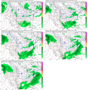
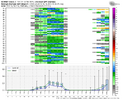
This model has been wrong all winter. Hopefully it's wrong again lol06z NAVGEM whiffs everybody. Diabolical outcome View attachment 168897
CNCsnwfan1210
Member


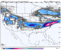
00z CMC ensemble had quite a few icy members/amped up solutions at hrs 144/156
Sent from my iPhone using Tapatalk
I'm not sure I'm seeing any real trends yet. Solutions seem to be across the board from a whiff or partial whiff to an amped system. We're seeing model suites bounce around and show little consistency from run to run.
I guess maybe the trend would be to increase the potential for ice in the southern CAD areas.
I think it's probably still wise to pattern-focus and use the ensembles first for another day or two.
The key is that we have the right players on the field, with a legitimate cold source nearby and a mechanism to deliver it into the area, via a strong HP.
Now comes the hard part...putting it all together.
NCHighCountryWX
Member
- Joined
- Dec 28, 2016
- Messages
- 530
- Reaction score
- 1,458
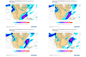
Color me skeptical on on a wave that turns the corner late. If we all miss it will more than likely be because we amplified the low too soon and spiked heights out front. We’ve also been stuck in a SER regime the entire month of February so there’s no reason to think that just gets totally muted here. Bet the streak. But I’m just a guyI'm worried about whichever scenario doesn't show snow. Until inside day 4 I am hugging the EPS...it's hard to beat. But it had a ton of spread, including whiffs. Several members with. no precip.
View attachment 168899
I'll take storm track too far SE at this lead time, what happened last month along the gulf coast isn't going to happen again this time, and odds are as we get closer there will be the usual NW trend. Yesterday it looked like the northern stream was screwing it up and allowing it leak NW and flood us with WAA now the other direction. Nothing close to being set in stone
packfan98
Moderator
A
I saw that earlier. Looks like they favor the track all the way up the coastline 'Noreaster kind of thing..
I think the MJO phases says otherwise but I'm no MJO guy at all, only look at what RC and others post on here about it.Color me skeptical on on a wave that turns the corner late. If we all miss it will more than likely be because we amplified the low too soon and spiked heights out front. We’ve also been stuck in a SER regime the entire month of February so there’s no reason to think that just gets totally muted here. Bet the streak. But I’m just a guy
SnowNiner
Member
GSP NWS rolling their eyes at this threat overnight. Basically saying it's cold chasing moisture. I think it's too early for that, but a couple things I don't like which I agree with them on; there's really no high pressure to the NE locking in the CAD, so it's kinda weak. The parent high is way out west (which will probably be weaker than shown as usual). If we had stronger high pressure up top, this could be a much bigger deal.
The other thing I don't like right now is the late blooming signature that's starting to show up. MBY in WNC never does well with those, always less precip than modeled. I want my storm blowing up at the MS delta fetching gulf moisture, not in the Atlantic. Raleigh and east however could do really well.
Everything still feels on the table, but just more heavily weighted right now North and East.
At the surface a ridge of high
pressure builds south into the area Monday and Tuesday. The center
of the high remains to our west, where the coldest air remains as
well. Still, temps may be cold enough as moisture and lift move into
the area ahead of a Gulf low early Wednesday for a rain/snow mix
before warming takes place with mainly rain during the afternoon.
Precip chances remain over the area Wednesday night as the low moves
up the Atlantic coast. Cold air tries to move in behind the low
changing rain to snow, especially across the mountains. NW flow snow
showers would linger across the mountains. Of course, as usual, it
is questionable whether cold air could move in fast enough for
wintry precip outside of the mountains, but it is possible with
lingering moisture and a weakly unstable air mass. The global
ensemble guidance shows the potential for wintry precip outside of
the mountains as well, but it is still uncertain given pattern
recognition.
When RC posts the lil MJO circle graphics and puts smiley face emojis that’s how I know we are looking good. I don’t ask too many questionsI think the MJO phases says otherwise but I'm no MJO guy at all, only look at what RC and others post on here about it.
Imo cold chasing moisture is only one of the possible scenarios. If we swing that initial wave through and form that secondary like we’ve seen over and over again the last few days it turns into something totally different. Prob still rain at GSP but not because of cold chasing moisture. Either way it’s not going to be easy getting this one to line up anywhere in SC but it never is.GSP NWS rolling their eyes at this threat overnight. Basically saying it's cold chasing moisture. I think it's too early for that, but a couple things I don't like which I agree with them on; there's really no high pressure to the NE locking in the CAD, so it's kinda weak. The parent high is way out west (which will probably be weaker than shown as usual). If we had stronger high pressure up top, this could be a much bigger deal.
The other thing I don't like right now is the late blooming signature that's starting to show up. MBY in WNC never does well with those, always less precip than modeled. I want my storm blowing up at the MS delta fetching gulf moisture, not in the Atlantic. Raleigh and east however could do really well.
Everything still feels on the table, but just more heavily weighted right now North and East.
At the surface a ridge of high
pressure builds south into the area Monday and Tuesday. The center
of the high remains to our west, where the coldest air remains as
well. Still, temps may be cold enough as moisture and lift move into
the area ahead of a Gulf low early Wednesday for a rain/snow mix
before warming takes place with mainly rain during the afternoon.
Precip chances remain over the area Wednesday night as the low moves
up the Atlantic coast. Cold air tries to move in behind the low
changing rain to snow, especially across the mountains. NW flow snow
showers would linger across the mountains. Of course, as usual, it
is questionable whether cold air could move in fast enough for
wintry precip outside of the mountains, but it is possible with
lingering moisture and a weakly unstable air mass. The global
ensemble guidance shows the potential for wintry precip outside of
the mountains as well, but it is still uncertain given pattern
recognition.
what i've noticed is that a phase is more probable than our previous systems and that should be factored into predictions... the ceiling is a little higher on this storm. the phase has a larger window. in golf we call this having more green to work with. even the modeled whiffs have that "almost a phase" look to them. also not dealing with some dumb baja low antics is a breath of fresh air- should reduce variability some.I'm not sure I'm seeing any real trends yet. Solutions seem to be across the board from a whiff or partial whiff to an amped system. We're seeing model suites bounce around and show little consistency from run to run.
I guess maybe the trend would be to increase the potential for ice in the southern CAD areas.
I think it's probably still wise to pattern-focus and use the ensembles first for another day or two.
The key is that we have the right players on the field, with a legitimate cold source nearby and a mechanism to deliver it into the area, via a strong HP.
Now comes the hard part...putting it all together.
this storm will have a more classic feel a la mid 2010s... we're going to see more posts about "blossoming precip". georgia screw zone in blow. should be a few few days, especially for me, i really like where i'm positioned
- Joined
- Jan 23, 2021
- Messages
- 3,875
- Reaction score
- 12,248
- Location
- Lebanon Township, Durham County NC
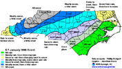
From seeing some of the sleet outputs by models, and thinking this could be a Nor'easter, the 1996 storm comes to mind as an extreme possibility. One of my most favorite storms. The 4-6" over northern Wake was almost all sleet.A
I saw that earlier. Looks like they favor the track all the way up the coastline 'Noreaster kind of thing..
