lexxnchloe
Member
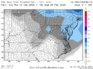
QUITE a jump in 6 hours
78

84

78
84


Yeh the backside vort with this I believe is heavily undermodeled as far as surface.Can't wait for NW flow up here with this system, I know that is pretty much a lock


This is my hope. If we can get a nice 1-3 I call that a winYeh the backside vort with this I believe is heavily undermodeled as far as surface.
A little better for NENCGEFS clown trend:
View attachment 194302


 droughtmonitor.unl.edu
Definitely on my bucket list. After I experienced 14" in 12 hours back in dec 2018 ive wanted to experience 3' in 24hrs.It’s just so much snow View attachment 194311
Where were you at that had 14 feet in 12hours? I think you meant 14" in 12 hours and 3' in 24.Definitely on my bucket list. After I experienced 14' in 12 hours back in dec 2018 ive wanted to experience 3" in 24hrs.
Never understand these.maps. We have had a 2 year running drought where we are down 24 in he's and we are only in D2?| U.S. Drought Monitor
No help despite the rain we got Sunday. If anything, it is worse.


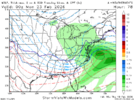
Aaaand Euro AI has come back slightly
View attachment 194327
Aaaand Euro AI has come back slightly
View attachment 194327


32.4 at IAD Feb 2010.Nothing like that’s going to happen. Even the DC crowd isn’t at all believing it. It’s way out on its own and is a terrible model as we know. They’re already anticipating the misery that will occur once the GFS backs way off, which probably will be with the 18Z.
This 34.6” is more than their largest on record, the 28” from the tragic Knickerbocker Storm centered on 1/28/1922. That storm also produced 9-10” at RDU-GSO, which was then the biggest in RDU since 1915.