-
Hello, please take a minute to check out our awesome content, contributed by the wonderful members of our community. We hope you'll add your own thoughts and opinions by making a free account!
You are using an out of date browser. It may not display this or other websites correctly.
You should upgrade or use an alternative browser.
You should upgrade or use an alternative browser.
Pattern Fab Feb
- Thread starter SD
- Start date
22.5°
32..gonna go drip my faucets just in case that met cold decides to spill my way later
Bad Bunny was even better, the Pats got destroyed, and no more freezes even in the 15-day here. That's all that I asked forSuper bowl more boring than the weather right now....geez. Kid Rock was great though.
J1C1111
Member
You got more freezes coming down the road. Enjoy the warm up while it lasts.Bad Bunny was even better, the Pats got destroyed, and no more freezes even in the 15-day here. That's all that I asked for
Poppadocacock
Member
Very light brief snow flurries while I was walking in the neighborhood in Simpsonville-Fountain Inn, SC about 6 am this morning. I pinged a report. You could see a streak just NE of my neighborhood on the CC radar. Nice surprise 
10.6
Made it to 31!
CNCsnwfan1210
Member
Coldest morning of the season for me 14F
Sent from my iPhone using Tapatalk
Sent from my iPhone using Tapatalk
22.7 this morning.
16. What a run of cold, kind of hate to see it go.
Rdu is -11.7 for the month. Even with the warm weather coming it's going to take a full scale 600dm sweat ridge to get back to normal for the month. I don't think that happens
Brent
Member
Heading near 80 degrees today! What a winter it's been other than 10 days in January
I still see no sign of any cold air either
I still see no sign of any cold air either
I found nothing of interest on the models this morning. Somebody correct me, please!
lexxnchloe
Member
Heading near 80 degrees today! What a winter it's been other than 10 days in January
I still see no sign of any cold air either
The West (well west of you) has had virtually no winter to this point/near the warmest on record. You‘ve been mild on many days as you said although not nearly as mild as in a place like Denver. So, you’ve been fortunate in that regard. And if unlike me you don’t like cold unless there’s snow, you’ve had a pretty darn good combo!
Whats the old post that always shows up when we are tracking:I found nothing of interest on the models this morning. Somebody correct me, please!
Official Guidance says: We'll heres what it says this a.m.
Friday
A chance of snow before 1pm. Mostly cloudy, with a high near 48. Chance of precipitation is 30%.
Friday Night
Mostly cloudy, with a low around 31.
Saturday
A chance of rain. Mostly cloudy, with a high near 46. Chance of precipitation is 50%.
Saturday Night
Rain and snow likely. Cloudy, with a low around 34. Chance of precipitation is 70%.
Sunday
Rain and snow likely. Cloudy, with a high near 45. Chance of precipitation is 70%.
Brent
Member
The West (well west of you) has had virtually no winter to this point/near the warmest on record. You‘ve been mild on many days as you said although not nearly as mild as in a place like Denver. So, you’ve been fortunate in that regard. And if unlike me you don’t like cold unless there’s snow, you’ve had a pretty darn good combo!
Yeah I mean we had our average snowfall at least... I was very shocked to discover that Amarillo has had half the snow we had and averages twice as much!!!
Granted some of the biggest snowstorms in the High Plains and Rockies have been in March and even April
Even here 4 of our 5 snowiest days on record are in March
But there's been no snow in March here since 2022
D-Ray
Member
Nice surprise dusting of snow graupel mix on the car this morning
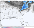
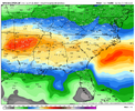
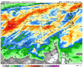
Rain next weekend I suppose? I am ok with a boring stretch after how hectic its been lately
View attachment 193948
Highly beneficial rains would be good news for the largely drought-ridden SE though sadly it’s not looking so good down here.
JimBobs
Member
Justus still posting clown maps and snow chances? Disservice to everyone with this setup. Should not be on the air.
Brent
Member
Rain next weekend I suppose? I am ok with a boring stretch after how hectic its been lately
View attachment 193948
Yeah we need a big rain if we're not having winter. People are acting like the snow was a flood here haha we had a half inch of qpf. Like it didn't help the long term issues at all
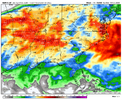
This is not gonna be reality: CFS 700 hours out, so boulder of salt. But all of us need twice this much to claw out of the hole we are inYeah we need a big rain if we're not having winter. People are acting like the snow was a flood here haha we had a half inch of qpf. Like it didn't help the long term issues at all
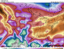
Downeastnc
Member
Would love to see how Jan 24th to tomorrow stacks up against any other similar period. PGV currently -12.5 for Feb.16. What a run of cold, kind of hate to see it go.
Weve made it to freezing mark at high noon
32
32
SnowNiner
Member
Well had a cold cruise with a ship with no heat going out of Norfolk, so that was what it was. Great vacation time with family and friends, but hurts bad missing the storm of the decade in MBY. Oh well I guess. What an awesome two week stretch though for winter weather. Grateful.
Moving on, looks like February wants to February again. Next year hopefully nino actually ninos.
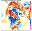
Moving on, looks like February wants to February again. Next year hopefully nino actually ninos.

wow
Member
A balmy 44 out here this afternoon. I’m about over it. 70’s are going to be awesome when they finally get here. Heat bros been talking about it for 40 days. Maybe it will finally get here and stay more than a day or two
NBAcentel
Member
I think warmth is legitimately coming this time, other then some wedge days here or there. some legit warmth showing up, especially with the MJO moving towards the maritime. Should get warmer as the ridge axis moves overhead/to our east, and if we are on the right side of boundary days and the ridge gets squished from from shortwave troughs, maybe even a 80 here or there.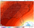
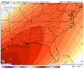
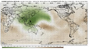
You can see the developing strong MJO pulse around the IO/MC, this should develop a strong NPAC ridge with time, and I’d imagine it will eventually try to go poleward. How long that takes determines the longevity of the warmth. My concern for cold risks is the progression of the MJO back into the pacific into early March, and given the ridge wanting to go poleward towards Russia along with Urals ridging returning, you can start to see hints of +EAMT showing up towards late Feb with high pressure flooding Asia again. another thing is with the big -WPO regime, is we are loading up Canada with a lot of cold air again, if we get that -WPO ridge to cutoff, the momentum under it would speed up and whatever is out west/in western Canada, will dislodge east. Another thing to add in there is the upcoming SPV disruption will likely rear its head with blocking again in M/A, especially as the final warming event occurs.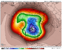
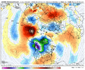
Also worth noting if we get a strong MJO propagation into the pacific again this March which is looking pretty likely, we likely at the very least have a shot at a moderate-strong El Niño later this year/early next year


You can see the developing strong MJO pulse around the IO/MC, this should develop a strong NPAC ridge with time, and I’d imagine it will eventually try to go poleward. How long that takes determines the longevity of the warmth. My concern for cold risks is the progression of the MJO back into the pacific into early March, and given the ridge wanting to go poleward towards Russia along with Urals ridging returning, you can start to see hints of +EAMT showing up towards late Feb with high pressure flooding Asia again. another thing is with the big -WPO regime, is we are loading up Canada with a lot of cold air again, if we get that -WPO ridge to cutoff, the momentum under it would speed up and whatever is out west/in western Canada, will dislodge east. Another thing to add in there is the upcoming SPV disruption will likely rear its head with blocking again in M/A, especially as the final warming event occurs.


Also worth noting if we get a strong MJO propagation into the pacific again this March which is looking pretty likely, we likely at the very least have a shot at a moderate-strong El Niño later this year/early next year
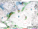
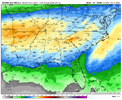
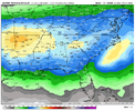
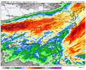
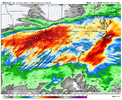
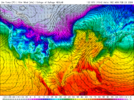
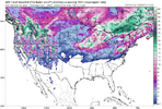
Just for fun, I was looking at the GFS and AIGFS a little while ago (both are similar), and the pattern generally progresses in that direction. Your ridge shoots toward the pole and Canada reloads with very cold air. We even have an arctic shot punching into the East, prior to this frame.I think warmth is legitimately coming this time, other then some wedge days here or there. some legit warmth showing up, especially with the MJO moving towards the maritime. Should get warmer as the ridge axis moves overhead/to our east, and if we are on the right side of boundary days and the ridge gets squished from from shortwave troughs, maybe even a 80 here or there.View attachment 193956View attachment 193957View attachment 193958
You can see the developing strong MJO pulse around the IO/MC, this should develop a strong NPAC ridge with time, and I’d imagine it will eventually try to go poleward. How long that takes determines the longevity of the warmth. My concern for cold risks is the progression of the MJO back into the pacific into early March, and given the ridge wanting to go poleward towards Russia along with Urals ridging returning, you can start to see hints of +EAMT showing up towards late Feb with high pressure flooding Asia again. another thing is with the big -WPO regime, is we are loading up Canada with a lot of cold air again, if we get that -WPO ridge to cutoff, the momentum under it would speed up and whatever is out west/in western Canada, will dislodge east. Another thing to add in there is the upcoming SPV disruption will likely rear its head with blocking again in M/A, especially as the final warming event occurs.View attachment 193960View attachment 193959
Also worth noting if we get a strong MJO propagation into the pacific again this March which is looking pretty likely, we likely at the very least have a shot at a moderate-strong El Niño later this year/early next year
Obviously, this is just an Op run, but I think this is where we're eventually heading. I do not think winter is over, and I do think we will be tracking another winter storm in a couple of weeks or so.
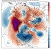
I think warmth is legitimately coming this time, other then some wedge days here or there. some legit warmth showing up, especially with the MJO moving towards the maritime. Should get warmer as the ridge axis moves overhead/to our east, and if we are on the right side of boundary days and the ridge gets squished from from shortwave troughs, maybe even a 80 here or there.View attachment 193956View attachment 193957View attachment 193958
You can see the developing strong MJO pulse around the IO/MC, this should develop a strong NPAC ridge with time, and I’d imagine it will eventually try to go poleward. How long that takes determines the longevity of the warmth. My concern for cold risks is the progression of the MJO back into the pacific into early March, and given the ridge wanting to go poleward towards Russia along with Urals ridging returning, you can start to see hints of +EAMT showing up towards late Feb with high pressure flooding Asia again. another thing is with the big -WPO regime, is we are loading up Canada with a lot of cold air again, if we get that -WPO ridge to cutoff, the momentum under it would speed up and whatever is out west/in western Canada, will dislodge east. Another thing to add in there is the upcoming SPV disruption will likely rear its head with blocking again in M/A, especially as the final warming event occurs.View attachment 193960View attachment 193959
Also worth noting if we get a strong MJO propagation into the pacific again this March which is looking pretty likely, we likely at the very least have a shot at a moderate-strong El Niño later this year/early next year
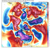
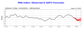
With the following strong -PNA forecast (goes out through Feb 23rd) starting this weekend and although Feb 12-15 looks cold up your way, it’s going to be hard to not have a solid mild period in the SE afterward prior to the hoped cooldown during the last 5-6 days of Feb/early March:
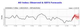
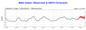
Also, AO and NAO are forecasted to rise sharply:
jmills152077
Member
wonder if we'll be able to get any thunder up this way next weekend. probably not if the AIFS is right on sfc LP track
Cold will come back but its probably a 21-25 day trip from here, not sure how beneficial mid March is for most of us. The way the waves will pass from trough to trough over the next 2 weeks will keep the snow chances from being a complete 0 but it's truly a thread the needle pattern
16 days later and we’ve still got snow and ice on roofs here. Hell of a stretch

