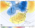
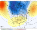
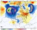
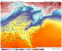
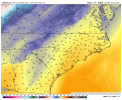
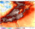
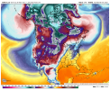
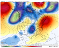
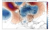
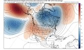
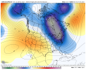
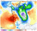
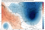
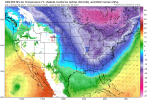
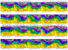
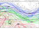
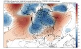
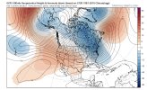
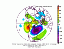
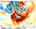
The general pattern is roughly the same. The biggest difference appears to be that the blocking out in the north Atlantic is a bit stronger and the ocean storm out in the central Pacific is farther east, which is helping to pump up heights in the west. That's the key for now. The ridge NW of the Aleutians is not in a favorable position for severe cold and storms for us. That really needs to change.
-
Hello, please take a minute to check out our awesome content, contributed by the wonderful members of our community. We hope you'll add your own thoughts and opinions by making a free account!
You are using an out of date browser. It may not display this or other websites correctly.
You should upgrade or use an alternative browser.
You should upgrade or use an alternative browser.
Pattern December to Remember
- Thread starter SD
- Start date
Mr. Golf
Member
tennessee storm
Member
We can only hope not mr golf. Hope your wrong sir…
tennessee storm
Member
You may just get your wish lol…
NBAcentel
Member
Mr. Golf
Member
I was actually referring to you friend ??You may just get your wish lol…
Mr. Golf
Member
If we get a flat aleutian ridge in December, we are fooked lol. More poleward is ideal I believeHopefully we can retrograde the Aleutian ridge sometime because if it sticks around then these warmer solutions will start trickling down like they have the last 2-3 days, very La Niña look with no -NAO to stop it, this has been staying in the hour 300s tho so not to worried yetView attachment 96144View attachment 96145
NBAcentel
Member
The winter teleconnection that most favors E US cold/troughing is a trough in the longitude of the central and eastern Aleutians. So, I don’t see how an Aleutian ridge can be considered ideal for E US cold lovers. When you say we, I assume you mean E US in general since most active members are there. If you’re talking central US, that’s obviously not going to be the same since it is centered 1,000 or so miles further west.If we get a flat aleutian ridge in December, we are fooked lol. More poleward is ideal I believe
NBAcentel
Member
See yaThis is effed up go back to whamby @SD View attachment 96147
NBAcentel
Member
This is gonna be a really really warm GFS run, maybe some 2015 type stuff
The GEFS still looks great as regards the MJO forecast, itself, for late in the run for E US cold prospects for mid to late December. However, as said before the upcoming GEFS forecasted -PNA/+AO/+NAO combo for later this week will need to largely reverse to give the E US a good shot at cold domination then as the MJO is far from the sole index to be considered. Still hoping that flip will occur by mid-December.
NBAcentel
Member
L
Logan Is An Idiot 02
Guest
For some reason I still feel like the GEFS. Will be way different
NBAcentel
Member
Gefs probably has 2 different camps with the colder solution and some western trough solutions, unfortunately it’s a progressive biased model meaning it could probably be leaning towards a EC trough given its faster/less amped issues associated with the progressive biasFor some reason I still feel like the GEFS. Will be way different
NBAcentel
Member
L
Logan Is An Idiot 02
Guest
Great look for @Webberweather53Maycember, returning 60 dews near the GLs lol View attachment 96151
L
Logan Is An Idiot 02
Guest
Maycember needs to be to thread nameMaycember, returning 60 dews near the GLs lol View attachment 96151
NBAcentel
Member
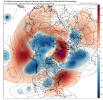
Aleutian ridge -nao? I'd love itWe’re about to at least put the SER out temporarily due to the Central US trough/ridge behind it, but first there’s wedges View attachment 96152
NBAcentel
Member
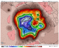
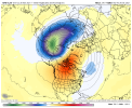
Yep you know the drill, the SPV/TPV moving towards the other side so our -NAO block can form and trap pacific air !Aleutian ridge -nao? I'd love itView attachment 96153
LickWx
Member
If y’all want snow head to England . 60 people have been snowed in for 3 nights now in a pub in Yorkshire !

 www.google.com

60 punters face third night trapped in Britain’s highest pub after Storm Arwen snow dump
Customers at Britain's highest pub face a third night snowed in after Storm Arwen dumped feet of snow which prevented them from leaving.
NBAcentel
Member
NBAcentel
Member
NBAcentel
Member
Just minor differences between models.CMC went all out View attachment 96162View attachment 96163
This is comical
L
Logan Is An Idiot 02
Guest
NBAcentel
Member
I’m honestly a fan of the southeast ridge solution and no not because it’s warm, but -PNAs typically mean more rain in the SE/especially northern/western, the GEFS solution is dry and cold NW flow, and a solution that would allow severe and possibly extreme drought to become widespread, gonna see way more fires over the NC mountains if we continue 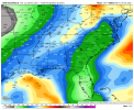

Stephenb888
Member
Well well the cold is back. Surprise surprise. These models don’t have a clue.
GeorgiaGirl
Member
Yikes at the difference between the GFS and GEFS. It's two different solutions that aren't even in the same ballpark.
Zero agreement on the Models. GFS has a cold dump for the West and a SE ridge. GEFS is much colder for the eastern US and the CMC(likely has a cold bias,but still) brings severe cold into the eastern half of the Country. Who knows what the Euro and the EPS will do. Might be a while before we know exactly what happens.
NBAcentel
Member
Stephenb888
Member
Can someone explain the difference between the GFS and the GEFS models?
when does the euro come out again?Zero agreement on the Models. GFS has a cold dump for the West and a SE ridge. GEFS is much colder for the eastern US and the CMC(likely has a cold bias,but still) brings severe cold into the eastern half of the Country. Who knows what the Euro and the EPS will do. Might be a while before we know exactly what happens.
LukeBarrette
im north of 90% of people on here so yeah
Meteorology Student
Member
2024 Supporter
2017-2023 Supporter
Rolling out nowCan someone explain the difference between the GFS and the GEFS models?
when does the euro come out again?
Don’t think CMC is cold biased as it recently showed very warm conditions like the gfs what the cmc is showing is the potential that this pattern brings in being able to dump serious cold our way and the quick changes in operationals shows how delicate the pattern is as this is what we talk about with the “windshield wiper” effect on models this should continue until all the models settle in on one solutionZero agreement on the Models. GFS has a cold dump for the West and a SE ridge. GEFS is much colder for the eastern US and the CMC(likely has a cold bias,but still) brings severe cold into the eastern half of the Country. Who knows what the Euro and the EPS will do. Might be a while before we know exactly what happens.


