L
-
Hello, please take a minute to check out our awesome content, contributed by the wonderful members of our community. We hope you'll add your own thoughts and opinions by making a free account!
You are using an out of date browser. It may not display this or other websites correctly.
You should upgrade or use an alternative browser.
You should upgrade or use an alternative browser.
Pattern December to Remember
- Thread starter SD
- Start date
smast16
Member
Been gone for like a week, and I didn't read all the way back. But I'm guessing the December to remember pattern has already been derailed. That super cold shot that was modeled for around the 4th and 5th vanished into mist I see.
We don't do cold December's around here anymore! This constant cycle of cold November's, warm winters then cold springs has gotten very old!Been gone for like a week, and I didn't read all the way back. But I'm guessing the December to remember pattern has already been derailed. That super cold shot that was modeled for around the 4th and 5th vanished into mist I see.
We gone be hurting in 2022. Hate Droughts!


^^Yep our worst droughts are the ones that start in the cold months and go into spring/summer.
smast16
Member
Brick said he prefers this.We gone be hurting in 2022. Hate Droughts!


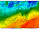
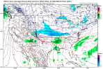
Zonal? ?Sinking south on the icon this don’t look terrible View attachment 96337
tennessee storm
Member
Yeah not good. Be honestZonal? ?
Yeah zonal is the worst outcome in my opinion. The last thing I would want is to flush all the cold and snow out of North America with Pacific air in December. Give me an amplified pattern even if we bake under a SER. Climo tells us it doesn't snow much in December anyway, especially the beginning of it. Keep Canada and the NW frigid and I'll just hope we can get it down this way in January during peak climo.Yeah not good. Be honest
The major ensembles look mainly mild through a good portion of their runs though there are still a few BN days thrown in. Things will change as we get further into the winter. Those wanting it to be cold dominated again should be patient as big changes in winter are the norm.
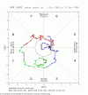
Currently, the GEFS forecasts call for a -PNA, +NAO, and +AO to commence later this week and hold on through day 14 (12/14). So, mild should be fully expected then. Those who want that should be happy. I just hope the dewpoints stay below 60 most days here. At the same time, the GEFS has an MJO that is still headed to phase 7 next week. The bias correction keeps it low amp 7 with it likely headed for low amp 8. We’ll then need to see if this will help change the PNA back to + and hope that the warm MC forcing doesn’t dominate and make it act like the MJO is in phases 4 and 5.
Currently, the GEFS forecasts call for a -PNA, +NAO, and +AO to commence later this week and hold on through day 14 (12/14). So, mild should be fully expected then. Those who want that should be happy. I just hope the dewpoints stay below 60 most days here. At the same time, the GEFS has an MJO that is still headed to phase 7 next week. The bias correction keeps it low amp 7 with it likely headed for low amp 8. We’ll then need to see if this will help change the PNA back to + and hope that the warm MC forcing doesn’t dominate and make it act like the MJO is in phases 4 and 5.
L
Logan Is An Idiot 02
Guest
Mark my word. This will be in the top 3 warmest December’s.
What are the top 3 for your area? I'm sure the trash pile of 2015 is in there.Mark my word. This will be in the top 3 warmest December’s.
Webberweather53
Meteorologist
The major ensembles look mainly mild through a good portion of their runs though there are still a few BN days thrown in. Things will change as we get further into the winter. Those wanting it to be cold dominated again should be patient as big changes in winter are the norm.
Currently, the GEFS forecasts call for a -PNA, +NAO, and +AO to commence later this week and hold on through day 14 (12/14). So, mild should be fully expected then. Those who want that should be happy. I just hope the dewpoints stay below 60 most days here. At the same time, the GEFS has an MJO that is still headed to phase 7 next week. The bias correction keeps it low amp 7 with it likely headed for low amp 8. We’ll then need to see if this will help change the PNA back to + and hope that the warm MC forcing doesn’t dominate and make it act like the MJO is in phases 4 and 5.
Destructive interference between the MJO and ENSO will make the favorable, cooler MJO phases harder to come by and less amplified for the time being, the one benefit of being in a neutral ENSO state or El Nino is that Pacific-W Hem MJO is more frequent + stronger. In the long run, we'll need to dislodge the MJO from the Maritime Continent-West Pacific to avoid getting consistently torched in mid-late winter, not entirely sure if that's going to happen this year.
L
Logan Is An Idiot 02
Guest
Not entirely sure. But I think this December will blow some records for the entire southeast. Maybe even most of the US.What are the top 3 for your area? I'm sure the trash pile of 2015 is in there.
What are the top 3 for your area? I'm sure the trash pile of 2015 is in there.
So, I just had looked it up and the Charlotte (nearby major city) third warmest Dec is at 53.0. Top 3 warmest are:
55.4 2015
54.7 1889
53.0 1956
Fourth warmest is way down at 50.6 (1971). It will be fun to follow this to see if he ends up right. He should get a good head start with the early month mild domination. But that’s still really going out on the limb!
NBAcentel
Member
LickWx
Member
No chance this gets near 2015. This is nothing like that month, unless I start seeing really warm lows in the forecast this is the top 10 at best. Although 4th warmest sounds very breakable.So, I just had looked it up and the Charlotte (nearby major city) third warmest Dec is at 53.0. Top 3 warmest are:
55.4 2015
54.7 1889
53.0 1956
Fourth warmest is way down at 50.6 (1971). It will be fun to follow this to see if he ends up right. That’s really going out on the limb!
L
Logan Is An Idiot 02
Guest
Looks like wintry fun and games for @Webberweather53Beautiful trend View attachment 96343
L
Logan Is An Idiot 02
Guest
Top 3. Mark my wordNo chance this gets near 2015. This is nothing like that month, unless I start seeing really warm lows in the forecast this is the top 10 at best. Although 4th warmest sounds very breakable.
NBAcentel
Member
Lol H5 pattern does look similar on the longer range stuff which is crazy but doubt we’re that warm again, id say that H5 pattern reminds me more of 2020No chance this gets near 2015. This is nothing like that month, unless I start seeing really warm lows in the forecast this is the top 10 at best.
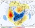
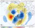
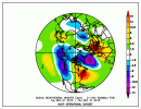
No chance this gets near 2015. This is nothing like that month, unless I start seeing really warm lows in the forecast this is the top 10 at best. Although 4th warmest sounds very breakable.
With the 30 year average being 44.6, this top 3 warm call (53+) means the call is for 8+ warmer than the new warmer 30 year normal, a very tough challenge. Let’s see what happens.
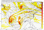
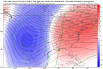
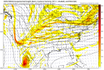
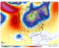
What's funny to me is 15-16 was a nino and everyone loves a nino for some reasonLol H5 pattern does look similar on the longer range stuff which is crazy but doubt we’re that warm again, id say that H5 pattern reminds me more of 2020 View attachment 96345View attachment 96346View attachment 96344
Dewpoint Dan
Member
I just hope the bottom doesn't fall out in January and leave us with bitterly cold air.Not entirely sure. But I think this December will blow some records for the entire southeast. Maybe even most of the US.
What's funny to me is 15-16 was a nino and everyone loves a nino for some reason
For cold preferrers, El Niño’s have averaged colder in DJF than neutral and La Niña in the bulk of the SE US based on longterm averages. Of course, the coldest are weak to moderate on average.
This La Niña though may end up only weak. That would give a higher chance at a BN DJF vs the chance with a stronger La Niña.
NBAcentel
Member
That was a suppa nino tho which often does suckWhat's funny to me is 15-16 was a nino and everyone loves a nino for some reason
L
Logan Is An Idiot 02
Guest
Patterns like this are extremely difficult to flip. Especially considering La Niña. IMO if the southeast torches in December then it will be a golf filled winter with little to no long lasting cold. Now I do think March could be a wild card month.I just hope the bottom doesn't fall out in January and leave us with bitterly cold air.
For cold preferrers, El Niño’s have averaged colder in DJF than neutral and La Niña in the bulk of the SE US based on longterm averages. Of course, the coldest are weak to moderate on average.
This La Niña though may end up only weak. That would give a higher chance at a BN DJF vs the chance with a stronger La Niña.
I was speaking more to the generalized statements that we start seeing in about June that equate to nino good, nina bad. Obviously there is data to support the claims, we do live in a region where a 14 day cold period and a big snow or 2 when in the midst of an overall warm winter leaves the memory of it being epic regardless of the enso stateThat was a suppa nino tho which often does suck
Webberweather53
Meteorologist
I'll have to take a closer look at things and pull out actual numbers when I get a chance, but in a La Nina winter, it's generally not a good sign for snow lovers to see a warm/SE ridge/-PNA dominated December because it tends to only get less favorable from here, February is usually (but not always (1988-89 for ex)) a lost cause in winters like this. If this was an El Nino or neutral ENSO winter, I probably wouldn't be concerned (yet).
Webberweather53
Meteorologist
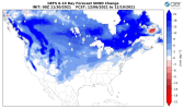
This is an essential building block we must continue patience ???View attachment 96347
I am in the blue shading. This is objectively a good thing.
Did we really get blanked in 75-76?I'll have to take a closer look at things and pull out actual numbers when I get a chance, but in a La Nina winter, it's generally not a good sign for snow lovers to see a warm/SE ridge/-PNA dominated December because it tends to only get less favorable from here, February is usually (but not always (1988-89 for ex)) a lost cause in winters like this. If this was an El Nino or neutral ENSO winter, I probably wouldn't be concerned (yet).
I'll have to take a closer look at things and pull out actual numbers when I get a chance, but in a La Nina winter, it's generally not a good sign for snow lovers to see a warm/SE ridge/-PNA dominated December because it tends to only get less favorable from here, February is usually (but not always (1988-89 for ex)) a lost cause in winters like this. If this was an El Nino or neutral ENSO winter, I probably wouldn't be concerned (yet).
If we assume December ends up mild, there are two notable moderate La Niña winter exceptions with very mild December’s that had a cold month later when looking back to just 1950:
1971-2 had a cold Feb, the coldest of DJF by far.
1984-5 had the well know historically cold Jan!
I wouldn’t mind a drought going into next year with all these rebuilding bills that were passed we need dry warm weather for projects. Minus the fires. Lot of projects still behind from the past 3 wet years.
NBAcentel
Member
Give me a -PNA/SER that’ll toss some ring of fire rain events towards us, if it’s not to strong, -PNA is always better then a +PNA for rain
Webberweather53
Meteorologist
Did we really get blanked in 75-76?
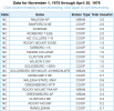
Many in central NC walked away w/ at least 1-2 winter storms that season, the greatest seasonal snowfall totals east of the mountains were near the Triangle that year.
A snow event in late November 1975, ice storm on Christmas day, and a pair of nickel/dime snow events on January 17-18 & Feb 2-3 1976 were observed in 1975-76.
NBAcentel
Member
I didn't know it was so slow on wxbell vs tidbits. It's not a terrible look for some onset stuff but would probably go to poop post 180 with all the energy loading in the west.If it wasn’t for that junk diving south north/NW of AK, that would be great for us but it totally kills us View attachment 96355

