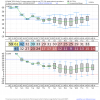
This screams brief snow to ip to zr back to snow for the cad regions.


Sent from my SM-G955U using Tapatalk


Sent from my SM-G955U using Tapatalk


Could this become a Midlands of South Carolina threat?
I think he said his ideal place to live would be along the I-70 corridor from Indy to Columbus. Those areas average about 2 feet per year. So its a good bit of snow but not so much that you get sick of it.I know you've said that you've wanted to move north sometime in the future (back??), but the perfect place for you to get enough snow to enjoy but not too much may be East TN/WNC at some elevation or West Virginia.
This screams brief snow to ip to zr back to snow for the cad regions.

Sent from my SM-G955U using Tapatalk
Hate. Actually I wouldn't mind a sleet event if we got a decent accumulationOr just sleet especially if you're anywhere close to Raleigh


Surprised Rah already mentioning snow for Thurs night Friday...The gfs is really trending slower/farther SW with the low in 50/50 position. If you look at the heights in the east over the last few runs you can see them compressing and sagging south as the low stays closer.
Sent from my SM-G955U using Tapatalk
I read that., rolled my eyes, and said kiss of death. The setup is certainly there though but we've seen better squanderedSurprised Rah already mentioning snow for Thurs night Friday...
Sent from my SM-G920V using Tapatalk
Bump if appropriate, but an observation ...
A week ago, we were supposed to be "cold" by N FL standards from the 24th through New Year; now NWS has 70's / 50's; not complaining but the lack of consistency and forecasting skill (models and NWS) is at best disconcerting ...
Can someone post EPS temps for Atlanta? I'm just worried it won't be cold enough for much winter precipitation besides NC like y'all keep postingGreensboro is even worse, certainly possible it doesn't get above freezing for an entire week straight (or more) if the EPS gets any colder.
View attachment 2193
DoneCan someone post EPS temps for Atlanta? I'm just worried it won't be cold enough for much winter precipitation besides NC like y'all keep posting

Can someone post EPS temps for Atlanta? I'm just worried it won't be cold enough for much winter precipitation besides NC like y'all keep posting

Hahaha! I don't even drive but no thanks. SD already gave me the EPS temps ensemble for ATL to put me at ease lolYou wanna see some real cold, don't have to go very far. EPS keeps Roanoke, VA below freezing for nearly a week and a half and the mean is already depicting single digits lows haha
View attachment 2195
Thanks. Puts me a little more at ease about possible winter weather. Would like to see it trend colder tho.Done
Sent from my SM-G955U using Tapatalk
18z gfs is more agressive this run with the midweek system
Would help many coming in overnight Wednesday vs during the day


Thanks. Puts me a little more at ease about possible winter weather. Would like to see it trend colder tho.
Yeah at 162 it tries to erode the wedge and flips RDU to rain, no way. We would stay frozen in that scenarioCan't recall too many times I've seen an ice storm show up at least w/ modest consistency on the GFS in the Carolinas, the non-local mixing scheme in the model usually eradicates most of these potential threats and leads to its bias to underestimate CAD until it's blatantly obvious an ice storm is coming. The model's surface parameterization issues are likely offsetting this a bit because that surface high might be a wee bit too strong in SE Canada over fresh snow cover.
View attachment 2197
Can't recall too many times I've seen an ice storm show up at least w/ modest consistency on the GFS in the Carolinas, the non-local mixing scheme in the model usually eradicates most of these potential threats and leads to its bias to underestimate CAD until it's blatantly obvious an ice storm is coming. The model's surface parameterization issues are likely offsetting this a bit because that surface high might be a wee bit too strong in SE Canada over fresh snow cover.
View attachment 2197
As Webber said, CAD events are always underestimated. A strong CAD can easily make it to ATL. It’s going to be close , it always is in ATL.Well in any case it doesn't look like this is the winter storm many on the board, including Atlanta. Doesn't look like much of a winter storm at all mostly cold rain. Don't think it'll get any colder to change it around.
It is. GFS erodes the wedge way to quickNot that I want an ice storm, but considering how much this ice event is being honked...I wonder if the wedge is being underestimated? Because like I said, CAD has a mind of it's own with temps. If there's a CAD like situation, I can be at least a few degrees colder than what's forecasted.
