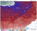
Yes they are with the GEFS showing signs of it is well.Both the AI/ECM getting interesting with a -NAO
-
Hello, please take a minute to check out our awesome content, contributed by the wonderful members of our community. We hope you'll add your own thoughts and opinions by making a free account!
You are using an out of date browser. It may not display this or other websites correctly.
You should upgrade or use an alternative browser.
You should upgrade or use an alternative browser.
Pattern December Doldrums 2025 🎄 ❄️
- Thread starter SD
- Start date
Light snow. Just a flurry right now, but something.
Still getting a few flakes, but I stuck my head outside and I'm getting mostly sleet.
Tsappfrog20
Member
Snow Accumulation in Youngsville!!

Sent from my iPhone using Tapatalk

Sent from my iPhone using Tapatalk
Oh Lort, heavy snow is gonna catch me off guard this morning. Lol

Sent from my iPhone using Tapatalk

Sent from my iPhone using Tapatalk
Can confirm a few tiny flakes and 31
LukeBarrette
im north of 90% of people on here so yeah
Meteorology Student
Member
2024 Supporter
2017-2023 Supporter
Might be the cutest little system ever. Just looked up at the sky and saw a hole in the clouds with blue skySnow falling in Blacksburg at a solid clip. Just started.
- Joined
- Jan 23, 2021
- Messages
- 4,602
- Reaction score
- 15,197
- Location
- Lebanon Township, Durham County NC
Yep, light flakes falling on west campus
RGEM Nailed it once again
Getting some graupel in Hillsborough!
packfan98
Moderator
Got some flakes flying in Greensboro. How many times has this happened already? Before Christmas too. It just wants to snow this year...
Still waiting on a big one though.
Still waiting on a big one though.
SnowNiner
Member
Any thoughts on what JB is saying?
View attachment 178765
It's what Grit and others have said, although the MJO plots show low amp phase 8/COD 8, there's been convection and activity, Kelvin Waves, etc along the equator that cancelled or overruled the MJO plots. That's why the mjo is so weak (with those past loops shown). This has made the atmosphere act like the bad phases of the mjo and thus the crap look the next few weeks. The hope is that in a couple weeks the mjo signal picks back up, convection on the equator goes back to phase 8 and we continue on with a good pattern. Models I believe did show this from what I've read, grit showed it too. I don't think dam bursting cold river of ice day after tomorrow conditions are likely, but hopefully we can get forcing in the pacific that favors cold in the SE again to start January.
Basically the mjo got hijacked by convection anomalies at the equator. We need the mjo wave to get back control of air force one and get off our plane.
Last edited:
Spitting a few grains of snow
Thinking same thing:Got some flakes flying in Greensboro. How many times has this happened already? Before Christmas too. It just wants to snow this year...
Still waiting on a big one though.
Fun Facts:
Today is the 16th straight day in a row Gboro has been Below Normal. The streak will make it past 20, before it gets broken second half of next week.
Slopes have 60 + inch base and it's only Dec 12th. Believe Beech mtn is already past 20 inches natural snow for the season. Lot of central VA, eastern VA and NE NC have already reached & passed their yearly snowfall totals.
If the blocking verifies , like the CFS has on latest run early Jan, we should catch another 7-10 day window of Coldest air of the season and hopefully a big one. I still think NE NC/ tidewater scores again Sunday night/Monday. Interested to see what LR on models look like a week from today. If we are going to get some favorable blocking over Greenland, then we should be seeing it on some ensembles/ perhaps Ops by then. Not just the CFS. Thats our best bet to funnel cold down. The trough off Alaska is like anchored down, cant get the WC ridging set up like we need
tennessee storm
Member
Negative pna is trumping everythingThinking same thing:
Fun Facts:
Today is the 16th straight day in a row Gboro has been Below Normal. The streak will make it past 20, before it gets broken second half of next week.
Slopes have 60 + inch base and it's only Dec 12th. Believe Beech mtn is already past 20 inches natural snow for the season. Lot of central VA, eastern VA and NE NC have already reached & passed their yearly snowfall totals.
If the blocking verifies , like the CFS has on latest run early Jan, we should catch another 7-10 day window of Coldest air of the season and hopefully a big one. I still think NE NC/ tidewater scores again Sunday night/Monday. Interested to see what LR on models look like a week from today. If we are going to get some favorable blocking over Greenland, then we should be seeing it on some ensembles/ perhaps Ops by then. Not just the CFS. Thats our best bet to funnel cold down. The trough off Alaska is like anchored down, cant get the WC ridging set up like we need
Nomanslandva
Member
If anything has fallen here it has evaporated because there is no trace of anything on my wife's car. I guess if one is lucky and gets under one of those heavier bands for a bit it may amount to something measurable. Right now, that good bad may miss me just to the south. 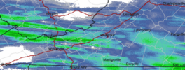
It does look like it is starting to snow on the mountains west of Salem so it may be here soon?

It does look like it is starting to snow on the mountains west of Salem so it may be here soon?
Always. One thing I root for , before anything else is a + PNANegative pna is trumping everything
MichaelJ
Member
Lt snow in Lewisville
a_gilmore88
Member
Flurries/graupel falling right now in Landis, NC. A surprise!
SN/IP mix coming down at a pretty good clip 33
wow
Member
Some light graupel/snow in Mooresville right now
NBAcentel
Member
Light snow/sleet in kannapolis
aturner1979
Member
Just started snowing here in SW Roanoke county. Temp up to 32 though.
Yay snow here now.
South Carolina snow shields are cranking this year. We are 100% going to get blanked this winter. You can just feel it
It's what Grit and others have said, although the MJO plots show low amp phase 8/COD 8, there's been convection and activity, Kelvin Waves, etc along the equator that cancelled or overruled the MJO plots. That's why the mjo is so weak (with those past loops shown). This has made the atmosphere act like the bad phases of the mjo and thus the crap look the next few weeks. The hope is that in a couple weeks the mjo signal picks back up, convection on the equator goes back to phase 8 and we continue on with a good pattern. Models I believe did show this from what I've read, grit showed it too. I don't think dam bursting cold river of ice day after tomorrow conditions are likely, but hopefully we can get forcing in the pacific that favors cold in the SE again to start January.
Basically the mjo got hijacked by convection anomalies at the equator. We need the mjo wave to get back control of air force one and get off our plane.
Once we get to Dec 17th, the SE will have had virtually every day colder than normal for 3 weeks. In addition, much of NC will have had 3 snows even though mainly minor. In the past few decades, only 2010 will have been clearly colder for that same period and 2002/2000 close, but none of those had 3 different snows in the RDU/GSO area. 1989 was the last time it was this cold and with 3 snows during this early period.
We are always too far south now, I guess. Things don’t work like they used to.Haven’t seen a single flake in my part of NE Durham this morning… only first looked around 830a but dang
LukeBarrette
im north of 90% of people on here so yeah
Meteorology Student
Member
2024 Supporter
2017-2023 Supporter
If anything has fallen here it has evaporated because there is no trace of anything on my wife's car. I guess if one is lucky and gets under one of those heavier bands for a bit it may amount to something measurable. Right now, that good bad may miss me just to the south. View attachment 178783
It does look like it is starting to snow on the mountains west of Salem so it may be here soon?
Was under a band for about 20 minutes. We have a quarter of an inch I’d say
Was under a band for about 20 minutes. We have a quarter of an inch I’d say
I declare Blacksburg VA the snow capital of the southeast / mid Atlantic for this winter
I saw mpings for around 830ish really nearby me but OH WELLWe are always too far south now, I guess. Things don’t work like they used to.
LukeBarrette
im north of 90% of people on here so yeah
Meteorology Student
Member
2024 Supporter
2017-2023 Supporter
I wouldn’t call us the Southeast haha, maybe southern Mid-AtlanticI declare Blacksburg VA the snow capital of the southeast for this winter
Not a —— thing here in Matthews
Yep I edited my post to say that! Right on the edge between the twoI wouldn’t call us the Southeast haha, maybe southern Mid-Atlantic
NBAcentel
Member
Best event of the year so far, more snowflakes then the eye can count finally
Graupel / Flurries. Yay

