-
Hello, please take a minute to check out our awesome content, contributed by the wonderful members of our community. We hope you'll add your own thoughts and opinions by making a free account!
You are using an out of date browser. It may not display this or other websites correctly.
You should upgrade or use an alternative browser.
You should upgrade or use an alternative browser.
Pattern December Doldrums 2025 🎄 ❄️
- Thread starter SD
- Start date
tomorrow will be an elite morning to catch a sunrise along the southern blue ridge escarpment. crystal clear skies with fog across the piedmont banked against the escarpment. not to mention, more than one CAM is keeping this fog/stratus around for so long that high temperatures fall well shy of current forecasts across the upstate and southwestern nc foothills
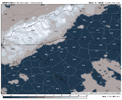


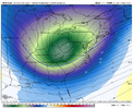
CPF....The GFS is going for the ridge bridge into Alaska on this run, obliterating the NW Cadian trough.
View attachment 178198
Straight fire for us.
The high temperature forecast at RDU today is going to be a bust unless some sun breaks through. The high temperature will struggle to reach the lower forties and the mid forties that were forecast look to be out of reach.
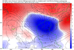
The EPO block needs to reorient N/S instead of circular or E/W like it has been. That will allow for a better opportunity to connect with the west coast ridge and spike the entire ridge axis.12z Euro cold run also, we just need that trough to dig more. Nice to see the pretty blues backing up though. The more this happens, the more we increase the chances of this not just being cold & dry & squeeze out something out of this.
View attachment 178213
THEN, the cold hammer drops, and depending on where the ridge axis sets up, we could potentially be looking at a BIG, very cold winter storm for many.
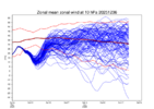
Someone with far more skills than this old geezer should do a deep dive when all this is over, on why all of the ensembles have repeatedly had to correct the Eastern US troughing time and time again in this pattern. I don't recall this much long-wave variance at the 7-10 day lead times, ever.6 days ago the GEFS had us in a SE ridge for Dec 12. Hahahahahahaha
View attachment 178208
View attachment 178210
Laugh while we can I guess
Makeitsnow
Member
Ffc had a lot of us getting to 50 but everyone is stuck at 45 or 46 and satellites shows plenty of cloud cover so bust here is likely too.The high temperature forecast at RDU today is going to be a bust unless some sun breaks through. The high temperature will struggle to reach the lower forties and the mid forties that were forecast look to be out of reach.
Avalanche
Member
Happy for the rain we got at the coast. Now looking forward to the next
The way they do a neutral color like green to represent a -9 departure from normal is intentional. Bothers me
Highest US snow-cover as of Dec 5th 2003-25 (%)(2003-24 avg 27%):
‘05 48
‘25 45
‘18 43
‘10 39
‘13 38
‘19 37
‘06 33
‘16 32
But more importantly for E US cold prospects is the Midwest snowcover: highest % as of Dec 5th (2003-24 avg 12%):
‘25 65
‘05 45
‘18 32
‘06 31
‘10 27
‘16 25
‘03 23
‘08 20
 www.nohrsc.noaa.gov
‘05 48
‘25 45
‘18 43
‘10 39
‘13 38
‘19 37
‘06 33
‘16 32
But more importantly for E US cold prospects is the Midwest snowcover: highest % as of Dec 5th (2003-24 avg 12%):
‘25 65
‘05 45
‘18 32
‘06 31
‘10 27
‘16 25
‘03 23
‘08 20
National Snow Analyses - NOHRSC - The ultimate source for snow information
NBAcentel
Member
Bigedd09
Member

Wen torch
Sent from my iPhone using Tapatalk
@Rain Cold Did you mean VA fantasy storms?
Wen torch
Sent from my iPhone using Tapatalk
lexxnchloe
Member
lexxnchloe
Member
Spann starting to notice.
BamWx- For January Temps, all of East BN and Great Lakes to Va/NC is Much BN
Sent from my iPhone using Tapatalk
Sent from my iPhone using Tapatalk
ducketta27
Member
Give me an NC snow next weekend
Sent from my iPhone using Tapatalk
Sent from my iPhone using Tapatalk
And for what its worth, ocean temperatures in Horry/Brunswick/New Hanover counties are running about 4 degrees below average for this date. It matters for us coastal people when thinking about winter weather. Even a degree or two cooler influence off the ocean can mean a huge dump like we saw in January or rain.
NBAcentel
Member
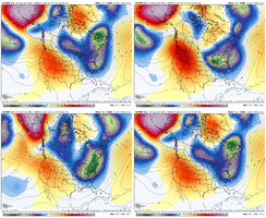
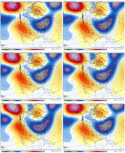
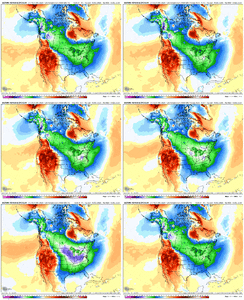
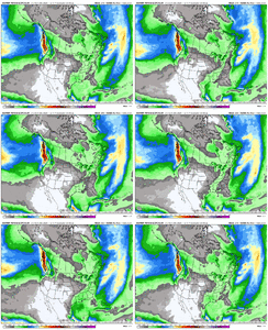
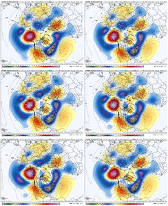
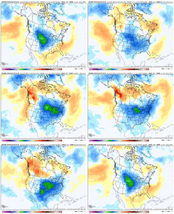
Now your speaking our language.AIFS ens has been shifting the trough axis west with a taller western ridge axis, and boy is it working wonders View attachment 178283View attachment 178281View attachment 178280View attachment 178282
NBAcentel
Member
AIFS ens has been shifting the trough axis west with a taller western ridge axis, and boy is it working wonders View attachment 178283View attachment 178281View attachment 178280View attachment 178282
Here is a loop for the AI of just the change from its previous run....colder on each panel for days 9-15
Same here with a dense fog advisory just issued. Temp has dropped to 34. Wouldn’t be suprised to start seeing some advisories issued freezing fog north and west of I-85
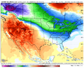
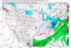
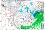
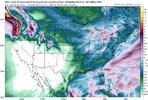
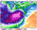
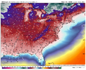
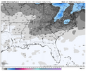
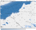
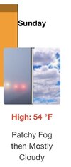
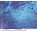
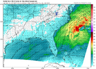
Small thing I’m watching for tomorrow in the Atlanta area. NWS has the city getting well into the 50’s but the HRRR and NAM are running about 10 degrees colder and keep most of the metro in the low 40’s all day. I presume due to thicker cloud cover and a bit of a wedge. Nothing major but could be the difference between another raw chilly day and the warmest day we’ve had all week.


Xlhunter3
Member

KRAH Freezing Fog Advisory #1
Orange, Durham, Person, Granville, Vance, Warren, Forsyth, Guilford, Alamance
Brent
Member
Small thing I’m watching for tomorrow in the Atlanta area. NWS has the city getting well into the 50’s but the HRRR and NAM are running about 10 degrees colder and keep most of the metro in the low 40’s all day. I presume due to thicker cloud cover and a bit of a wedge. Nothing major but could be the difference between another raw chilly day and the warmest day we’ve had all week.
View attachment 178308
View attachment 178309
View attachment 178310
Same thing happened here today... Was supposed to be in the 50s and most places stayed below 45
Some places the fog never broke even
And it's always been colder tomorrow
I don't think we've had one day even near normal this month yet
cams have stayed considerably cooler than other guidance around here with lingering fog/clouds. Very interested to see how it goes, some big bust potential on temps if they score a coup here. I’m always skeptical of NAM showing these solutions though considering it struggles to mix correctlySmall thing I’m watching for tomorrow in the Atlanta area. NWS has the city getting well into the 50’s but the HRRR and NAM are running about 10 degrees colder and keep most of the metro in the low 40’s all day. I presume due to thicker cloud cover and a bit of a wedge. Nothing major but could be the difference between another raw chilly day and the warmest day we’ve had all week.
View attachment 178308
View attachment 178309
View attachment 178310
- Joined
- Jan 5, 2017
- Messages
- 3,770
- Reaction score
- 5,969
Still falling here. Down to 34.7 - how low will it go?
There's a bit of a lee side trough with sort of a backdoor front pushing into NE Georgia. I think there is a small chance of some token flakes into the NE burbs. Probably just a touch too warm, but worth the curiosity nevertheless.Small thing I’m watching for tomorrow in the Atlanta area. NWS has the city getting well into the 50’s but the HRRR and NAM are running about 10 degrees colder and keep most of the metro in the low 40’s all day. I presume due to thicker cloud cover and a bit of a wedge. Nothing major but could be the difference between another raw chilly day and the warmest day we’ve had all week.
View attachment 178308
View attachment 178309
View attachment 178310
Same here. Can't go much lower since we're saturated, but have a scrapper ready if you need the car in the AM.Still falling here. Down to 34.7 - how low will it go?

