-
Hello, please take a minute to check out our awesome content, contributed by the wonderful members of our community. We hope you'll add your own thoughts and opinions by making a free account!
You are using an out of date browser. It may not display this or other websites correctly.
You should upgrade or use an alternative browser.
You should upgrade or use an alternative browser.
Pattern December Doldrums 2025 🎄 ❄️
- Thread starter SD
- Start date
If we don’t hit big this year we never will again.Good lawd son
View attachment 177830
Blue_Ridge_Escarpment
Member
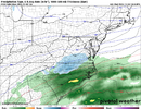
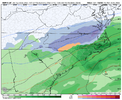
Yeah the NAM was going to go for itGood start to the 12z suite. The 12Z NAM has sharpened up the approaching Sunday/Monday S/W rather substantially.
For the twelve 6”+ RDU storms since MJO records started, here are the MJO phases with the largest # of these storms:
-3: 3.5 28.2”
-8: 2.5 16.8”
-5: 2 13.2”
-1: 1.5 23.7”
-7: 1 10.8”
-4: 1 5.9”
-2: 0.5 9.0”
-6: 0 0.0”
MJO amplitude:
Weak: 63.9” (on or inside circle)
Mod 37.8” (1-2 amp)
Strong 5.9” (2+ amp)
-The MJO is progged to be weak phase 8 Dec 8-9th
-All of the 6”+ RDU snows during phases 8, 1, and 2 were when the MJO was inside the circle.
-Phase 3 leading may seem counterintuitive but it’s not when considering that 3 of the 3.5 phase 3 storms were during Feb or Mar, when phase 3 is one of the coldest phases:
Last edited:
you gotta think the LR is gonna start to light up a little more here in the next 3-5 days
Geez didnt he just say last week there be a big warm up after 12/15?Allan just said that he is skeptical of any big warmup through mid January!
Sent from my iPhone using Tapatalk
@SD Dec 7you gotta think the LR is gonna start to light up a little more here in the next 3-5 days
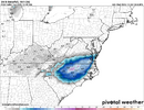
GFS looked roughly the same as 6z far as the monday event. vort not as sharp as 00z but a bit more consolidated
Georgia Weather History for December 3rd
In 1886, a great snowstorm dumped up to 42 inches of snow in the southern Appalachian Mountains. Twenty-five inches fell at Rome, GA.In 1971, a major winter storm hit the northern half of Georgia. Up to 8 inches of snow fell across the northeast corner of the state with a combination of snow, sleet and freezing rain falling elsewhere as far south as Macon. Nearly 3 inches of sleet fell in Athens. Most north Georgia schools were closed. The accumulation of ice caused numerous chicken houses, carports and sheds to collapse. Two people were injured in Oglethorpe County when their carport fell on them.
In 1983, a severe thunderstorm brought high winds and four tornadoes to parts of north Georgia. One F-0 tornado occurred in Oglethorpe County destroying a double-wide mobile home near Enterprise. Two F-1 tornadoes touched down in Cherokee and Paulding Counties. An F-2 tornado touched down in Fulton County in the Fulton Industrial Park area destroying one warehouse and heavily damaging others.
- Joined
- Jan 2, 2017
- Messages
- 1,566
- Reaction score
- 4,279
Thats a good sign for sure!Allan just said that he is skeptical of any big warmup through mid January!
Sent from my iPhone using Tapatalk
Bigedd09
Member
candian has some action monday morning...
Bigedd09
Member
holy cow is the gfs gonna get a rare W???
BrickTamland
Member
BrickTamland
Member
Good to see the GFS and Canadian both showing a potential storm. Just want to see the potential is there now and then see how totals work out as we get closer.
ducketta27
Member
Watch out Mitch, it’s coming for ya
Sent from my iPhone using Tapatalk
I wish. Armpit of Hell is strong down our way.Watch out Mitch, it’s coming for ya
Sent from my iPhone using Tapatalk
Even a stopped clock is right twice a day and a blind squirrel can find a acorn every now and then. I hope the GFS model can be right for once about Friday's event.
Brent
Member
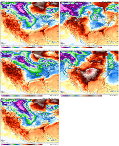
Man what extreme consistency.
View attachment 177852
Haha people are freaking out over the long range here and I'm like guys... We're about to have our second winter threat in 4 days... On December 4th
There's been years here without anything before Christmas
Man what extreme consistency.
View attachment 177852
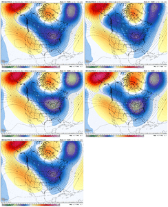
That’s why I typically strongly prefer the trends of ensemble means for that far out (day 10+) over often jumpy operational runs. And even the ensemble means are sometimes jumpy and even clueless in retrospect. For example, consider the upcoming -NAO/-AO next week. Just 5 days ago, even the ensemble means had +NAO/+AO for next week!
oh yeh I know. Just trips me outThat’s why I typically strongly prefer the trends of ensemble means for that far out (day 10+) over often jumpy operational runs. And even the ensemble means are sometimes jumpy and even clueless in retrospect. For example, consider the upcoming -NAO/-AO next week. Just 5 days ago, even the ensemble means had +NAO/+AO for next week!
That was @Rain Cold dude!@SD Dec 7
Oh dang my badThat was @Rain Cold dude!
Triangle bullseye happens so rarely - I want this so bad lol
NCHighCountryWX
Member
- Joined
- Dec 28, 2016
- Messages
- 699
- Reaction score
- 1,918
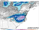
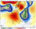
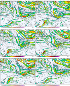
Canadian over the next 138 hours. And its still going. Biggest takeaway is how close , almost exact Canadian an GFS are for Monday
View attachment 177848
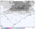
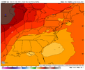
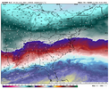
The 12Z Euro has an off the coast low on 12/8 but it’s significantly too warm for snow per 850s and dry over much of NC outside of far SE part of the state.
Bigedd09
Member
Ridiculous. Dr. no strikes again
Sent from my iPhone using Tapatalk
Sent from my iPhone using Tapatalk
Webberweather53
Meteorologist
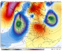
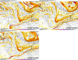
I really think late next week could get interesting.
View attachment 177858
Yeah we might be opening the door for another clipper system at least (like we had in Nov) if things can trend favorably the next few days or so


