CNCsnwfan1210
Member
Day 4 usually is in the wheelhouse
Sent from my iPhone using Tapatalk
I wouldn’t worry about that too much when the models can’t even agree on something 96 hours out.12z GFS andddd Euro are both Clipper Central from 12/7 through 12/11
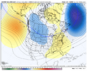
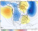
That will be transient as westerly momentum/then an +EAMT eventually push that ridge east towards Alaska/Yukon mid-late Dec. Without any momentum loss and with an SSW reflection event, you're just not gonna get a persistent trough either over Alaska or the West.I'm simply not a big fan of the troughing projected by ensembles(EPS and GEFS particularly) near Alaska. Please correct me if I'm wrong but this is a scenario in which yes there would be cold air but it would struggle to be a quality cold air source and one that consistently fleets quickly due to lack of established blocking upstream near Greenland and limited support for established 50/50 lows. Northern stream kinda squashes everything which would favor weak positively tilted troughing over the eastern CONUS and with limited confluence(from our SS) and heights ahead of any trough potentially only leading to weak low pressure systems over our area(this being said will gladly take the much needed rain). The frequent shortwaves/clippers from the NS could still lead to some snow especially for the mountains but it doesn't necessarily favor areas outside of climatological norm for early December. It's a tough look for the southeast right now but once the phase 8 MJO fully sets in(from what I've heard the lag usually takes roughly 5-10 days but that may be incorrect) we should be set up beautifully beginning 2nd week of December. View attachment 177616View attachment 177617
Definitely could see some kind of overrunning mess take shape especially for yall.Pattern isn't terrible coming up its just not one that knocks my socks off. I wouldn't be shocked if we tried to sneak something in likely either a late blooming coastal or some weird overrunning messy thing. I also wouldn't be surprised to see a breakdown about week 2 into week 3. That said a breakdown probably gets replaced by a similar pattern potentially colder right around christmas.
That will be transient as westerly momentum/then an +EAMT eventually push that ridge east towards Alaska/Yukon mid-late Dec. Without any momentum loss and with an SSW reflection event, you're just not gonna get a persistent trough either over Alaska or the West.
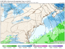
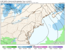
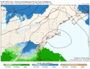
I don't know what's up with the AIFS snowfall physics. Tomer Burg's p-type confidence maps make a bit more sense (in the context of the model) with snow chances along the Virginia border. The EPS is much drier on the same parameter, but snow is a bit further south along the NC/SC border. Then the GEFS is a nothingburger after leading the way in snowfall chances for several days... funny how these things work.

It will be interesting to see if we're in the process of flipping to a predominantly +PDO. The PDO has been strongly negative since 2020 and predominantly negative for most of this century. Perhaps winters of old in the SE can make a comeback, soon.On Nov 29th, the WCS daily PDO rose from ~-0.81 to -0.52, the fastest daily rise since Sept. 2nd:
View attachment 177630
//uploads.tapatalk-cdn.com/20251201/541a5363d9ce17eb93ffc98076ea8e55.jpg
Looks like the Alaskan ridge is trying to return on the latest EPS/AIFs ensemble LR.
Sent from my iPhone using Tapatalk
On Nov 29th, the WCS daily PDO rose from ~-0.81 to -0.52, the fastest daily rise since Sept. 2nd:
View attachment 177630

I think the issue all along in this setup is that if you flex the wave a bit stronger, it becomes warmer. That's fine, but it's going to be challenging to get both decent precipitation AND keep it cold. But it's definitely worth watching, especially in the more northern areas of course.A lot of people don't seem to realize just how incredible 12z Euro today was for even areas showing rain with p-type. I ran some soundings in Upstate SC and Northeast GA and almost every single one was pushing the border of that freezing line at all levels. Should that run have been a tick colder, you'd be seeing euro 12z all over the internet.
Yeah I agree, I'm hoping for a continuation of the suppression trend before the NW tick comes in. Still probably have a little bit of time. GFS and Euro has swapped places oddly enough.I think the issue all along in this setup is that if you flex the wave a bit stronger, it becomes warmer. That's fine, but it's going to be challenging to get both decent precipitation AND keep it cold. But it's definitely worth watching, especially in the more northern areas of course.
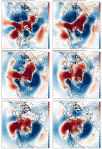
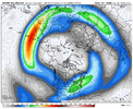
Oh I fully agree once AAM rises that it will completely flip. I was mostly talking about the next week and a half or so.That will be transient as westerly momentum/then an +EAMT eventually push that ridge east towards Alaska/Yukon mid-late Dec. Without any momentum loss and with an SSW reflection event, you're just not gonna get a persistent trough either over Alaska or the West.
Euro whole runView attachment 177646
SN
View attachment 177642
ZRView attachment 177643
Temps during the height of the event, all the way at/below freezing near the SC borderView attachment 177645

Honestly looking at the sounding, that should be snow into northern SCEuro is locking in and even getting colder at H85. We might have something here, euro in the shorter range is good View attachment 177647View attachment 177648
That’s right wedge on down to daddyTrending colder at H85 on the AIFS, 850s Below 0z all the way down to CLT during precip onset, colder surface to View attachment 177655View attachment 177656
