Going into early Dec, it looks like we'll have a good reservoir of cold across Canada, so any hiccup / mishap with the ridge / trough pattern (in the good direction) could result in a bit of action...
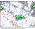
But broadly speaking, we're likely going to have a Pac Jet problem as the jet is retracted as about as far west as we ever see it here on Dec 5 - this leads to western ridging hanging out in the Aleutians and Bering Strait
View attachment 177131
All else being equal, here are some of the parameters which control the Pac Jet:
ENSO: Retracted and Poleward jet favored during La Nina. Extended and Equatorward jet favored during El Nino
MJO: Jet extends during 5-6-7-8 and retracts during 1-2-3-4. Jet is max extended during 7-8-1 / Max retracted during 3-4-5
EAMT (East Asian Mtn Torque): +EAMT (High pressure in EAsia) adds momentum to the Jet / -EAMT (Low pressure in EAsia) reduces momentum
Arctic Oscillation: If ++AO, jet is more poleward. If --AO, jet is more equatorward
Here's an animation of the MJO in each phase, with the Pac Jet in purple. Green is enhanced convection. Brown is reduced convection.
View attachment 177132
For -EPO / +PNA type ridging, we want the goldilocks scenario where it isn't retracted to the west and it isn't overly extended to the east, bit it's in between the 2. And we want it running west to east (more equatorward / more south) and not running poleward up toward the Gulf of Alaska.
For our current situation, we've gone thru a recent period of weak +EAMT, but all signs point to that flipping to -EAMT as seen here with Low pressure in EAsia on this 5-day avg for Nov 28 - Dec 3. That favors the retracted jet shown above.
View attachment 177133
Typically, these -EAMT and +EAMT episodes run in cycles, so I wouldn't be surprised for this to flip back around to +EAMT in mid-late Dec
And this MJO wave looks as good as ever to me. Sure, we can quibble about a slow down with convection lingering in the W Pac etc., but that's common with the MJO of today...hard to get it to look much better than this. Whether it runs thru 8-1-2 in low amp or within the circle is pretty immaterial in my mind - just get it out of that area from the far E Indian Ocean thru the Maritime Continent, thru the far W Pacific (2nd half of Phase 3 to 1st half of Phase 7)
In a post back on Nov 13th, I mentioned a general progression of Dec (7-8- 1/2 way thru 1) and Jan 1-15 (1/2 of 1 and thru 2). That looks to be on track.
The GFS Ext and Euro Monthly are lock in step here:
View attachment 177134
View attachment 177135
So the winning plan as we go into mid and late Dec will be to keep the core of the cold in Canada and have the MJO progression and flip to more +EAMT to extend the Pac Jet to the east, resulting in ridging being closer to the West Coast and more troughing E of the Rockies.
The SSW going reflective and not absorptive is a bit of a kick in thuh...as historically these early winter Canadian Warming SSWs have contributed to high latitude blocking patterns showing up - but what do you know, not this time it seems. This may be another feather in the cap of the "I hate SSWs" camp (which I am not a member of, lol).
Although, as seen in Judah's post yesterday, his world-famous model is showing cold for us in mid-Dec. It's probably because of the model showing SPV stretching associated with the SSW.