-
Hello, please take a minute to check out our awesome content, contributed by the wonderful members of our community. We hope you'll add your own thoughts and opinions by making a free account!
You are using an out of date browser. It may not display this or other websites correctly.
You should upgrade or use an alternative browser.
You should upgrade or use an alternative browser.
Pattern Dazzling December
- Thread starter Rain Cold
- Start date
dsaur
Member
That's what's best for us in Ga. Don't want a big heat pump coming close. Stay in Fla. under the panhandle, let the cold air stay at all levels. Happy times, lol. I think this will resolve into a weak gulf low tracking across Fla., at some point in this pattern, and throwing cold moisture into cold air over Ga. Too much going on in the southern stream with cold air close, to not get lucky at least once. Oh, wait...yeah, right...forgot.. this is Ga, lol....it takes woo woo whammy fingers, the planets aligning, hell freezing...and then some lucky timing.Quite a bit of members with a weak low reflection in the gulf over a two or three day period.
dsaur
Member
Well, the doc had some central Ga sleet for the 18th, and now kffc is talking about a central Ga chance, so I'm curious how the doc does with it Mon.Gfs with big hit for the midsouth. Still waiting on euro before I get excited
NCSNOW
Member
- Joined
- Dec 2, 2016
- Messages
- 9,540
- Reaction score
- 18,971
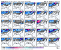
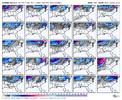
The 12z Euro isnt anyones friend who wants to see some token flakes east of Apps and accumulating snows Mid South. I really hope its off and Can,GFS have it pegged right. Id get to catch a backside flake Thurs night,Christmas day flurry maybe, if they(GFS/Can) are correct. Also my neighbors on other side of Apps would get white ground.
All globals have a clipper/Northern Stream snow shower here Tuesday.
Bottom line be weary of the Euro/Ukmet depiction. Rooting for yall, hopefully someone avoids the shutout before this Pattern setup pivots on to something else.
All globals have a clipper/Northern Stream snow shower here Tuesday.
Bottom line be weary of the Euro/Ukmet depiction. Rooting for yall, hopefully someone avoids the shutout before this Pattern setup pivots on to something else.
Six Mile Wx
Member
olhausen
Member
Are you speaking of before Christmas or after Christmas ? Or both?The 12z Euro isnt anyones friend who wants to see some token flakes east of Apps and accumulating snows Mid South. I really hope its off and Can,GFS have it pegged right. Id get to catch a backside flake Thurs night,Christmas day flurry maybe, if they(GFS/Can) are correct. Also my neighbors on other side of Apps would get white ground.
All globals have a clipper/Northern Stream snow shower here Tuesday.
Bottom line be weary of the Euro/Ukmet depiction. Rooting for yall, hopefully someone avoids the shutout before this Pattern setup pivots on to something else.
dsaur
Member
It's fascinating to me that the doc can see this little moisture streak across cental/middle/ n central Ga. but miss the big dog days later, yet Goofy is fixated on the big dog App runner, or whatever hybrid storm comes about.. and ignores bits of energy moving over Fla. Any one of these pieces of energy in the southern stream can find some cold air to interact with at any point.... can easily throw moisture over parts of Miss, Ala, and Ga. I'm figuring I'm going to see some sleet Monday..... maybe just a few ticks or some patter in the leaves for a few minutes...and maybe more, but I'd be surprised if I don't see something.
bouncycorn
Meteorologist
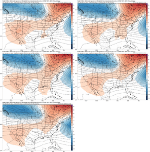
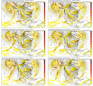
Long range NAM is looking more and more like the MMFS with the low in the gulf hanging out instead of shooting south/east. Also both MMFS and NAM show a stronger low in Ontario.. different than ECMWF and GFS.
Ideally, the GOM low sits in the gulf south of Alabama and the northern stream/Ontario low is stronger to help funnel cold air south in the cold airmass, aiding blocking. These features combined are what MMFS showed last night and are definitely within the realm of possibilities.
Ideally, the GOM low sits in the gulf south of Alabama and the northern stream/Ontario low is stronger to help funnel cold air south in the cold airmass, aiding blocking. These features combined are what MMFS showed last night and are definitely within the realm of possibilities.
Last edited:
Storm5
Member
LR nam is a jokeLong range NAM is looking more and more like the MMFS with the low in the gulf hanging out instead of shooting south/east. Also both MMFS and NAM show a stronger low in Ontario.. different than ECMWF and GFS.
Ideally, the GOM low sits in the gulf south of Alabama and the northern stream/Ontario low is stronger to help funnel cold air south in the cold airmass, aiding blocking. These features combined are what MMFS showed last night and are definitely within the realm of possibilities.
NCSNOW
Member
- Joined
- Dec 2, 2016
- Messages
- 9,540
- Reaction score
- 18,971
Before,Are you speaking of before Christmas or after Christmas ? Or both?
bouncycorn
Meteorologist
Yes, taking long range NAM at face value is a joke, doesn't mean there isn't any info to gain from it though. It often handles mid latitude cyclone strength well, even in long ranges, due to it's function of calculating graupel in it's microphysics, whereas global models don't.LR nam is a joke
And even at 60 hrs the difference is clear. Cyclone in northern stream is much stronger on the NAM.


Brent
Member
Benholio
Member
What's the first thing we should be looking for when the 0z GFS starts rolling? Good or bad
bouncycorn
Meteorologist
Other than the upper level western ridge, here are a couple of surface features I'll be watching -What's the first thing we should be looking for when the 0z GFS starts rolling? Good or bad
1) there should be a northern stream low pressure system form around 54 hours in the midwest. Watch how it propagates north into Canada. Stronger low = good.
2) Watch how the gulf low around hr 72 moves. If it shoots south/southeast into Florida around 84 hours, that's no good. We want a weak low to hang around there (possible) or to retrograde across northern Florida to off the coast of the carolinas in the Atlantic (old solution, unlikely at this point imo)
bouncycorn
Meteorologist
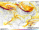
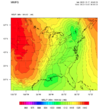
18z MMFS is coming in right now. It takes that weak gulf low and pushes it north thru the NE before the main trough pushes thru the plains.. a solution GFS has been trending towards and one that I believe we could see on other global models soon as well. The first low pushes north so quickly that a secondary low forms in the gulf late on the 22nd. Likely to still cut, but a possibility worth watching for.

Brent
Member

